

Seattle Weather: Showers, breezy winds and cooler temperatures Tuesday
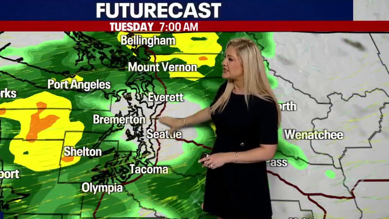
Evening Weather Forecast, 9/28
FOX 13 Seattle has your evening weather forecast for Monday, Sept. 28.
Our next fall frontal system moves in for Tuesday, bringing widespread showers and breezy winds to western Washington. Showers will start in the north interior and move southward throughout the day Tuesday.
The central Puget Sound will see a bit of a rain shadow from the southerly flow, and the heaviest rain is expected in the north interior and coast, the Olympics and along the strait.
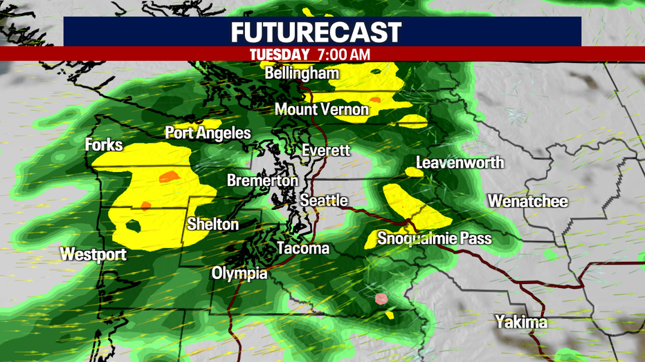
Our next fall frontal system moves in for Tuesday, bringing widespread showers and breezy winds to western Washington. (FOX 13 Seattle)
Rainfall totals starting Monday evening through late Tuesday show anywhere between 1–3" for the mountains and up to 1.25" for the north interior. Fewer amounts are expected for the central Puget Sound and into the south sound.
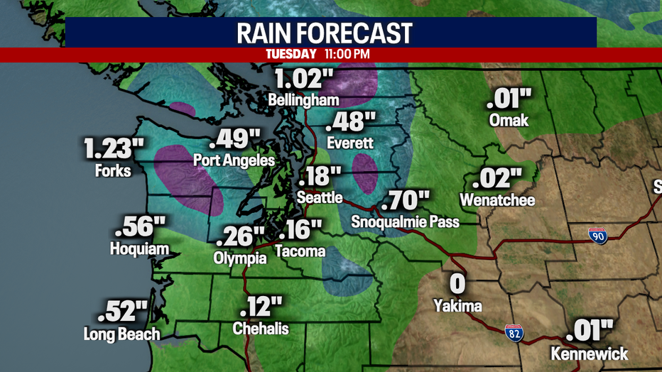
Rainfall totals starting Monday evening through late Tuesday show anywhere between 1–3" for the mountains and up to 1.25" for the north interior.
Winds will pick up Tuesday as the strong frontal system moves inland, bringing the strongest gusts to the north interior and along the Strait of Juan de Fuca. Winds for the Puget Sound will see gusts between 25–35 mph.
We will need to watch for potential power outages and downed tree limbs as the trees are still heavy with leaves.
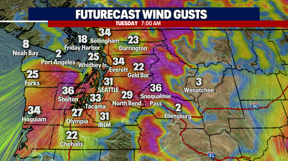
Winds will pick up Tuesday as the strong frontal system moves inland.
A Wind Advisory is in effect for San Juan County and western Whatcom County for wind gusts up to 45 mph.
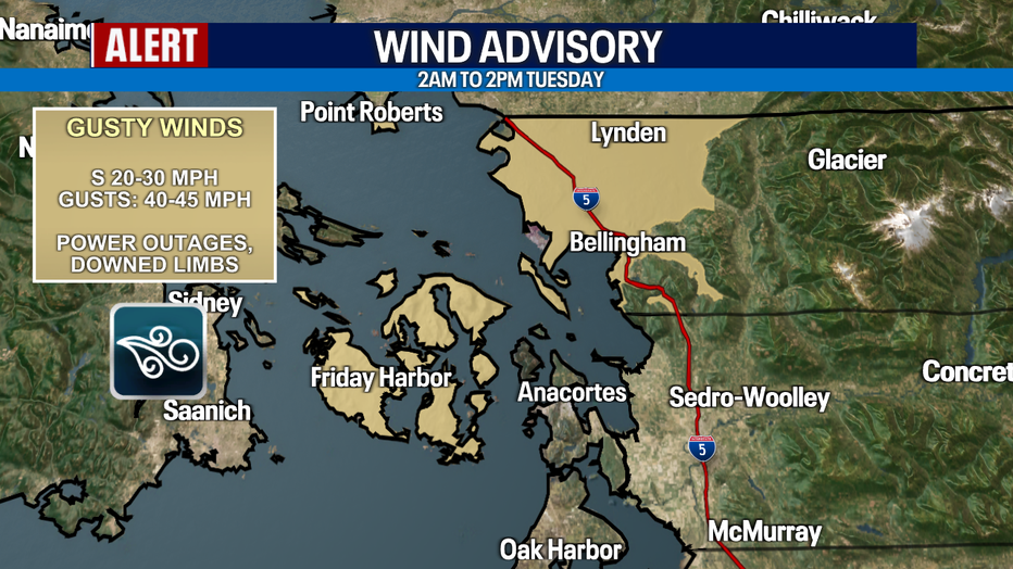
A Wind Advisory is in effect for San Juan County and western Whatcom County for wind gusts up to 45 mph.
Temperatures Tuesday will be on the cooler side, only reaching the upper 50s to low 60s. Highs are typically in the upper 60s at this time of year, so this is another day of below average temperatures.
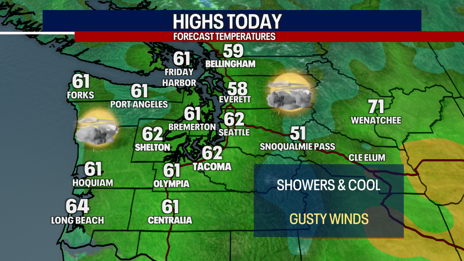
Temperatures Tuesday will be on the cooler side, only reaching the upper 50s to low 60s.
Showers will taper Tuesday night into Wednesday morning, with morning fog and afternoon sunshine for midweek.
Thursday is looking a little mixed, with some forecast models showing dry skies and some showing showers, mainly north. We will see mainly dry skies right now with mostly cloudy skies, but watch for changes to the forecast.
The weekend is looking drier as an upper level ridge of high pressure slowly builds, returning to mostly sunny skies with highs in the upper 60s.
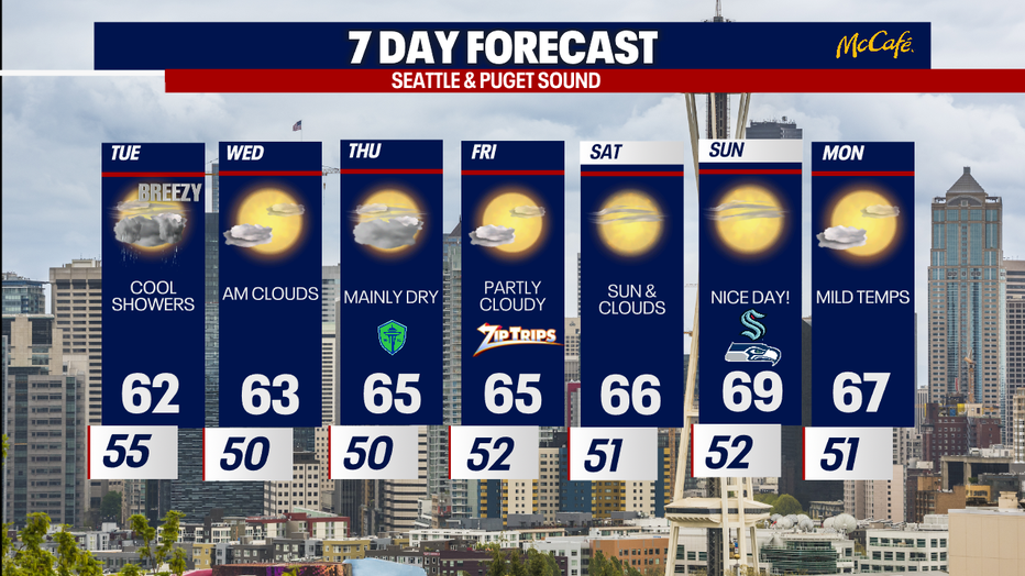
Showers will taper Tuesday night into Wednesday morning, with morning fog and afternoon sunshine for midweek.
The Source: Information for this story came from the FOX 13 Seattle Weather Team.
MORE NEWS FROM FOX 13 SEATTLE
Two dead after drive-by shooting in Kent, police investigating
6 WA Starbucks locations closing amid broader shutdown. Here's where
UW stabbing suspect ordered another round of mental health evaluations
Family clarifies facts in Lake Tapps drowning tragedy
These are the best foodie cities in the US, according to a new ranking
Seattle Mariners looking outside organization for next manager
Chelan Hills Fire: 5 arrested, 6th suspect sought
To get the best local news, weather and sports in Seattle for free, sign up for the daily FOX Seattle Newsletter.
Download the free FOX LOCAL app for mobile in the Apple App Store or Google Play Store for live Seattle news, top stories, weather updates and more local and national news.