

Showers wrap up leaving us with a dry weekend!
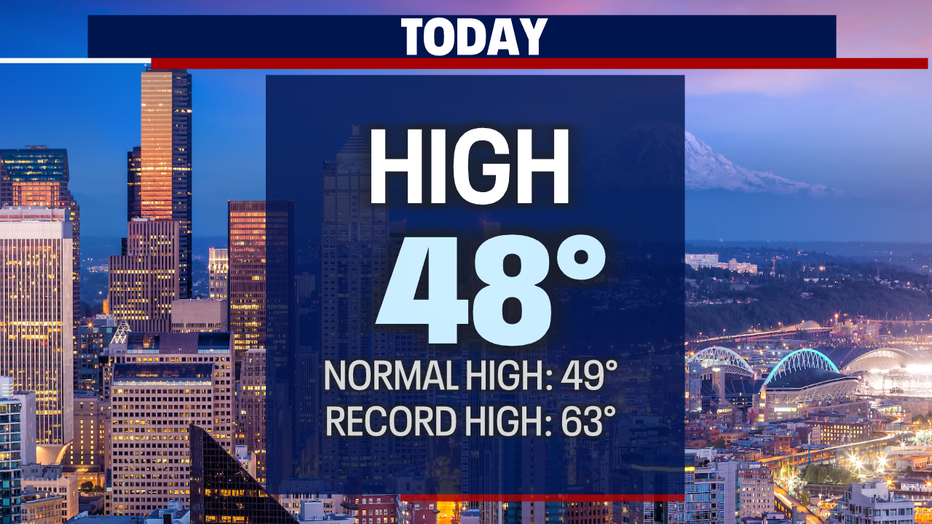
Seattle - We made it to the weekend! After some Friday showers highs topped out in the mid 40s. Winds were gusty for many sports too. Some of us, like SeaTac International Airport saw winds kick up to 40mph.

Wind will relax into the overnight hours with temperatures falling to the upper 30s to low 40s.

High pressure is now building in and will hand us a pretty decent weekend! Saturday and Sunday will be dry with more sunshine each day. By Monday, a weak front will slide over the area dropping in light showers early in the day. Most precip will fall over the coast, mountains, and North Sound. Otherwise, look for ridging to build back in for the rest of the week leaving us with a nice and mostly dry forecast.

Temperatures will hang very close to average for this time of year except for early Sunday morning where we'll be waking up to lows near freezing for many. Seattle starts the day around 35 with temperatures finding their way into the mid 40s.

By midday Saturday we'll see clouds breaking apart for filtered sunshine.

By Sunday at 1pm skies clear even more for a partly to mostly sunny afternoon.

By late Sunday our ridge breaks down, opening the door for a weak system to slide through the region. Nothing major here, but some of us will see a few showers during the early Monday morning commute.

By 8am Monday showers will start to become scattered with most of the bulk of the system pushing into the Cascades.

The rest of the week features dry weather! Temperatures hanging in the normal range for this time of year. Highs near 50 with overnights in the upper 30s to low 40s. Enjoy!
Have a great weekend all! ~Erin Mayovsky, FOX 13 Forecaster

*Beach Forecast

*Mountain Forecast

*Central WA Forecast
