Storm bringing snow to the mountains, strong winds to Bellingham area
SEATTLE -- A March storm is bringing snow to the mountains and strong winds to areas up north.
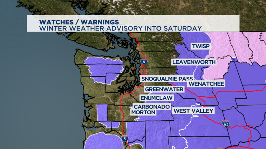
While a lot of people saw some snow this morning, we've got a Winter Weather Advisory for areas where that snow is actually going to stick around. It went into effect at 5 a.m. and will go well into Saturday for the mountains. Two to four inches of new snow is expected during the day Friday and a few more inches at night.

The steady precipitation tapers off into showers as the system offshore drops south into Oregon.
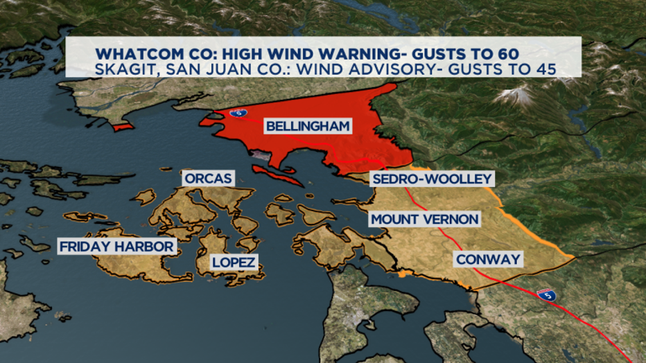
Cold winds will pick up near Bellingham, where skies will clear first but will be very blustery with a High Wind Warning. Gusts up to 60 mph are possible, which could mean some localized power outages.

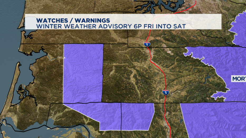
Some low elevation snow could come back for parts of SW Washington, including eastern Grays Harbor County where a Winter Weather Advisory starts at 6 p.m.

Overnight lows will be near freezing for the Puget Sound lowlands so lingering showers could be some snow showers early Saturday.
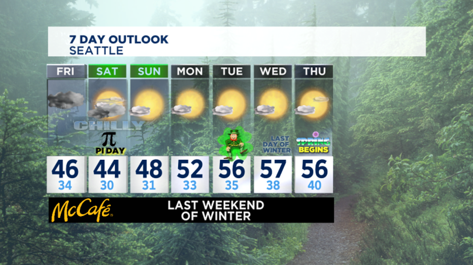
We stay chilly this weekend but it the beginning of a decently long stretch of dry and sunny weather for our rainy season. While we'll see a potentially snowy morning on Saturday for the SW corner of the state, the rest of us are just really frosty.
Temperatures improve starting Monday, and by the last day of winter on Wednesday we'll see temps scooting up towards 60. Spring officially begins in the Pacific Time Zone at 8:51 p.m. on Thursday.


