Super Bowl Sunday weather: Clear skies and above-average temperatures in Seattle

Clear skies and above-average temperatures in Seattle this weekend
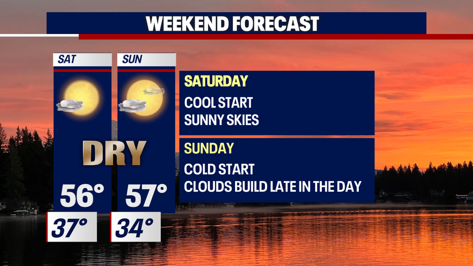
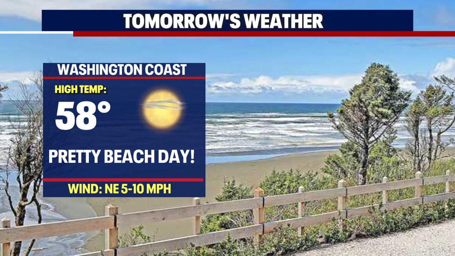
As we sail into Saturday and Sunday, temperatures climb even more into the mid to upper 50s with some spots, like North Bend looking to hit 60.
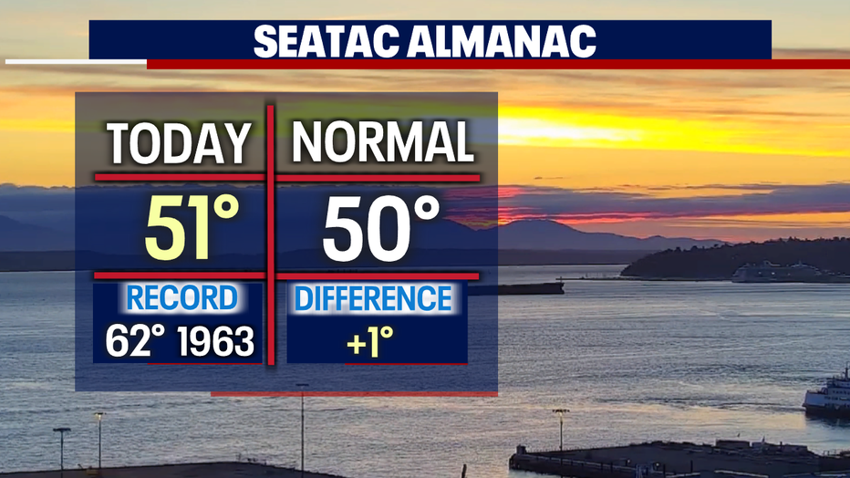
Seattle - Welcome winter sunshine! We're kicking off the weekend warmer than average, only by a degree Friday, but we'll take it!
As we sail into Saturday and Sunday, temperatures climb even more into the mid to upper 50s with some spots, like North Bend looking to hit 60.
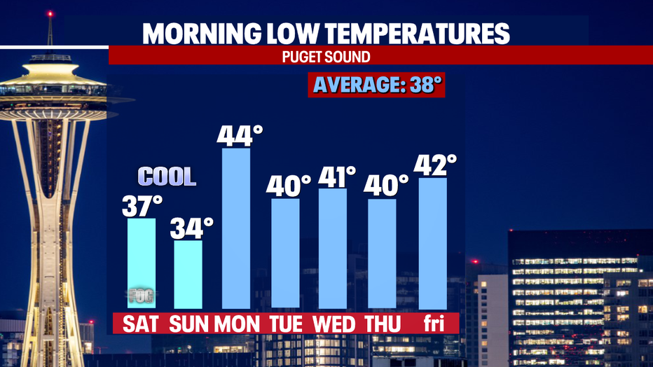
Overnight lows Saturday and Sunday take a dip into the low 30s. Areas like Bellingham, Forks, Shelton, and Chehalis will be a bit chilly as you wake up Saturday morning. Otherwise, most communities hang in the mid to upper 30s near average.
The start of the week brings back warmer overnight lows.
Okay, now more on our dry weekend! High pressure remains strong offshore keeping weather systems at bay. From the Canadian border to Southern California, conditions will feel more like spring and summer rather than winter, especially the farther south you go.
The Northwest warms into the mid to upper 50s while Los Angeles heats up into the mid 80s to near 90 for some.
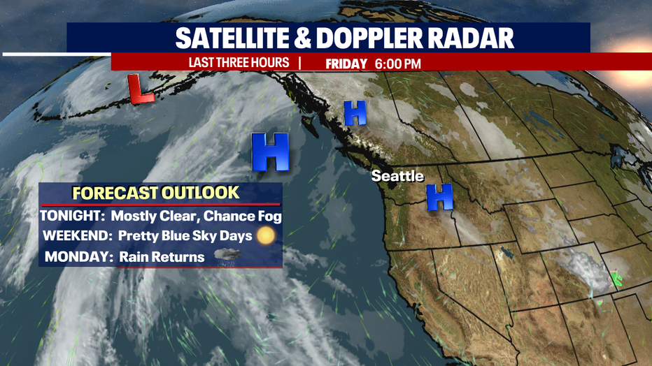
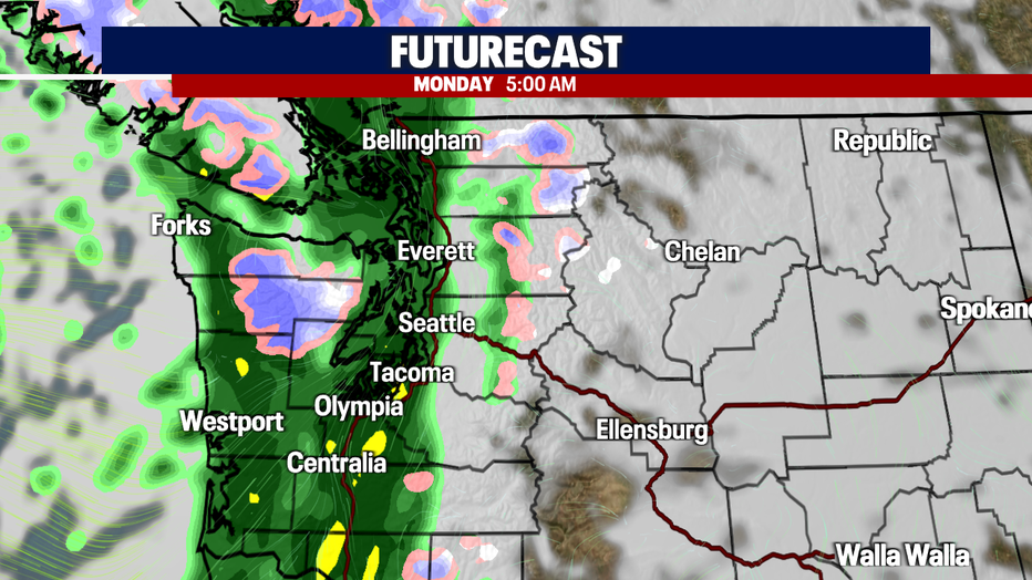
Unfortunately, all good things usually come to an end, and our end is Monday. High pressure breaks down late Sunday allowing a front to deliver wet weather just in time for Valentine's Day. By the start of the commute, rain is widespread from the coast to the foothills.
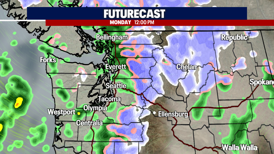
By noon, rain tapers to just showers, mainly hanging to the north. The mountains will continue to see snowfall for a nice refresh on the slopes. Most resorts will only see 2-5" of new powder.
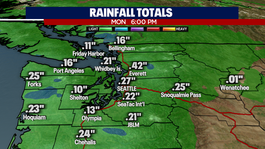
Rain totals Monday are low, ranging from .10" in Shelton to .42" in Snohomish County.
The rest of the week is back under the influence of high pressure. Look for mostly cloudy to partly sunny skies. Highs cool into the upper 40s close to normal. Enjoy!
~ Erin Mayovsky, FOX 13 Forecaster,

*Beach Forecast
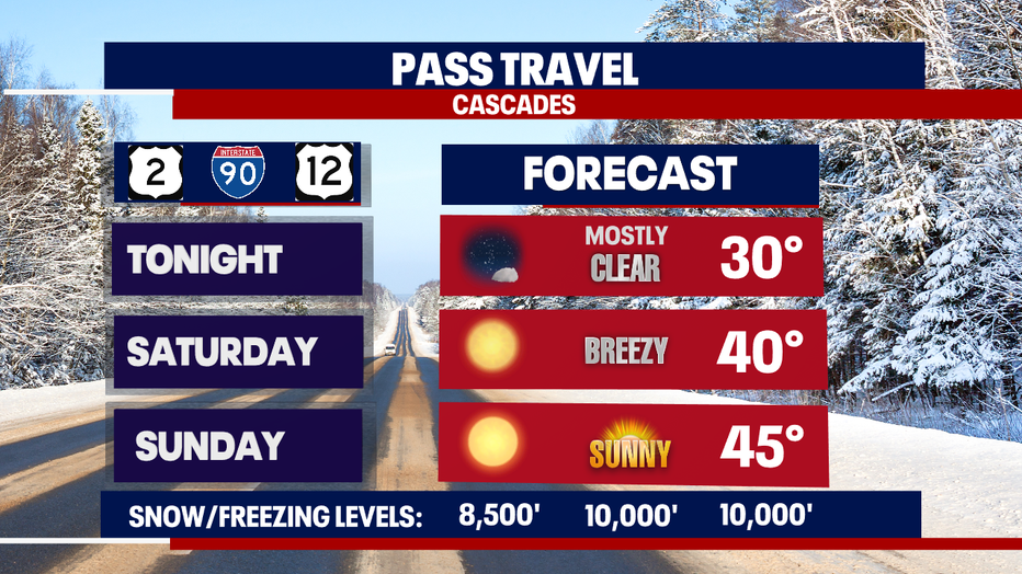
*Mountain Forecast
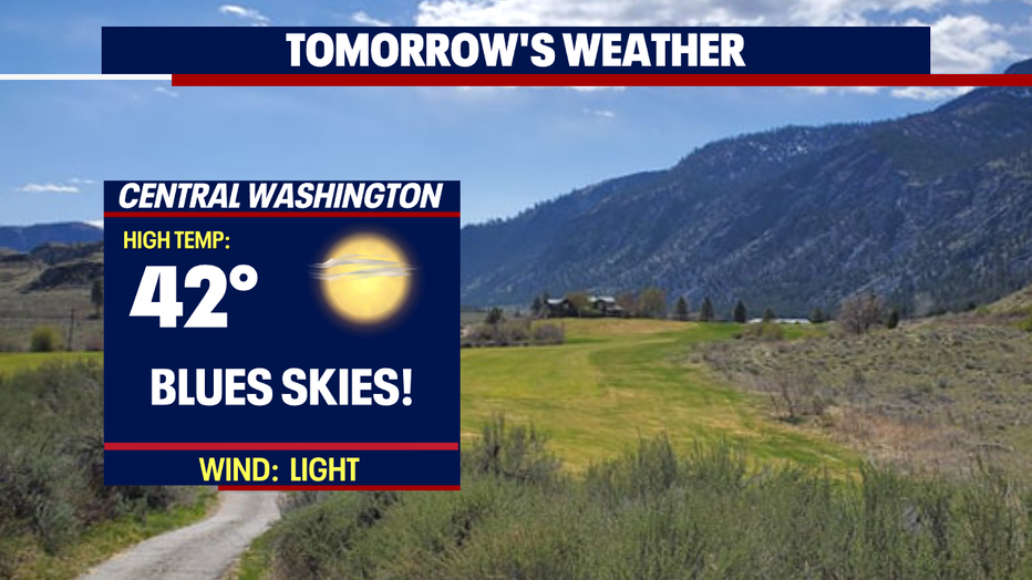
*Central WA Forecast