

Seattle weather: Heat is on this weekend along with hazy to smoky skies at times
Hotter temps on the way this weekend
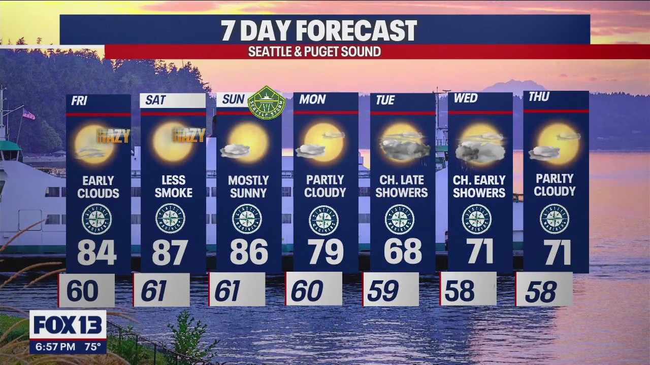
We'll start to see less smoke in the area, and we can look forward to a chance of showers next week.
Seattle - Another day in the books in the 70s. SeaTac hit 78 at the airport with warmer highs to the south.
We also dealt with more hazy skies from wildfires burning in Eastern WA and British Columbia.

Thursday marks the 65th day in a row that we've seen 70+ temperatures. The longest stretch on record is 72 days set back in 2017.

As we move into Friday, there's a small chance for a few spotty showers to roll through from the south to the north. Also, the Southern Cascades could see a thunderstorm by the afternoon.

Wake-up temperatures tomorrow sit near 60 for Seattle with a few passing clouds.

Here's a peek at possible shower activity mid-morning. We are expecting just a few pockets.

Look for hazy skies again Friday with highs in the low to mid 80s for most areas.

Air quality will fluctuate between good and moderate levels through the weekend.

Fire danger is elevated as dry and unstable conditions remain over the Central and Southern Cascades along with gusty outflow winds and relative humidity as low as 22%. A "Red Flag Warning" will remain in effect through 5 p.m. Friday.

More heat is on tap for the weekend with highs cruising into the upper 80s to near 90 for some.
By Monday highs cool to near average with even cooler air heading our way the rest of the week. Temperatures could dip into the upper 60s as we'll see a chance for a few showers. Enjoy!
Have a great rest of the week! ~Erin Mayovsky, FOX 13 Forecaster

*SeaTac Rain Almanac

*Coast Forecast

*Mountain Forecast

*Central WA Forecast
