Seattle weather: Cooler highs this weekend with a chance of a drizzle

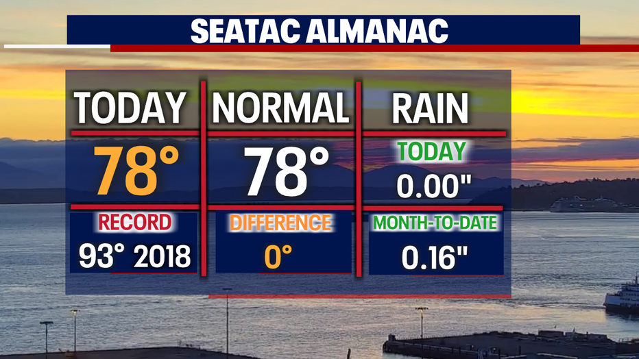
SEATTLE - Another stellar day across the Pacific Northwest! Highs warmed into the mid to upper 70s. Sea-Tac hit 78 today.
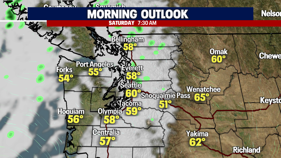
Overnight clouds increase as a weak disturbance drops a few pockets of showers in Western Washington. Lows remain fairly mild with Seattle only cooling off into the low 60s. The average seasonal low for this time of year is now 57.
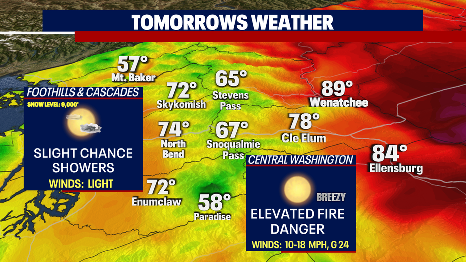
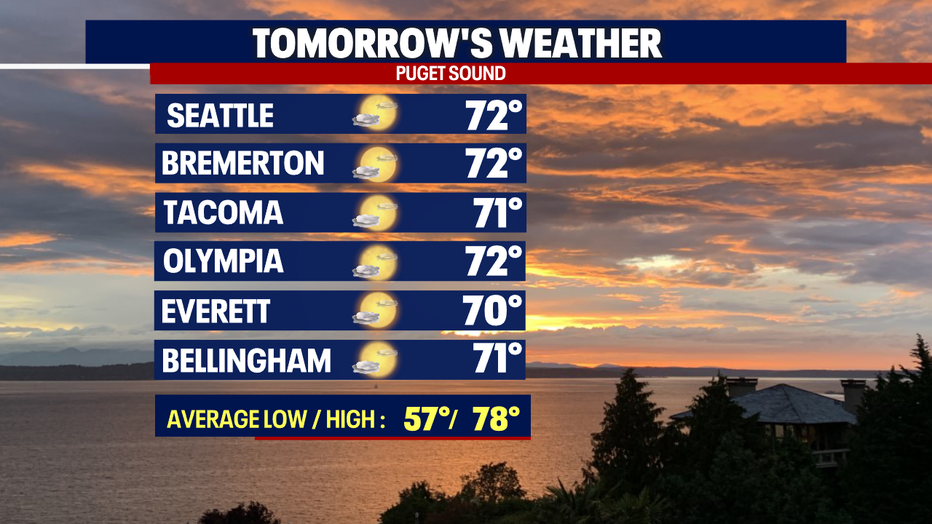
Saturday's highs top out in the low 70s for most areas under partly cloudy skies.
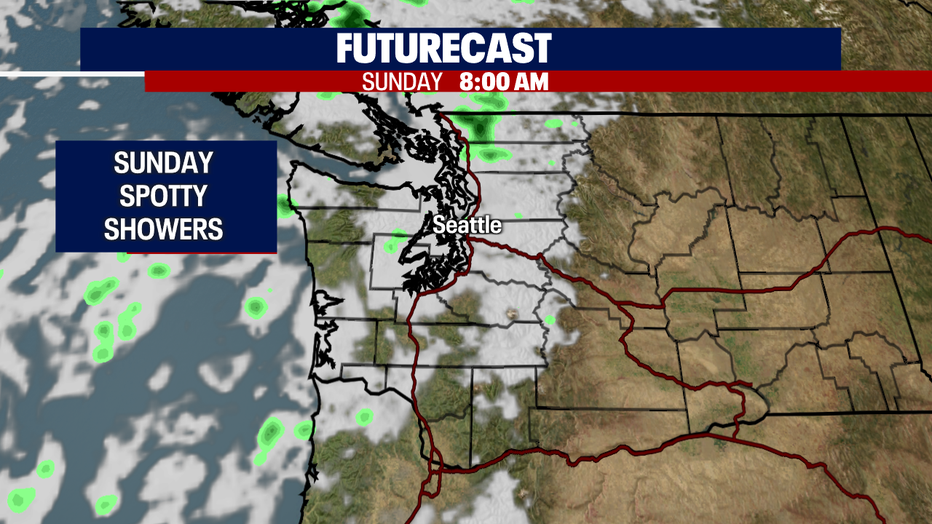
Clouds will increase again Saturday night into Sunday morning as another system sinks into the region. We have another chance for a few spotty showers, mainly over the mountains and into the North Sound. Almost everyone else looks to hang under partly sunny skies by the afternoon. Highs only land near 70 Sunday afternoon.
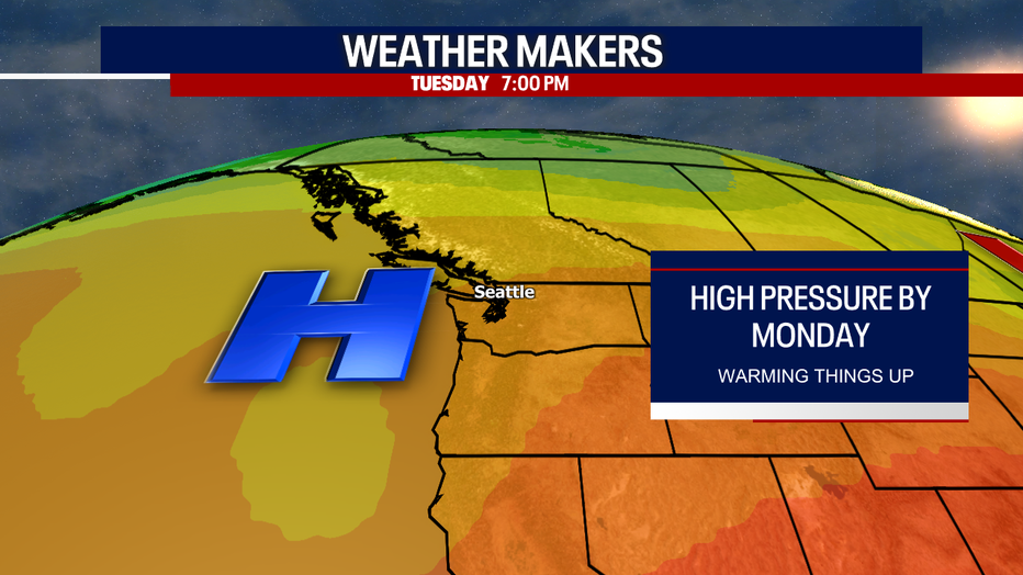
Don't get used to the cooler temperatures though…starting Monday, high pressure builds off the coast and slides inland giving way to clearer skies and warmer highs. Look for mid to upper 70s with low 80s mid-week.
At this point, our weather trend has us in a pattern of morning and late-night clouds with plenty of sunshine in between. And looking ahead to the extended forecast models, we find ourselves warmer and drier. Enjoy!
Have a great weekend all! ~Erin Mayovsky, FOX 13 Forecaster

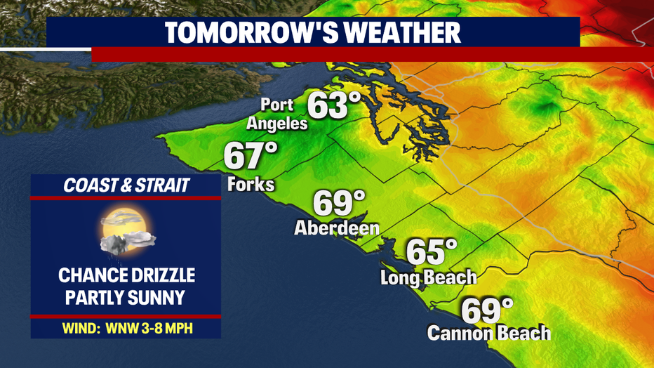
*Beach Forecast
*Foothills, Mountains, & Central WA Forecast