Cloudy with a chance for light showers Seafair Sunday
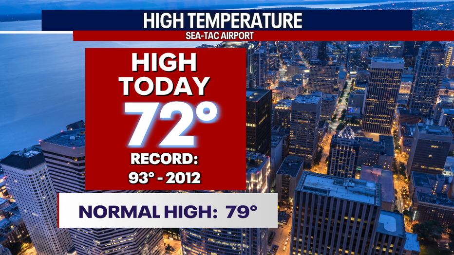
SEATTLE - We haven't seen the 70s since the last day of July, but Saturday we did as cooler highs took over the region with a few light showers too. We were seven degrees below average at the airport at 72.
Overnight skies are cloudy and hazy with a chance for a few showers. Temperatures only cool into the low to mid 60s. Our normal seasonal low for this time of year is 58.

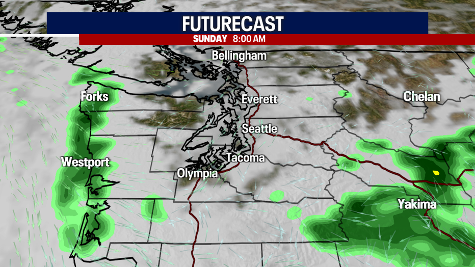
Just a few spotty showers waking up Sunday morning.
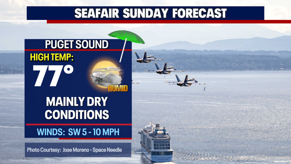
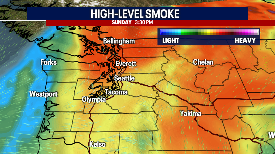
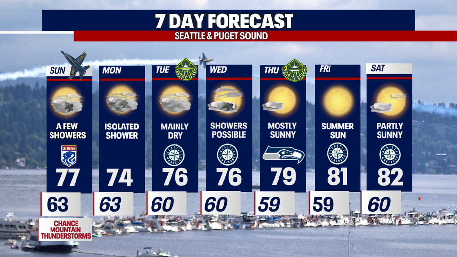
High warm into the upper 70s Seafair Sunday with clouds and haze leaving us with filtered sunshine.
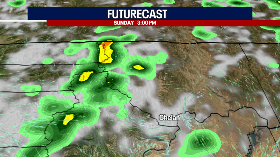
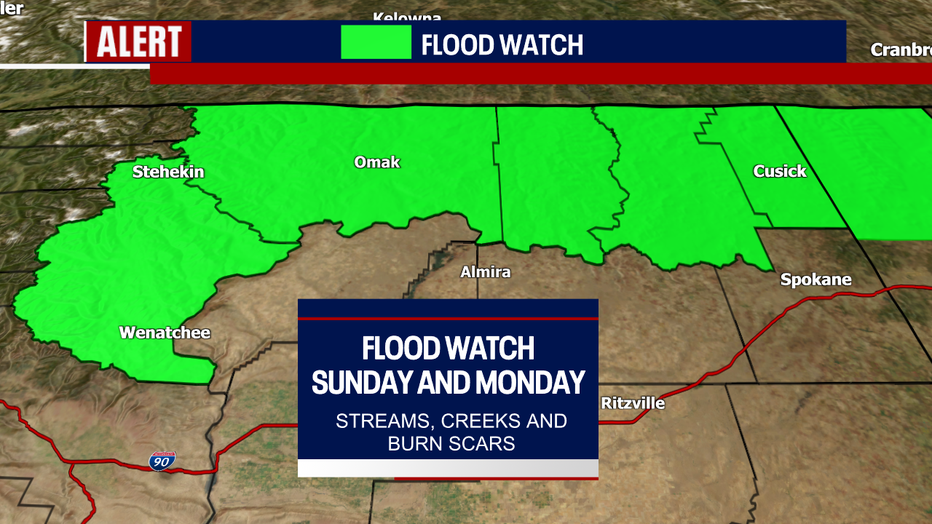
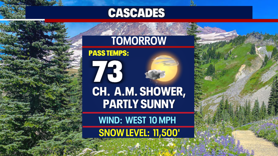
Most of tomorrow's rain will hang over the Cascades and to the east in Okanogan County where a Flood Watch is in effect Sunday into Monday. Excessive runoff from heavy downpours may result in area creeks, streams and flood prone locations to become problematic.
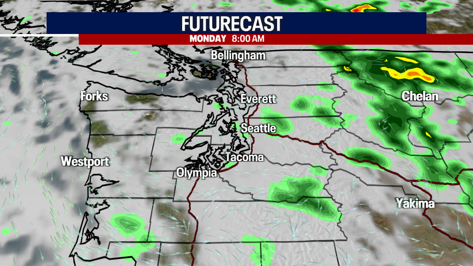
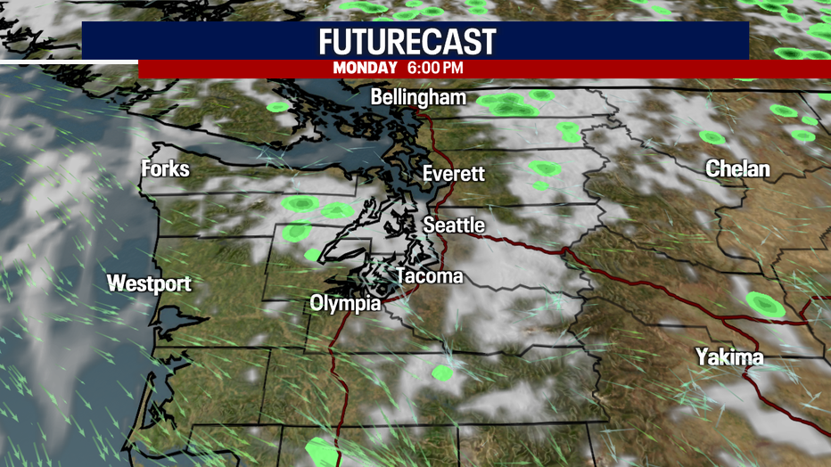
It is dry for the most part Monday west of the mountains, but again Okanogan County will experience heavy rain at times. Highs on Monday cool into the upper 60s to mid 70s under mostly cloudy skies.
The rest of the week we're forecasting mostly dry conditions with the exception of Wednesday where a few quick light morning showers fall before clearing out to partly sunny skies.
Highs warm throughout the week into the upper 70s to low 80s. Stay tuned as the extended outlook could see 90 temperatures for several days in a row.
Have a safe and happy Seafair Sunday all! ~Erin Mayovsky, FOX 13 Forecaster
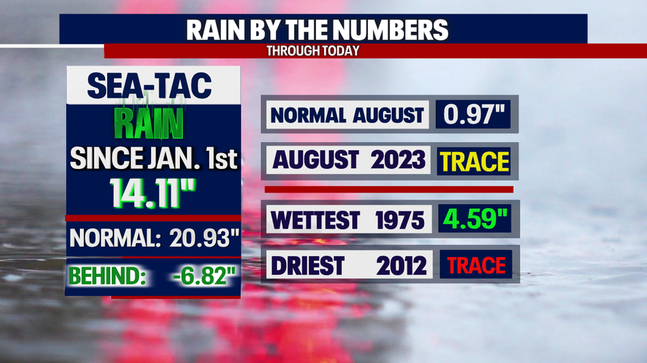
*Seatac Rain Almanac
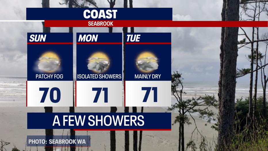
*Coast Forecast
*Mountain Forecast
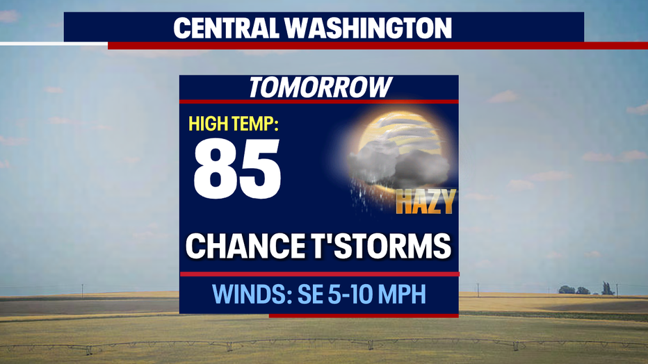
*Central WA Forecast