Seattle weather: Rain going away and temps will warm up a bit

Rain clears out into the weekend
FOX 13 Forecaster Erin Mayovsky and Chief Meteorologist Lisa Villegas have the details.
SEATTLE - A cool day across Western WA with highs only in the upper 60s to low 70s. Not only were we cool, but some of us saw a little rain too. Sea-Tac only recorded just a trace of rain.
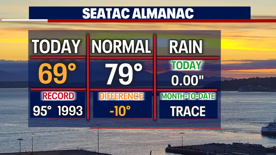
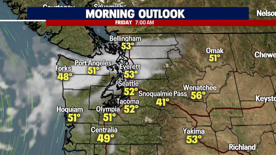
Overnight temperatures will fall well below average (58) under mostly clear skies. Look for temps to drop into the upper 40s to low 50s.
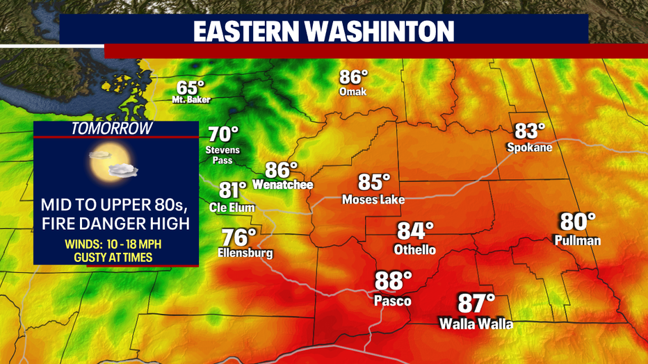
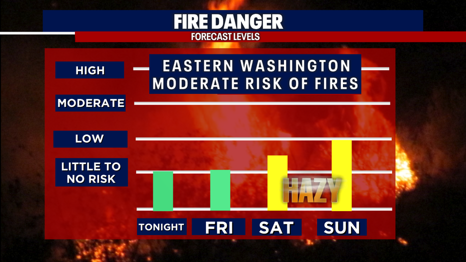
As we push further into August and temperatures warm even more, the threat of fires breaking out continues, especially with our dry tinder grounds. The risk for Western WA is low currently, but it's been a busy week for firefighters in Eastern WA. A couple of new fires have sparked under very dry and gusty conditions.
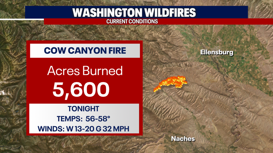
The Cow Canyon Fire jumped to 5,600 acres burned Thursday with winds gusting at times. A Wind Advisory will remain in effect through late tonight before gusts start to relax.
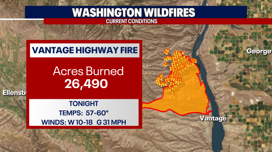
The Vantage Highway Fire is now 21% contained with nearly 27,000 acres scorched. Winds will gust out of the west tonight up to 31 mph making it another tough night for crews battling this raging fire.
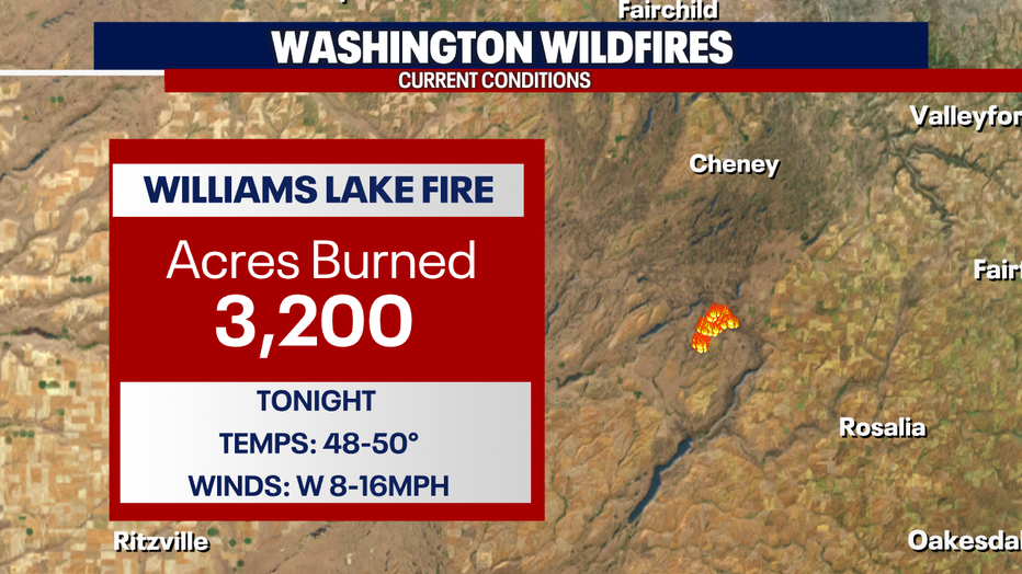
And the Williams Lake Fire near Cheney is now at 3,200 acres burned with winds already relaxing and will continue into Friday. This will help firefighters gain more containment.
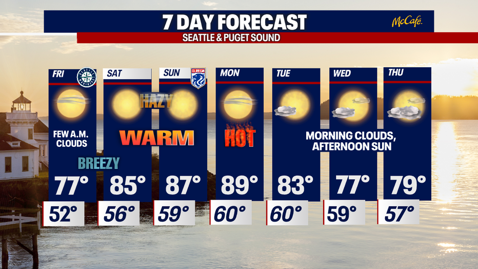
Unfortunately, not great news for firefighting efforts as our pattern shifts back to high-pressure controlling the region. We'll bring back warm to hot temperatures through the weekend into next week.
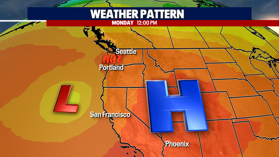
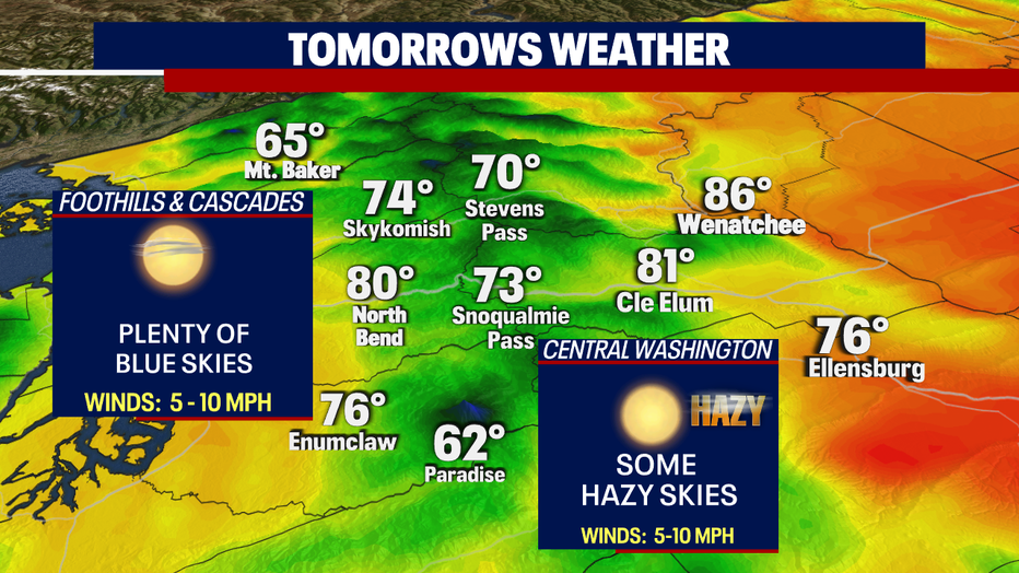
Highs Friday climb into the upper 70s near normal with plenty of blue skies. The real warm up starts this weekend and hangs on through early next week. We potentially could hit 90 again by Monday with slightly cooler highs Tuesday.
Mid-week we expect highs to normalize back down into the 70s.
Have a great rest of the week all! ~Erin Mayovsky, FOX 13 Forecaster
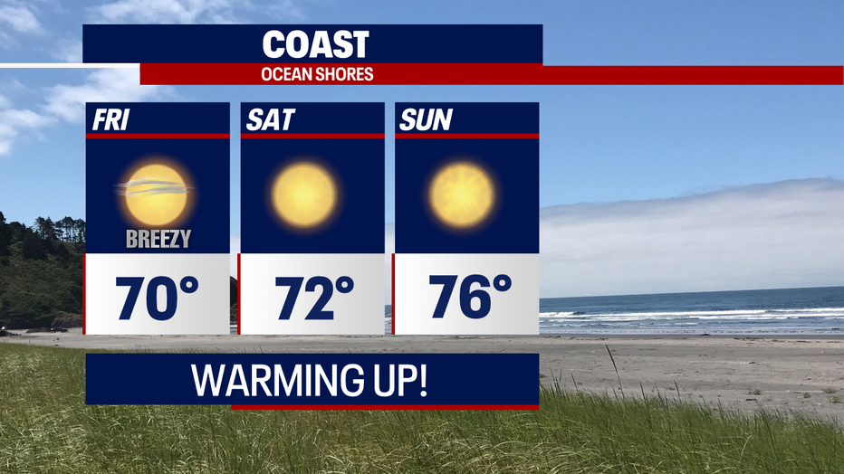
*Beach Forecast
*Foothills, Mountains, Eastern WA Forecast