Cleaner air on the way: Rain, wind, & mountain snow help boost air quality Friday

Rain coming in on Friday, clearing up the smoky skies
The site IQAir ranked Seattle and Portland as the two worst cities in the world for air quality on Wednesday and Thursday – worse than areas in China and southeastern Asia that usually top the list.
SEATTLE - Clean air is on the way now folks!
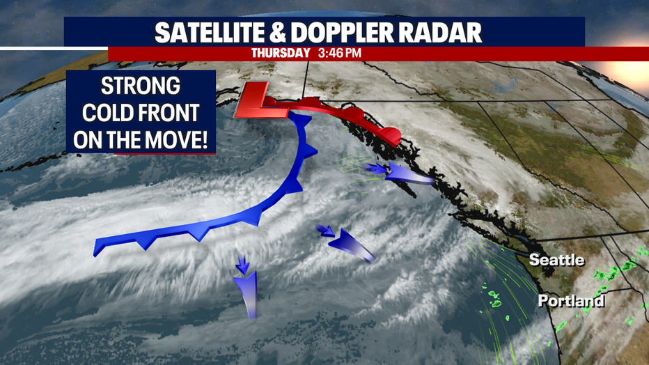
Finally, a cold front moving into the Northwest tomorrow will give us just what we need to make sure air quality levels get back in the good zone!
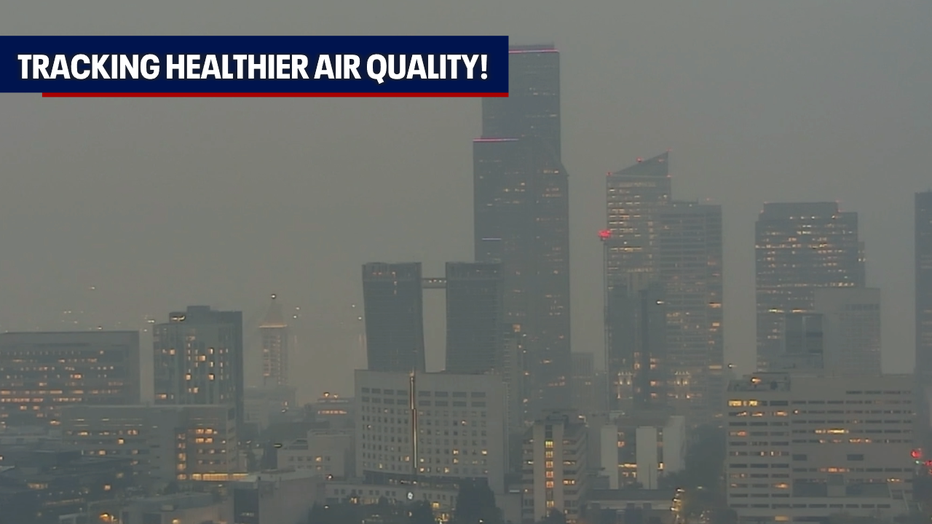
Pictures like the one below will not exist this weekend, and hopefully, moving forward. We'll lock this one up in the archives!
A strong moving system is on the way and will hit the coast first early Friday morning. This is the first real Fall weather maker, and we certainly need it!
Lowland rain and mountain snow will finally drop into the region. These conditions, along with breezy winds will clear out the atmosphere of any smoke and haze.
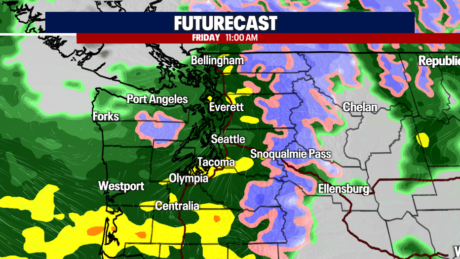
By 8 a.m. Friday, most of Western Washington sees rain.
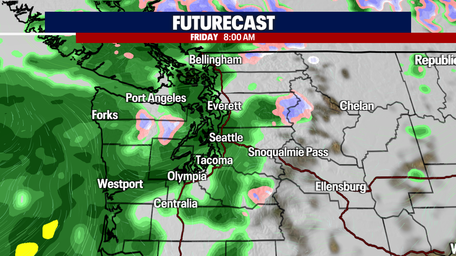
By 11 a.m., rain becomes widespread with snow falling over the mountains in the higher elevations. This weekend snow levels sit between 4,000' to 3,500'. If you're driving over the Cascades, expect a wintry mix at times, especially over Stevens and White Passes.
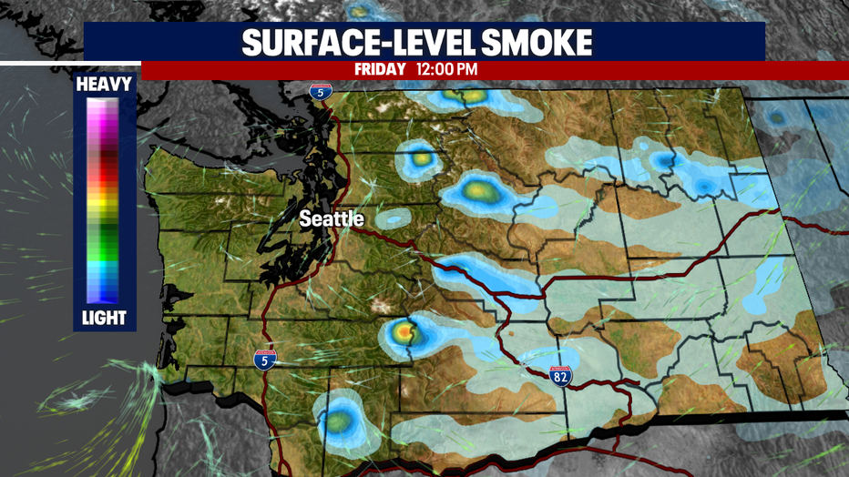
By lunchtime Friday, we're clear of most smoke. Eastern WA looks great too!
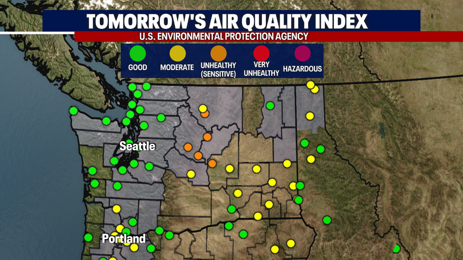
Most air quality will return to good levels across the state, except for a few areas in Central WA where levels will fluctuate between unhealthy for sensitive groups to moderate.
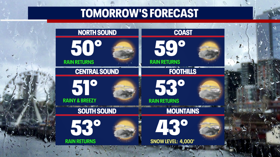
Highs on Friday dip well below average as this system moves across the region.
Seattle only lands in the low 50s tomorrow. The average for this time of year is 59, dropping to 58 this weekend.
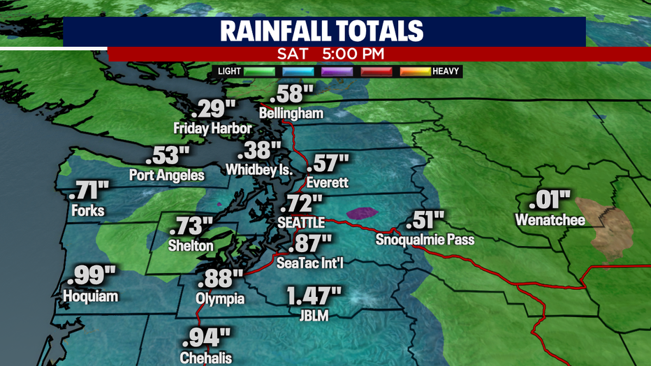
So how much rain do we expect? Well, some of us could see anywhere from just over a quarter of an inch to almost an inch and a half by Saturday evening. And just to put that in perspective, that's more than we saw in the month of October. In fact, from June until now we've seen just near an inch of rain, which put us into the driest summer on record.
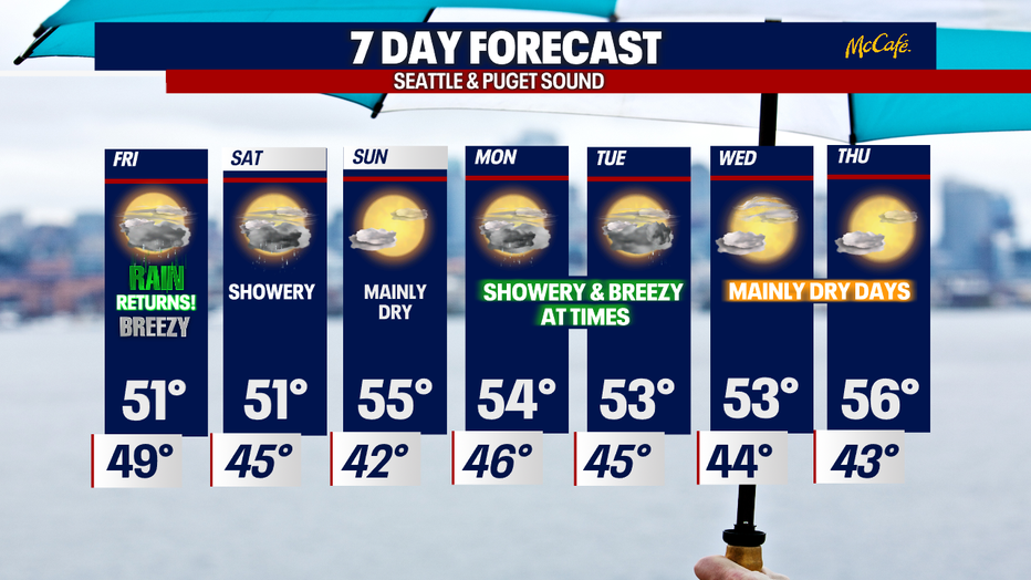
A look at the 7-day forecast keeps us showery at times with below-normal highs. Enjoy!
Have a great rest of the week all! ~ Erin Mayovsky, FOX 13 Forecaster
