Dry, sunny and cold Sunday, before more rain pushes in this week

Rain, shine... and a chance for a white Christmas?
Will we have a white Christmas this year? FOX 13 Meteorologist Abby Acone is tracking your forecast to find the answer!
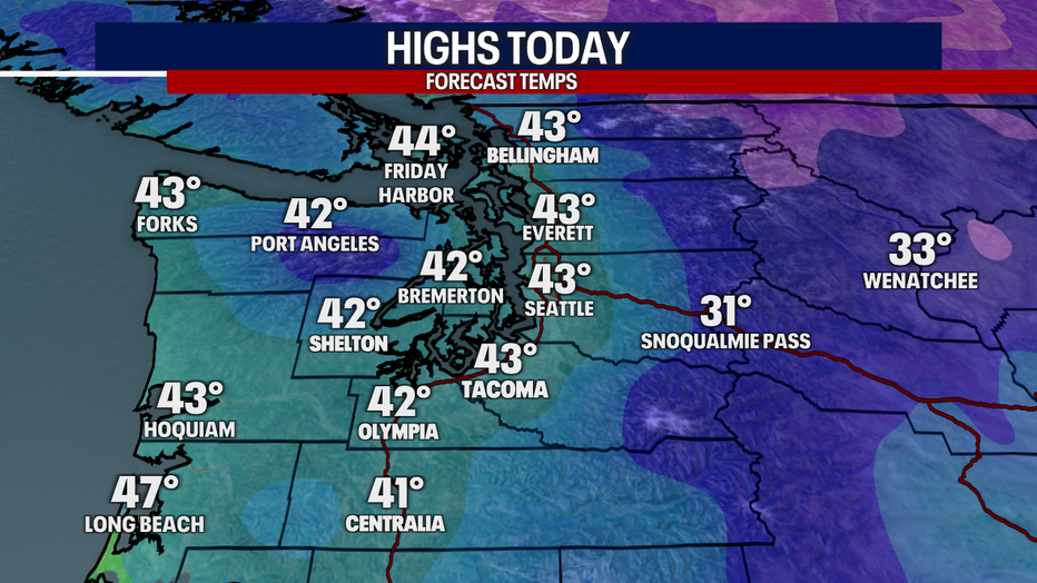
SEATTLE - Today's weather will be absolutely beautiful! I'm tracking partly to mostly sunny skies in Western Washington. However, don't let the sunshine fool you: it'll still be cold. Highs will only reach the low 40s! Grab the warm coat, gloves and sunglasses before you step outside.

This morning, the passes were still struggling with compact snow and ice on the roads after heavy snow overnight. Hopefully the sunshine and dry weather today will allow WSDOT crews to clear the roads. I'm expecting pass travel to improve throughout the day. Today will be pure perfection along the ski resorts.
Moderate mountain snow is forecast for Monday. I think the passes could get anywhere from 5-10"+ of snow tomorrow. Light snow will fall on Tuesday.

Here in the lower elevations, there's a slight chance for a rain/snow mix late tonight to Monday morning. For the most part, I'm not expecting the snow to stick in the lower elevations. For neighborhoods on the Kitsap Peninsula, the Hood Canal, Port Angeles, Sequim, the Olympics and eastern Strait of Juan de Fuca, there's a slightly better chance for a light coating of snow Monday.
Snow would most likely accumulate on cool surfaces like grass and patio furniture. Because highs tomorrow will lift above freezing in the afternoon, any lowland snow may melt fairly quickly.

The National Weather Service has also hoisted a Winter Weather Advisory from 4 p.m. today to 4 p.m. Monday. Between 5-16 inches of snow could fall above 2,500 feet. This impacts Crystal Mountain and Paradise at Mt. Rainier.

Isolated to scattered showers are expected on Tuesday with chilly temps. Wednesday could be gusty, particularly for the coast.
Beginning Thursday and lasting through Christmas, the lowlands could see a light, on-and-off rain/snow mix. Forecast models continue to suggest the chance for light lowland snow on Christmas. I'm not buying that outcome quite yet—because for snow to fall here in the lowlands, all the right ingredients need to come together (cold temps, moisture and storm system). I think the most likely outcome would be for light flurries to fall, mostly over the foothills and higher elevations, with little to no accumulations for most. Stay tuned because this forecast could change!

MORE FROM FOX 13 WEATHER:
DOWNLOAD: FOX 13 Weather and News Apps
WATCH: Forecast and Radar
READ: Closures and Delays
CHECK: Latest Weather Alerts and Live Traffic Map
INTERACT: Submit your Weather Photo
DAILY BRIEF: Sign Up For Our Newsletter
FOLLOW: Lisa Villegas, Erin Mayovsky, Brian MacMillan, Abby Acone and Scott Sistek
Watch FOX 13 Seattle for the latest news:

