

Seattle weather: Atmospheric river brings rain, rising rivers this week
Seattle weather: Wet conditions, breezy winds expected Monday
A warm front arrived Sunday night and will continue to cross through the region during the day on Monday, increasing rain in the lowlands and rising snow levels to around 8000 feet.
SEATTLE - A classic Pacific Northwest atmospheric river is setting up and will keep western Washington in a wet and relatively mild pattern through much of the week.
Moisture streaming in from the Pacific will bring multiple rounds of rain, along with warmer temperatures and rising snow levels in the mountains. Rain and melting snow could lead to rising rivers and potential flooding concerns later this week. While we may catch short breaks between rain bands, the overall theme through Friday will be unsettled and soggy.
Rain returns tonight
Western Washington will get a short break from the rain this afternoon and early evening. Overnight lows will stay mild, in the upper 40s, with increasing widespread rain overnight.

It will be a mild Monday night in Western Washington with increasing rain. (FOX 13 Seattle)
Tuesday and Wednesday: More rain, rising rivers
Big picture view:
The next surge of moisture arrives tonight and Tuesday as the core of the atmospheric river shifts south into western Washington. That means more widespread rain Tuesday through Wednesday.

Widespread rain returns to Western Washington early Tuesday morning. (FOX 13 Seattle)
With snow levels staying high, much of the precipitation will fall as rain in the mountains. That raises concerns for rain falling on existing snowpack, which can accelerate runoff and push area rivers higher later this week.

Seattle weather patterns tied to a pineapple express will push snow levels higher, turning mountain snow slushy. (FOX 13 Seattle)
Temperatures remain mild, with highs in the 50s and overnight lows in the upper 40s to low 50s.
Late week into the weekend
What's next:
The wet pattern continues into Thursday and Friday, with additional waves of moisture moving through the region. The heaviest precipitation will likely stay focused on the mountains, coast, and Olympic Peninsula, where rainfall totals will continue to add up. Looking ahead to next weekend, forecast models hint at a shift toward cooler conditions as the atmospheric river finally moves out and another weather system arrives from the northeastern Pacific.
For now, Saturday and Sunday look dry and partly cloudy.
What to watch this week
What we know:
The biggest concern over the next several days will be rising rivers, especially in areas draining the Cascades and Olympics where rain and melting snow combine. We’ll be watching closely for potential river flooding as the week progresses.

Periods of heavy rain and melt mountain snow will increase river levels. (FOX 13 Seattle)

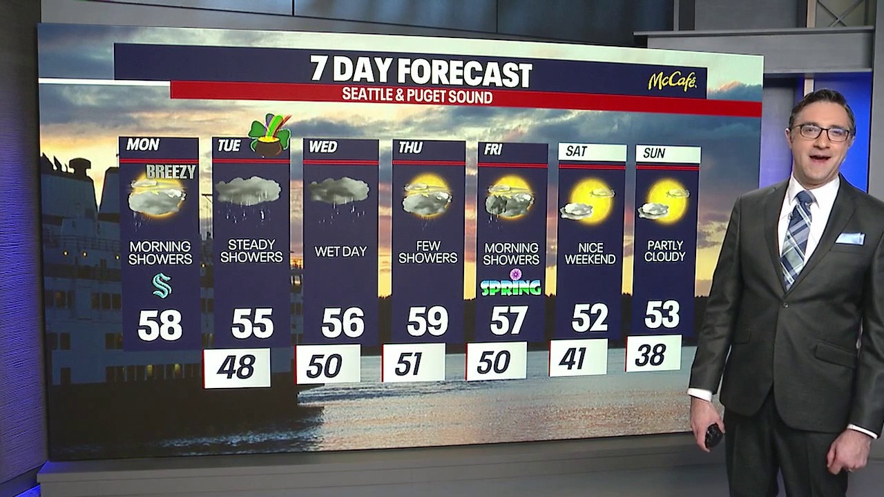
An atmospheric river will bring periods of rain and breezy conditions for much of the week. (FOX 13 Seattle)
MORE NEWS FROM FOX 13 SEATTLE
Arrest made in 2024 triple fatal Everett, WA hit and run
Former WA resident says she was victim of alleged License Express flaw
FBI adds WA double-murder suspect Samuel Ramirez Jr. to Most Wanted List
WA judge rules on media figures' access to Capitol in Olympia
Seattle Mayor proposes $410M levy to fund city libraries
To get the best local news, weather and sports in Seattle for free, sign up for the daily FOX Seattle Newsletter.
Download the free FOX LOCAL app for mobile in the Apple App Store or Google Play Store for live Seattle news, top stories, weather updates and more local and national news.
The Source: Information in this story comes from weather models interpreted by the FOX 13 Seattle weather team.