

Seattle weather turns wetter with pineapple express
Seattle weather: Warmer temperatures, rain ahead this week
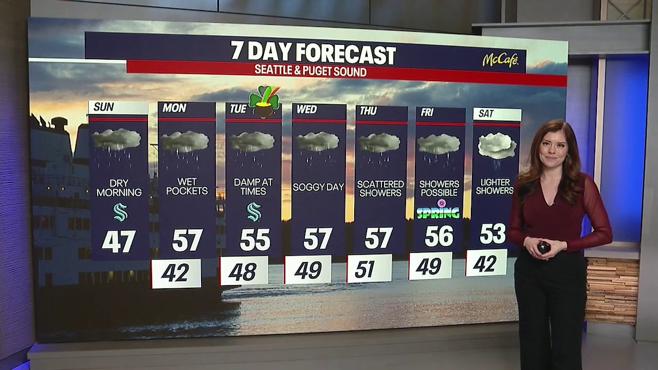
FOX 13 meteorologist Abby Acone has your seven-day forecast.
Rain returns as atmospheric river approaches
SEATTLE - Some communities across western Washington woke up to a slick start this morning, with icy spots in a few areas. Otherwise, clouds dominated early in the day as we moved through the morning hours.
As the day continued, we expected rain to increase through the afternoon, along with some snow in the mountains and at higher elevations. Snow levels will continue rising into Monday morning as we begin gearing up for an on-and-off atmospheric river pattern this week.
Also Sunday, two flood warnings were in effect for Southwest Washington - including the Chehalis and Skookumchuck Rivers.

Seattle weather temperatures will stay above freezing for most areas as rain develops overnight. (FOX 13 Seattle)
What is a "pineapple express" setup?
This incoming system this week will have characteristics of a "Pineapple Express." That’s a slightly warmer type of atmospheric river where the corridor of moisture stretches much farther south — reaching as far as the Hawaiian Islands.
When that happens, it tends to transport milder, moisture-rich air into the Pacific Northwest, bringing steady periods of rain along with warmer temperatures than a typical winter system.

Seattle weather will likely stay damp for much of the day as another surge of atmospheric moisture moves through. (FOX 13 Seattle)
A darker, wetter week ahead
Overall, the upcoming week is shaping up to be cloudy and wet, with rain arriving in waves rather than one continuous event. It could also turn a bit breezy at times as each round of moisture pushes through.
Unfortunately for skiers and snowboarders, the feet of mountain snow that accumulated in recent days will take a hit during this warmer stretch. With snow levels rising and temperatures climbing, a good portion of that fresh snowpack will begin to melt and turn slushy on the slopes.

Seattle weather patterns tied to a pineapple express will push snow levels higher, turning mountain snow slushy.
Rivers running higher
As warmer rain falls on the snowpack, rivers, creeks, and streams across western Washington will likely run higher through the week.
At this point, the main river flooding concern remains the Skokomish River, where additional flooding is expected.
However, if this atmospheric river becomes stronger or more persistent than currently forecast, river flooding could become a larger concern in other areas as well.
We’ll continue to monitor the situation closely, so be sure to stick with us for updates in the days ahead as this active weather pattern unfolds.

Seattle weather will also trend milder, meaning mountain snow melts faster while lowland rain continues through much of the week. (FOX 13 Seattle)
Thanks so much,
Meteorologist Abby Acone and the FOX Weather Team
MORE NEWS FROM FOX 13 SEATTLE
Arrest made in 2024 triple fatal Everett, WA hit and run
Former WA resident says she was victim of alleged License Express flaw
FBI adds WA double-murder suspect Samuel Ramirez Jr. to Most Wanted List
WA judge rules on media figures' access to Capitol in Olympia
Seattle Mayor proposes $410M levy to fund city libraries
To get the best local news, weather and sports in Seattle for free, sign up for the daily FOX Seattle Newsletter.
Download the free FOX LOCAL app for mobile in the Apple App Store or Google Play Store for live Seattle news, top stories, weather updates and more local and national news.