

Seattle weather: Some smoke, but otherwise warm and comfortable
Seattle weather: Wildfire smoke could return to western WA
Red Flag Warnings and Fire Weather Watches are in effect as more thunderstorms and strong outflow winds remain possible Thursday.
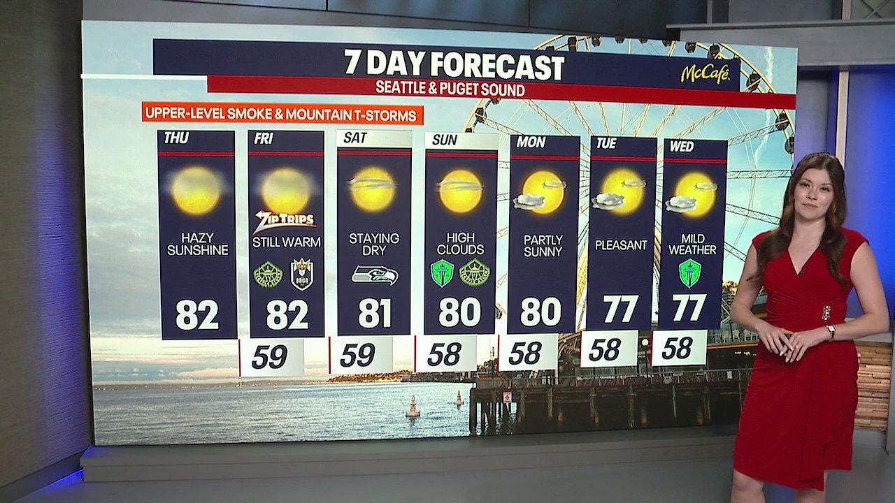
SEATTLE - Western Washington will stay in a typical summer pattern through the weekend, with comfortable summer temperatures in the Puget Sound lowlands.
For the rest of Thursday, expect mostly sunny skies away from the coast, with highs in the 70s and lower 80s inland. Tonight will be comfortable, with lows in the 50s and low 60s.
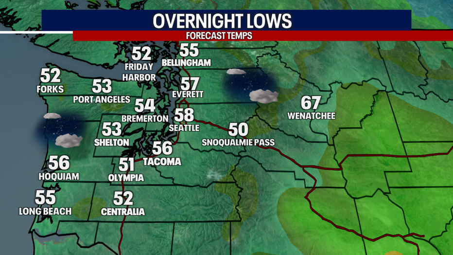
It will be comfortably cool tonight in Western Washington with overnight lows in the mid to upper 50s. (FOX 13 Seattle)
Friday will be similar, but the focus shifts to the mountains. Increasing instability could trigger afternoon and evening thunderstorms again over the Cascades and Olympics. Some storms may produce little or no rain while generating dry lightning and gusty winds.
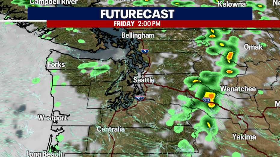
Thunderstorms will develop over the mountains on Friday afternoon. (FOX 13 Seattle)
That is a concern during wildfire season because lightning could spark new fires, while sudden wind gusts could quickly spread existing fires.
Weekend outlook
A ridge builds back into Western Washington on Saturday, bringing another nice sunny afternoon. Morning marine clouds will push inland but should evaporate by midday.
Highs will again reach the 70s and lower 80s around Seattle. There is still a slight chance of a late-day shower or thunderstorm over the Cascades.
Sunday looks warm and mostly sunny.
Smoke in Western Washington
Smoke will remain aloft through at least Friday, leading to some hazy skies. Daytime heating will mix some smoke toward the surface, but onshore flow should keep surface air quality from becoming too poor across most of Western Washington.
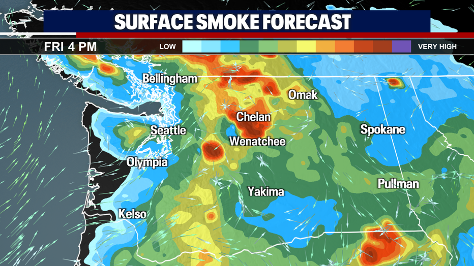
Light surface level smoke could move into the Puget Sound lowlands Friday afternoon. (FOX 13 Seattle)
Wildfires, air quality and red flag warning
Fire danger remains high east of the Cascades. The combination of dry fuels, warm weather, unstable conditions and potentially dry thunderstorms will create an elevated risk for new fire starts and rapid fire spread.
A Red Flag Warning is in effect for portions of the Olympics and Cascades later Thursday into Friday. The primary concerns are dry lightning and strong outflow winds from thunderstorms.
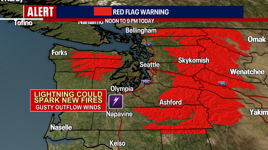
A Red Flag Warning has been issued for the Olympics and Cascades due to expected afternoon thunderstorms. (FOX 13 Seattle)
Smoke from ongoing wildfires will also continue to affect parts of Central and Eastern Washington, with air quality varying depending on wind direction and proximity to active fires.
Cooler weather next week
The ridge of high pressure will hold through Sunday night before another upper-level trough moves on Monday and lingers through much of next week. That will bring additional mountain thunderstorm chances and will bring more morning cloud cover.
By the middle of next week, highs should cool into the mid 60s to mid 70s.
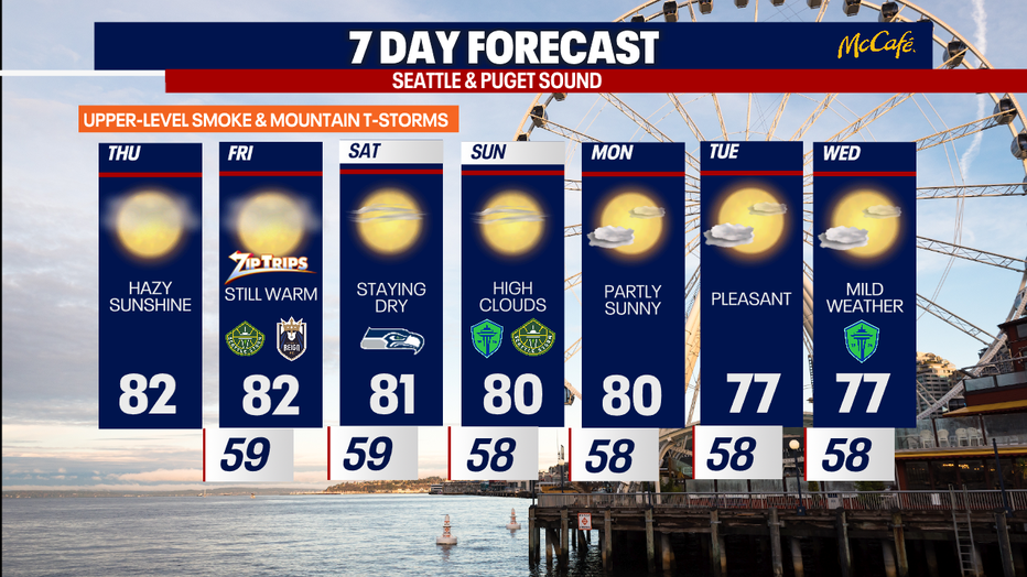
It will be a warm and very quiet next 7 days in Seattle with plenty of sunshine. (FOX 13 Seattle)
MORE NEWS FROM FOX 13 SEATTLE
Semi-truck crash blocks I-405 off-ramp to I-90 in Bellevue
Man arrested for arson at Spanaway, WA house connected to homicide investigation
Seattle Council grills city leadership over 'Bite of Seattle' response
Here's where fires in Washington state are burning
Luigi Mangione expected to plead guilty in federal court: Report
Seattle Sounders fall 2-1 to C.D. Guadalajara in Leagues Cup
Amtrak service suspension between Seattle, Portland extended again
Whole Foods recalls dips, salsas, guac, and more after Salmonella outbreak
To get the best local news, weather and sports in Seattle for free, sign up for the daily FOX Seattle Newsletter.
Download the free FOX LOCAL app for mobile in the Apple App Store or Google Play Store for live Seattle news, top stories, weather updates and more local and national news.
The Source: Information in this story comes from weather models interpreted by the FOX 13 Seattle weather team.