

Seattle weather: More sunshine, high-level smoke
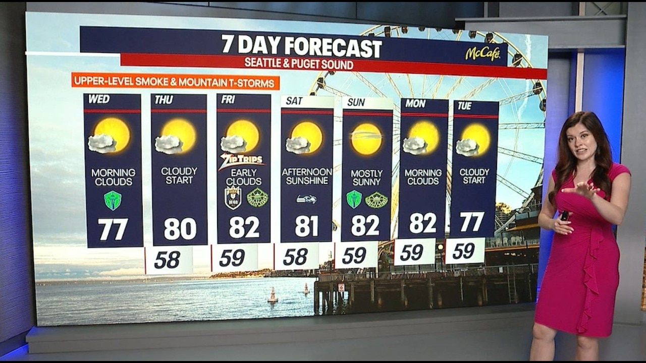
Seattle weather: Upper-level wildfire smoke moves into western WA
Seattle weather: Upper-level wildfire smoke moves into western WA
SEATTLE - Western Washington will turn warmer Thursday through the weekend with more sunshine in the forecast, combined with some upper-level smoke.
A weak upper-level trough remains overhead, while onshore flow continues at the surface. That combination is keeping temperatures slightly below average Wednesday, with highs in the 70s inland and the mid to upper 60s along the coast.
For the rest of Wednesday, expect more sunshine. There is enough instability over the Olympics and North Cascades this afternoon for a chance of thunderstorms. A Red Flag Warning has been issued due to high fire danger.
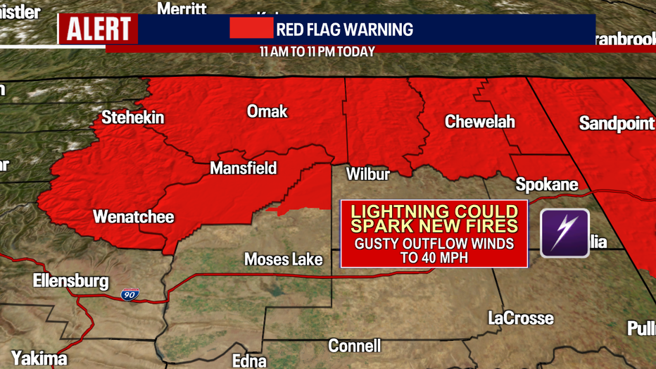
A Red Flag Warning has been issued for parts of Central and Eastern Washington. (FOX 13 Seattle)
Tonight, the marine layer will make another push inland. Overnight lows will be in the 50s. Clouds will spread from the coast into the Puget Sound region overnight, with many areas starting Thursday under morning cloud cover. The good news is that the marine layer will be thinner, so we will get back to the sunshine faster.
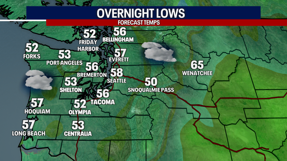
It will be cool with increasing clouds Thursday morning in Western Washington. (FOX 13 Seattle)
Thursday and Friday will be warmer, with highs in the upper 70s and low 80s inland. Coastal communities will stay cooler, with highs in the mid to upper 60s.
There is another chance of afternoon showers or thunderstorms over the Olympics and Cascades both Thursday and Friday.
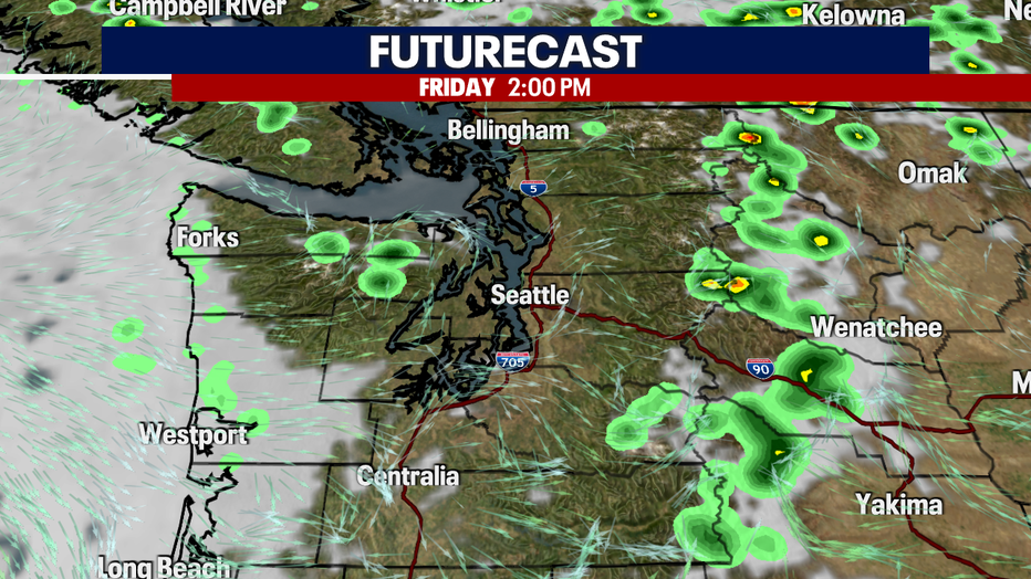
Thunderstorms are possible in the Cascades each afternoon through Friday. (FOX 13 Seattle)
Wednesday night will be big for stargazing
We're in the middle of an unusually busy stretch for skywatchers, with a six-planet alignment and the peak of the Perseid meteor shower happening at nearly the same time.
Six planets, Mercury, Mars, Jupiter, Saturn, Uranus and Neptune, will be aligned on Wednesday night. It's often called a "planet parade," although the planets aren't actually lined up in a straight line in space. They're simply positioned in a way that makes them appear along a similar path across our sky.
For the best view from Western Washington, you'll want to be up before sunrise on Thursday morning and find a location with a clear view toward the eastern and southeastern sky. Don't expect to see all six planets with your naked eye. Jupiter, Mars, Saturn and Mercury are the easier targets, while Uranus and Neptune are much fainter and generally require binoculars or a telescope. The farther you can get away from city lights, the better. Give your eyes 15 to 20 minutes to adjust to the darkness.
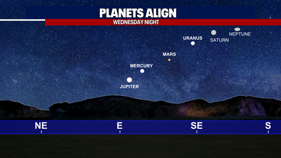
Six planets, Mercury, Mars, Jupiter, Saturn, Uranus and Neptune, will be aligned on Wednesday night. (FOX 13 Seattle)
At the same time, we're approaching the peak of the Perseid meteor shower, which is one of the most popular meteor showers of the year. The Perseids are created by debris left behind by Comet Swift-Tuttle. As Earth passes through that debris trail, tiny particles burn up in our atmosphere, creating those familiar streaks of light across the sky.
The best time to see the Perseids will be in the hours before dawn. The peak comes overnight Wednesday into Thursday.
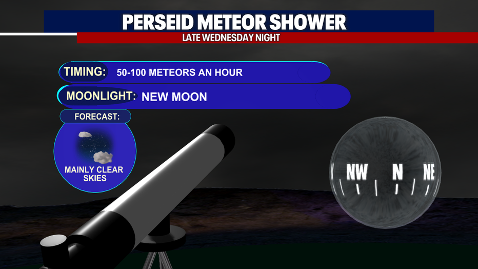
The best time to see the Perseids will be in the hours before dawn. Thursday morning. (FOX 13 Seattle)
Weekend outlook: Warmer, but not hot
Temperatures will stay warm this weekend with highs in the low 80s and plenty of sunshine. We will still have a chance of thunderstorms over the mountains, so stay tuned as we get closer.

Warm and dry weather will continue in Seattle over the next 7 days. (FOX 13 Seattle)
Wildfire smoke in Western Washington
Upper-level wildfire smoke could become more prevalent in the Puget Sound area through at least Friday. We are not expecting unhealthy air at the surface. However, if you are sensitive to smoke, you will want to check the air quality in the upcoming days.
Wildfires, air quality in Central and Eastern Washington
Central and Eastern Washington remain the areas of greatest concern for wildfire smoke and poor air quality.
There is a chance of afternoon thunderstorms, which could produce some showers or thunderstorms over the mountains and north Central Washington. Any thunderstorms that develop could bring lightning and gusty winds, which would create additional challenges for firefighters.
MORE NEWS FROM FOX 13 SEATTLE
All evacuations for Spokane fires lifted, sheriff's office says
Man arrested for arson at Spanaway, WA house connected to homicide investigation
Seattle Council grills city leadership over 'Bite of Seattle' response
Here's where fires in Washington state are burning
‘Lime Scooter takeover’ event floods Seattle with riders
More major road construction closures coming this weekend across western WA
Renton, WA man accused of killing mother, stabbing officer pleas ‘not guilty’
Deadly disease outbreak kills 2,000 as experts reveal what Americans should know
To get the best local news, weather and sports in Seattle for free, sign up for the daily FOX Seattle Newsletter.
Download the free FOX LOCAL app for mobile in the Apple App Store or Google Play Store for live Seattle news, top stories, weather updates and more local and national news.
The Source: Information in this story comes from weather models interpreted by the FOX 13 Seattle weather team.