

Seattle weather: Warm Work Week Ahead

Seattle weather: warm work week forecast
FOX 13 meteorologist Ilona McCauley has your forecast for the weekend.
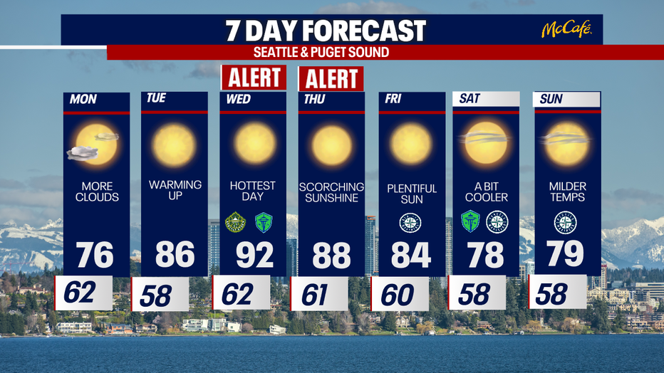
Seattle - After a warm end to the weekend with highs hitting 90 degrees at Sea-Tac, we'll see a slightly cooler afternoon on Monday. Highs will range from the 60s in the coastal area to the upper 70s in the Puget Sound Interior.
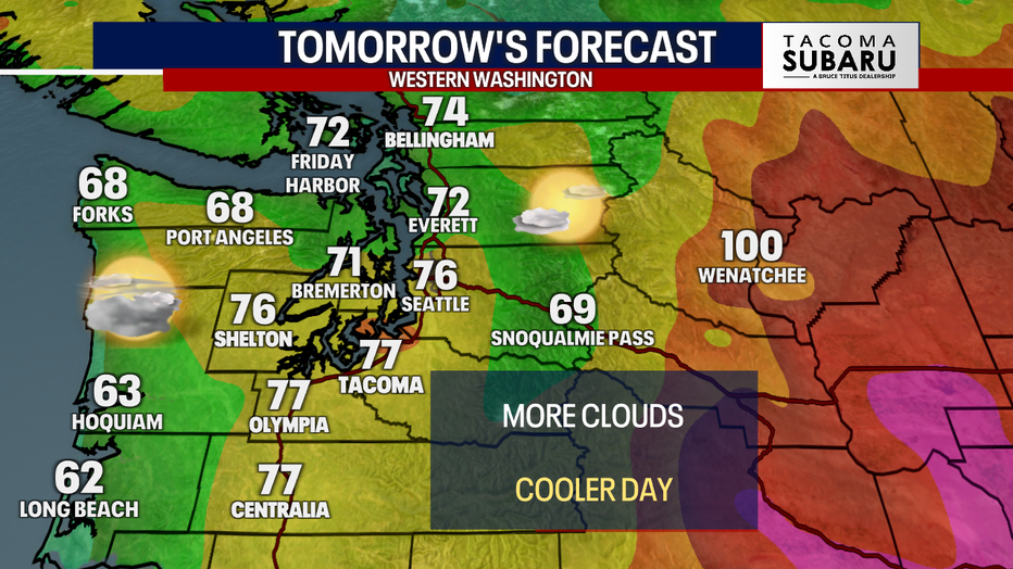
Onshore flow increasing on Monday will lead to a cooler day.
The heat will continue just east of the Cascades where afternoon highs will climb into the triple digits through much of the day on Monday. Evening lows will remain mild with little relief from the heat.
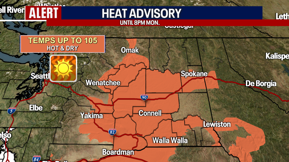
Afternoon highs will be hot a few days in Central and Eastern Washington with little relief in the evenings. (FOX13 Seattle)
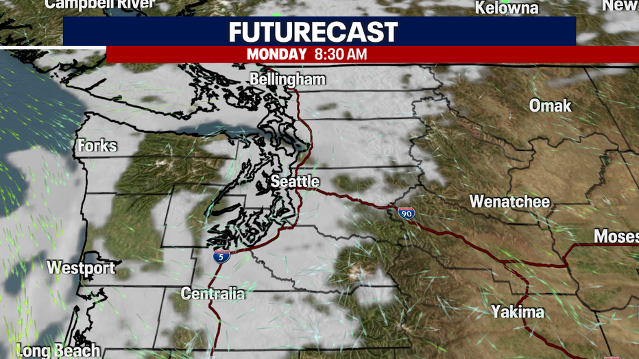
A weak disturbance will sink southward out of British Columbia, increasing onshore flow. This will result in more clouds and a slightly cooler afternoon.
Weak disturbance will bring cool temps and more clouds to the region on Monday. (FOX13 Seattle)
While much of Western Washington will get a short break in the heat, the fire threat remains high to the east. Conditions are expected to be breezy, hot and dry throughout the day tomorrow.
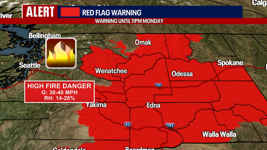
Breezy, hot and dry conditions will lead to increased fire threat.
The heat will return by the middle of the week with afternoon highs well into the 90s in parts of Western Washington. We will see more normal temperatures by next weekend.
A brief break from the heat before 90s return mid-week. (FOX13 Seattle)