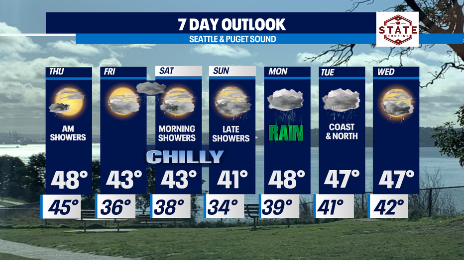
Drying out as we head into the weekend with a much cooler airmass on the way!

Near-record temperatures in Western Washington as December begins
FOX 13 Meteorologist Brian MacMillan has unseasonably warm temperatures in the forecast for early December.
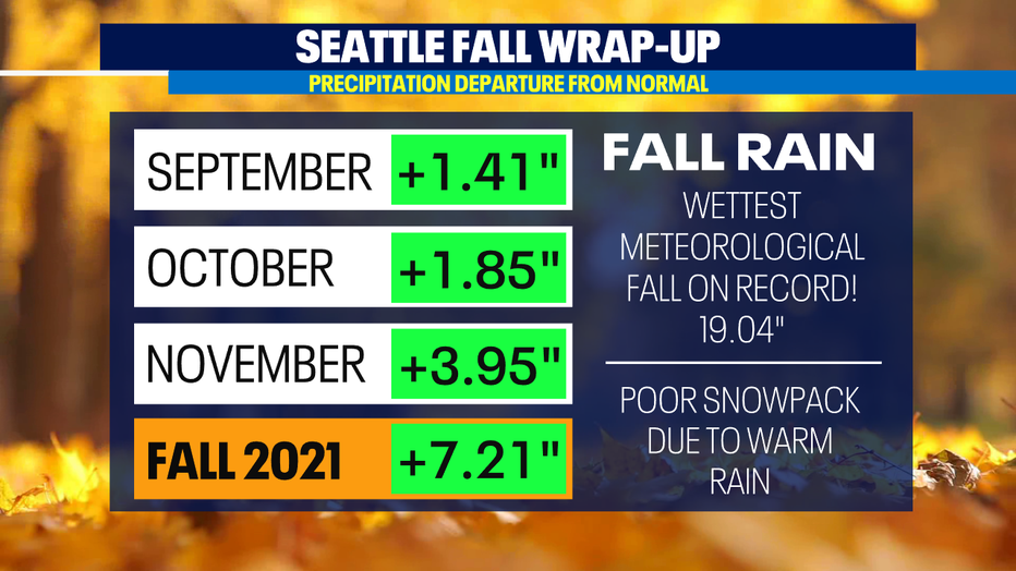
SEATTLE - September through November will go into the Seattle record books as the wettest meteorological fall ever!
Meteorological fall runs September 1 through November 30 and during this time Seattle accumulated 19.04 inches of rain, which is 7.21" above average for this time period. That blows away the all time record, thanks to several atmospheric rivers that pounded Western Washington.
READ MORE: Sea-Tac Airport sees wettest fall ever recorded
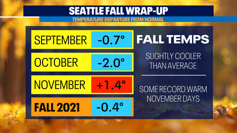
Temperatures remained close to average for the fall, but a warmer than average November meant low snowpack in the mountains.
Looking ahead, the weather trends drier than wet the next seven days. However, a much cooler airmass will return starting Thursday. Expect highs in the 40s starting Friday with overnight lows dropping into the 30s.
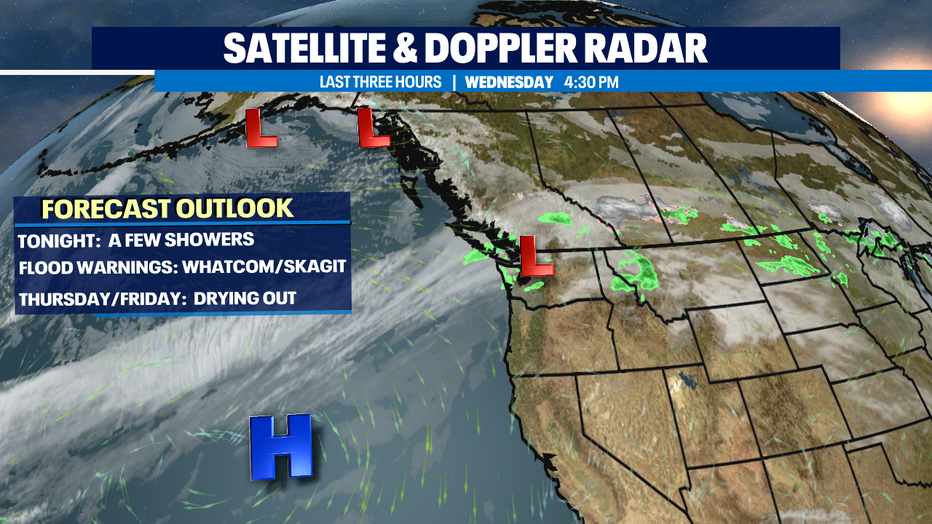
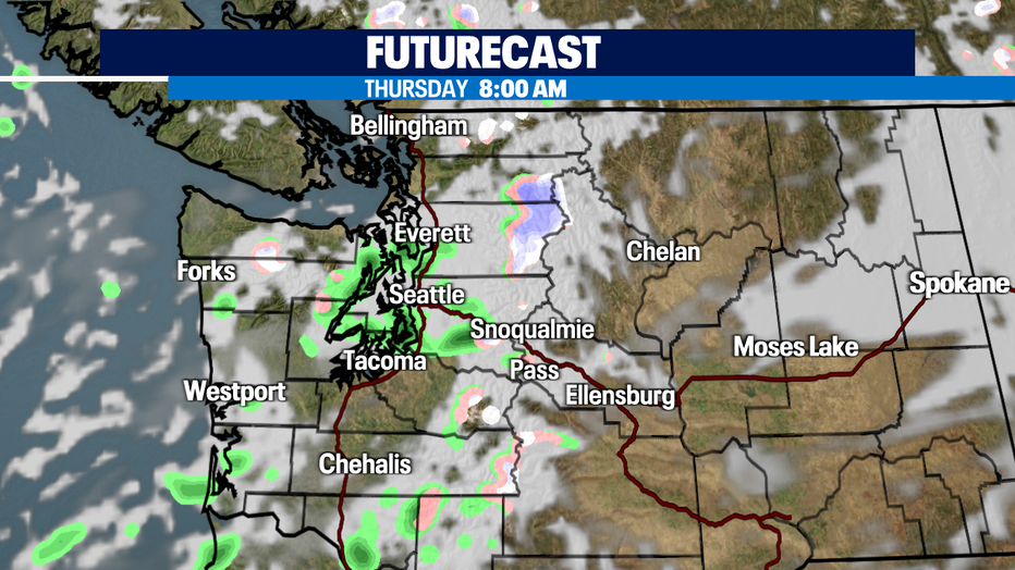
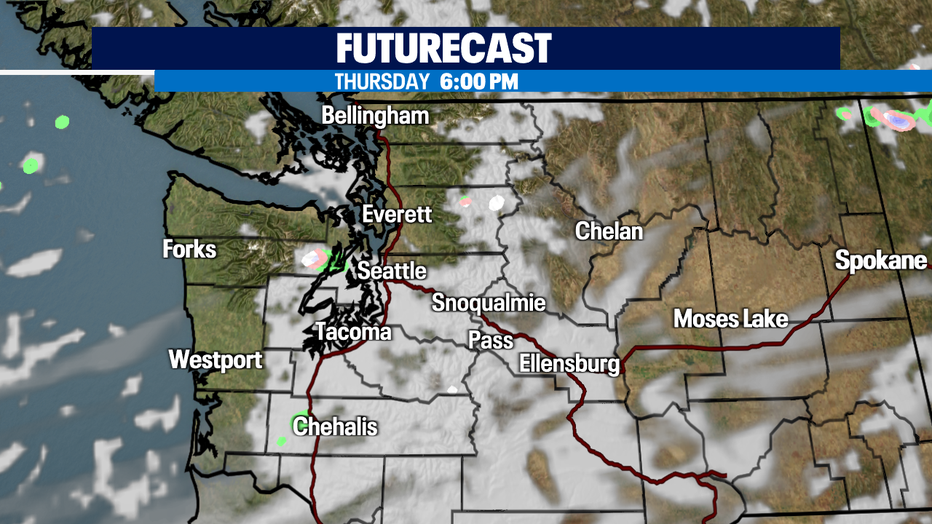
The next chance for widespread rain is late Friday night into early Saturday. Showers return again late Sunday into Monday for a soggy first half of the day.
Have a great night all! ~Erin Mayovsky, FOX 13 Forecaster
MORE FROM FOX 13 WEATHER:
DOWNLOAD: FOX 13 Weather and News Apps
WATCH: Forecast and Radar
READ: Closures and Delays
CHECK: Latest Weather Alerts and Live Traffic Map
INTERACT: Submit your Weather Photo
DAILY BRIEF: Sign Up For Our Newsletter
FOLLOW: Lisa Villegas, Erin Mayovsky, Brian MacMillan and Scott Sistek
Watch FOX 13 Seattle for the latest news:

