

Washington’s shakiest decade: Four earthquakes in 10 years left a deadly toll
A look back at Seattle's long history with earthquakes
As a 4.2 magnitude earthquake had many in the greater Seattle area chirping on social media, a major discussion is happening at DNR over a major Seattle fault earthquake.
SEATTLE - A major earthquake on the Seattle Fault could send a tsunami as high as 33 feet into Elliott Bay, a potentially devastating scenario that has renewed interest online in Washington's earthquake risk.
While such an earthquake is considered rare, scientists say Washington's history shows seismic activity does not always arrive at regular intervals.
Harold Tobin, director of the Pacific Northwest Seismic Network, said the Seattle Fault represents a particularly dangerous scenario because it runs directly beneath the region.
"I mean it’s natural for people to pick up on stories about what could happen; what are some of our worst-case scenarios, bad days, earthquake situations," said Tobin. "The Seattle fault really is kind of our worst-case scenario."
A tsunami with little warning
A Cascadia Subduction Zone earthquake would have a much more widespread impact, but a Seattle Fault earthquake could wreak havoc on the city because of its proximity.
"It’s right under our feet, so the shaking here in the city would be really strong, and also it could trigger a tsunami immediately right in Elliot Bay," explained Tobin.
The Seattle Fault Zone produces major earthquakes very infrequently, on the scale of thousands of years. The last major earthquake on the fault occurred in the year 923, according to the information provided by the Washington Geological Survey.
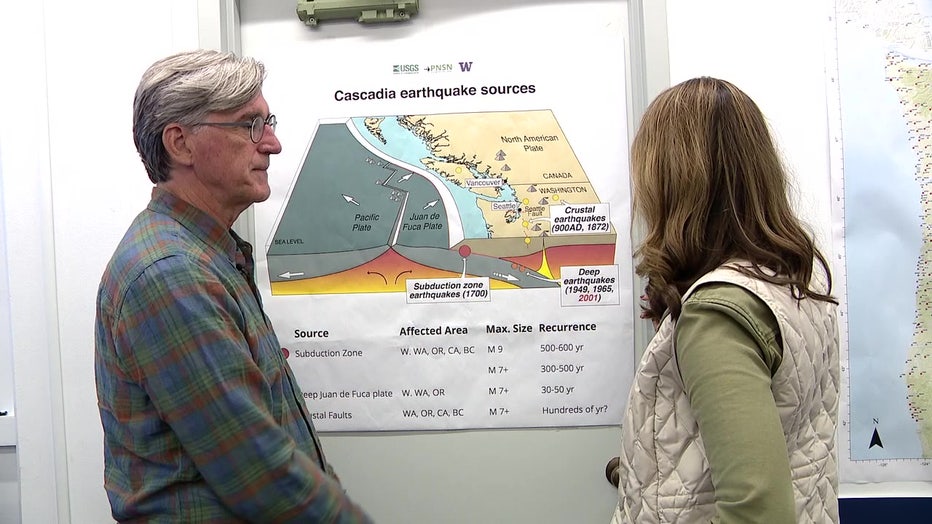
Map detailing earthquakes in Western Washington, as well as their type and frequency. (FOX 13 Seattle)
That earthquake is estimated to have been between magnitude 7.5 and 7.8.
Tobin described the fault having ripped right under Bainbridge Island, under the city, under Lake Washington."
If a similar earthquake happened today, the impacts could be devastating for downtown Seattle and communities around Elliott Bay.
Tobin said the threat would extend beyond Seattle's downtown waterfront, pointing to marinas, harbors, houseboats and infrastructure around the region.
Unlike some tsunami threats that allow time for an official warning, a Seattle Fault tsunami could arrive quickly after the shaking begins.
"Unfortunately, there would be much less time and as soon as people felt the earthquake, if you’re close to the waterline, if you’re in the harbor anything like that, you want to quickly move to higher ground," explained Tobin.
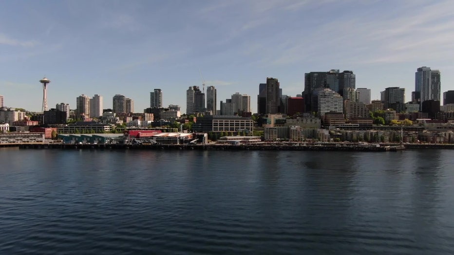
Seattle Waterfront as seen from Elliott Bay. (FOX 13 Seattle)
A wall of water along the waterfront
Daniel Eungard with the Washington Geological Survey studies how tsunamis could affect the region. He said concerns surrounding the Seattle Fault remain relevant even though major earthquakes on it are rare.
"Earthquakes and tsunamis are a reality of living here in the Pacific Northwest," Eungard said.
Washington has the second-highest earthquake risk in the country, according to Eungard.
He said waves generated during the 923 earthquake may have reached heights of up to 33 feet along what is now Seattle's waterfront.
"You could imagine about the height of a three-story building. That’s about the amount of water that came washing through the waterfront at that time," explained Eungard. "Of course, the Seattle Waterfront looked very different in the year 923."
A tsunami would also come on top of damage already caused by the earthquake itself.
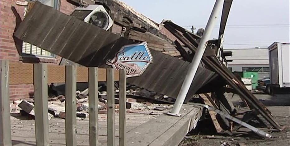
"Pioneer Square is known to have a lot of older brick style structures," said Eungard.
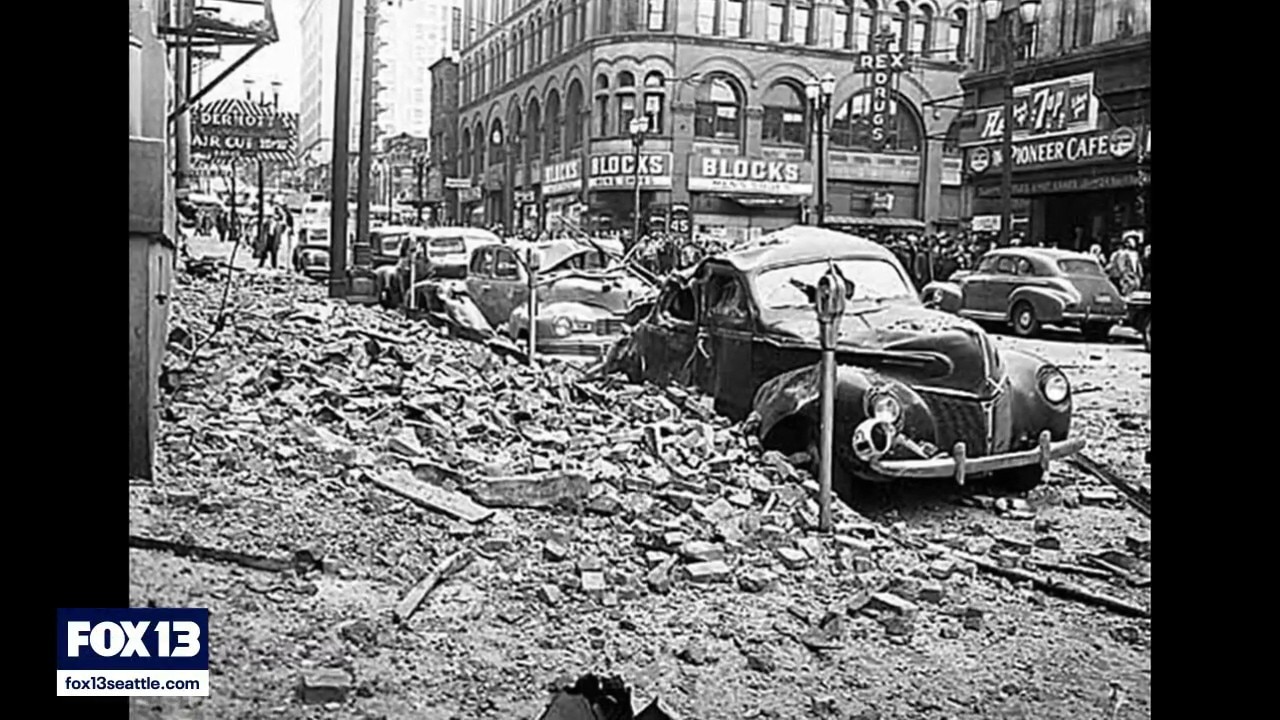
Eungard said facades from some buildings collapsed into streets during the 2001 Nisqually earthquake, creating obstacles for first responders.
Featured
Nisqually earthquake rocked western Washington 25 years ago
On Feb. 28, 2001 at 10:54 a.m., a 6.8 magnitude earthquake rattled western Washington, leaving billions of dollars in damages, several hundred people injured. One person died of a heart attack.
Four earthquakes in 10 years
Washington's earthquake history also shows how seismic activity can appear to cluster.
Beginning in 1939, the state experienced four notable earthquakes in roughly a decade.
The first struck just before midnight in 1939. Local historians reported tremors continuing for 21 minutes, while theatergoers in Aberdeen, Chehalis and Seattle reportedly fled into the streets.
Tobin said the account of 21 minutes of shaking may not mean the initial earthquake itself lasted that long.
The earthquake occurred before the Richter scale was in use, so no magnitude was recorded.
Another earthquake struck in 1945. The magnitude 5.5 earthquake rocked communities along the Cascades. In Roslyn, a boy was hit by a falling brick. In North Bend, part of Mount Si came crashing down.
A year later, a magnitude 6.3 earthquake damaged buildings and a packaging plant.

Old newspaper clipping of earthquake activity in Seattle. (Public domain)
The deadly 1949 earthquake
The largest earthquake of the stretch came in 1949.
The magnitude 7.1 earthquake killed eight people and left visible damage across the region. In Pioneer Square, chimneys were twisted and monuments fell. At Green Lake, massive cracks opened in the pavement.
"The 1949 earthquake was a very similar earthquake to Nisqually in 2001," said Tobin.
Both the 1949 earthquake and the 2001 Nisqually earthquake occurred deep within the Earth's crust. While they produced strong shaking, they could not rupture the surface and did not produce the kind of tsunami associated with a major Seattle Fault earthquake.
Eungard noted that the 1949 and Nisqually earthquakes occurred roughly 50 years apart but cautioned against interpreting that as a predictable schedule.
"It’s not a stop watch, it’s not every 50 years on the dot," remarked Eungard.
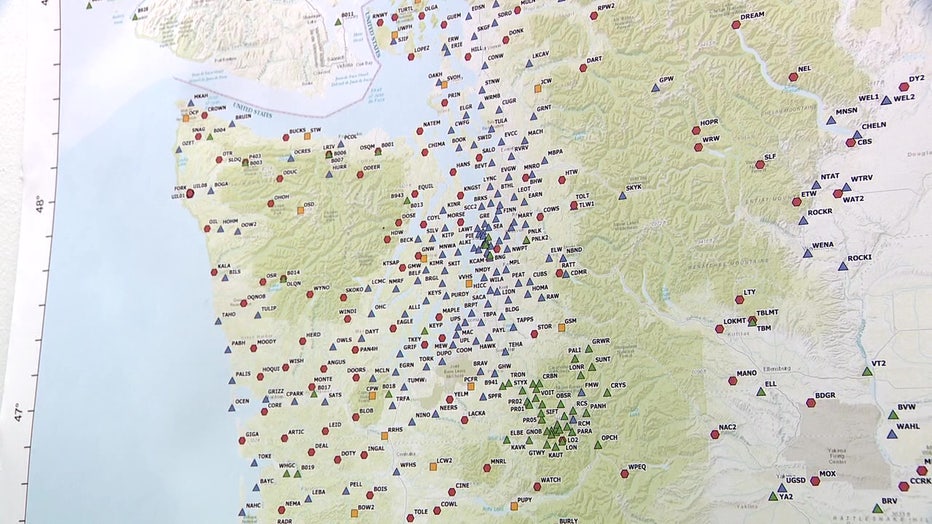
Western Washington earthquake map. (FOX 13 Seattle)
Why are some decades shakier?
Scientists do not fully understand why earthquakes sometimes appear to cluster over particular stretches of time.
The recent past has been comparatively quiet.
"It turns out the past decade, maybe the last 15 years even, have been much quieter than even the 1990s, early 2000s, 1980s," said Tobin.
That does not mean another earthquake is due, nor does a quiet period indicate the region's earthquake risk has disappeared.
"Some decades are definitely shakier than others overall. Not one earthquake, and not just one earthquake and its aftershocks, but really over spans of time," said Tobin.
Scientists can use those past earthquakes to better understand how buildings and infrastructure respond to shaking. Tobin said improved building construction can make a significant difference, while older buildings that survived Nisqually without retrofits are not guaranteed to withstand the next major earthquake.
MORE NEWS FROM FOX 13 SEATTLE
Dan Wilson will not return as Seattle Mariners manager
6 WA Starbucks locations closing amid broader shutdown. Here's where
Seattle police, city leaders push back on Mayor Wilson's proposed budget
Kurt Cobain's Nirvana studio hits Airbnb in Olympia, WA
Puyallup, WA realtor couple, neighbor share story behind viral TikTok
New Amtrak Airo trains to debut Sept. 30 in the Pacific Northwest
1,150-acre Benton County fire prompts evacuation orders
To get the best local news, weather and sports in Seattle for free, sign up for the daily FOX Seattle Newsletter.
Download the free FOX LOCAL app for mobile in the Apple App Store or Google Play Store for live Seattle news, top stories, weather updates and more local and national news.
The Source: Information in this story comes from original reporting by FOX 13 Seattle reporter Lauren Donovan.