

Seattle weather: Warm Sunday, showery Monday on the way
Warm, sunny weekend leads into a rainy Monday
Mondays are already an uphill battle, but FOX 13 Chief Meteorologist Lisa Villegas is tracking an ESPECIALLY tough one! Rain is back in our forecast before clearing out Tuesday afternoon.
SEATTLE - After clouds burned off Saturday skies were beautiful with highs above average. Seatac hit 81 at the airport.

Overnight expect partly cloudy conditions with temps in the mid to upper 50s.

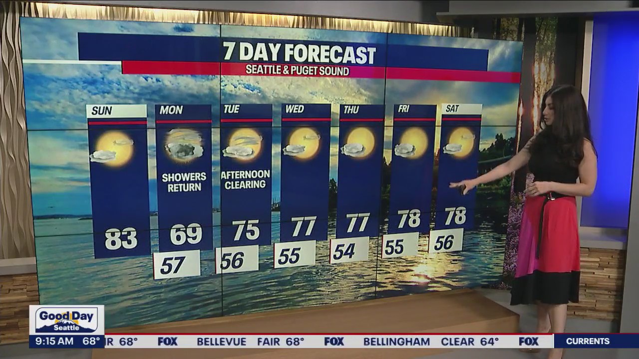
Sunday will look a lot like Saturday with morning clouds giving way to afternoon sunshine. Highs warm into the low 80s around Puget Sound.

If you can believe it, we are forecasting the return if rain on Monday as our ridge of high pressure shifts east, opening the door for a system to finally deliver some rain.

Here's a peek at futurecast showing us the timing of the rain around the region. By 9am rain pushes inland across Puget Sound into the foothills.

By early afternoon rain lets up to areas of lighter showers.

Another wave of rain picks up just after dinner time with the heaviest cells south and east of Seattle, mainly over the foothills and Cascades.

We're not forecasting a deep amount of moisture, but anything in the bucket at this point we'll take since we haven't seen any rain since June 20th. Models are hinting that some areas inland could pick up to 0.25". The northern coast could see up to 0.75" with a 0.25" to 0.50" for the Cascades.

Showers may linger Monday night into early Tuesday before wrapping up. Highs on Monday will run cool in the mid to upper 60s, but we do rebound back into the mid 70s both Tuesday and Wednesday.

The rest of the week into the weekend look for clearer skies and warmer highs in the upper 70s to low 80s. Enjoy!
Have a great weekend all! ~Erin Mayovsky, FOX 13 Forecaster

*Seatac Rain Almanac

*Coast Forecast

*Mountain Forecast

*Central & Eastern WA Forecast


