

Seattle Weather: On and Off Showers Throughout the Week

Seattle weather: rainy work week ahead
FOX 13 meteorologist Ilona McCauley has your forecast for the weekend.
Seattle - On and off showers will continue overnight as lows cool into the upper 30s and low 40s. Temperatures will be near freezing over the passes with more snow on the way.
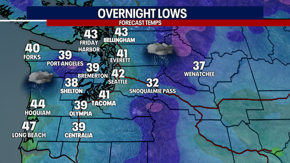
Lingering rain overnight with lows in the upper 30s and low 40s.
A convergence zone will settle into mountain passes around I-90 and US-2 ramping up snow totals in the area. Snow levels will be around 3000' with up to 10" possible. The Winter Weather Advisory will remain in effect until 11pm. Be sure to monitor pass travel if driving through the mountains overnight.
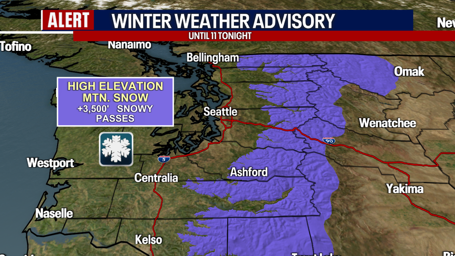
Snow could affect Stevens and White Passes through Sunday evening. (FOX 13 Seattle)
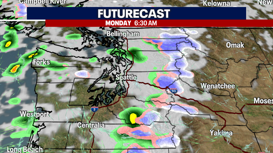
On and off showers will be around on Monday as the disturbance exists the area. A weak ridge will build in, bringing a short break in the rain, but will return by Tuesday evening.
A weak ridge will give us a temporary break in the rain.
Stray showers and cooler air in the wake of Sunday's cold front will lead to a cooler
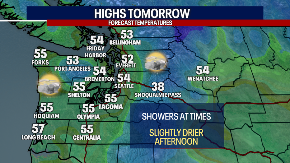
Another cool day around the region as highs only climb into the mid 50s in some spots.