

Seattle weather: Thunderstorms exit, summer heat returns
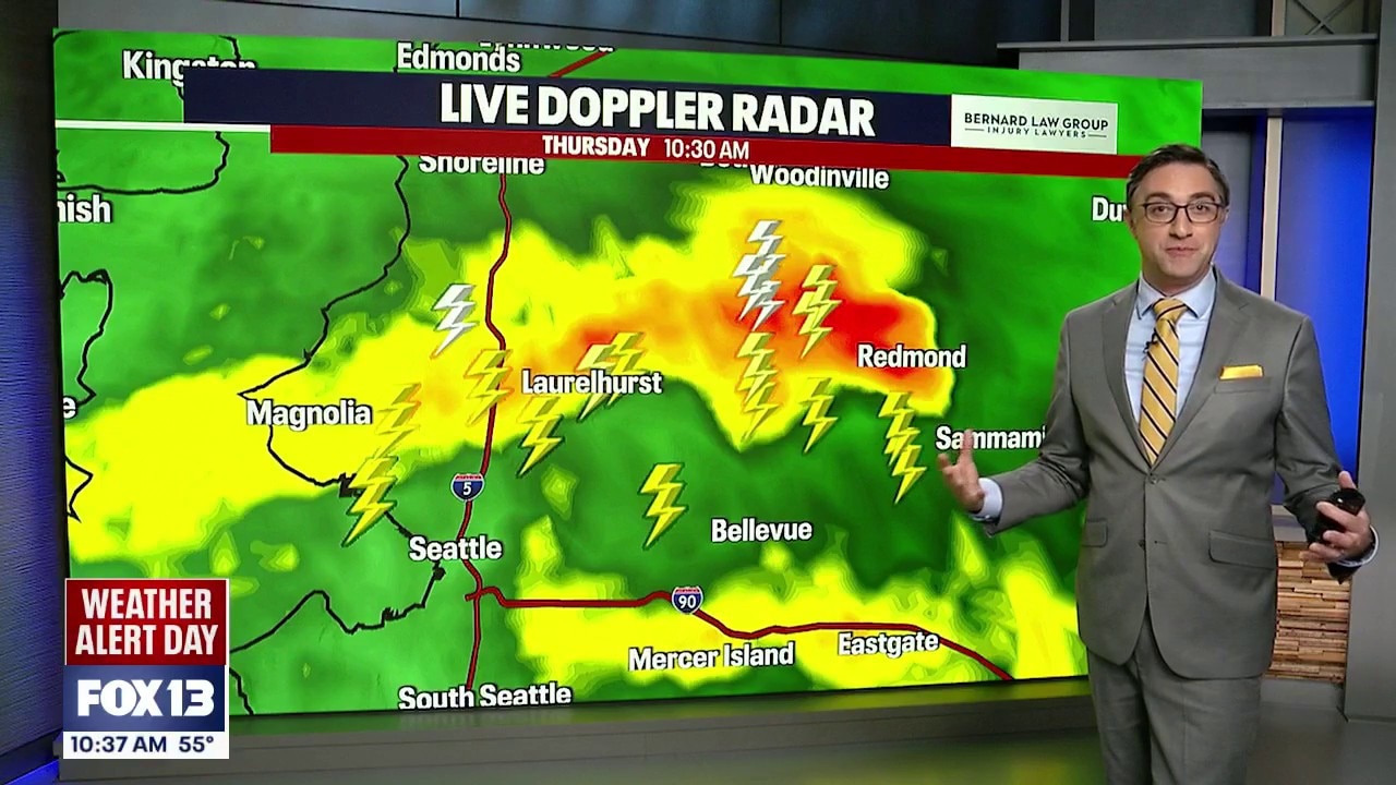
Lightning strikes continue across Western WA
Thunderstorms, lightning strikes and heavy rain continue across Western WA this morning and will begin moving north over the next hour.
SEATTLE - Thunderstorms and showers are wrapping up in Western Washington, and warmer, drier weather is on the way.
A low pressure system moving across the Pacific Northwest will keep scattered showers and a few thunderstorms around through Thursday evening. Not everyone will see rain, but many communities have at least a chance of getting wet before skies begin clearing overnight. Early Friday morning, most of Western Washington will be dry, setting the stage for a stretch of warmer and drier weather.
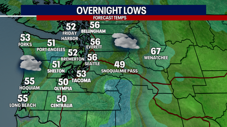
Rain will subside and we'll be looking at mostly cloudy skies by early Friday morning. (FOX 13 Seattle)
Thunderstorms wrapping up on Thursday
The best opportunity for showers and thunderstorms Thursday afternoon and evening will be across the Olympic Peninsula and north of Seattle, toward Whatcom County.
Thursday's thunderstorms also bring an important wildfire concern. A Red Flag Warning remains in effect for parts of the Olympics and Cascades through this evening. Even a single lightning strike can spark a wildfire if it hits dry vegetation, and gusty winds around thunderstorms can make any new fire spread quickly.
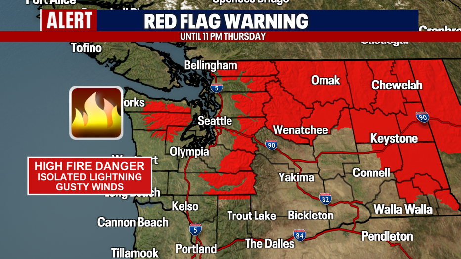
A Red Flag Warning is in effect for parts of Washington State. (FOX 13 Seattle)
West of the Cascades, we don't see a lot of thunderstorms, but the spring and summer months are the most common times of the year for them.
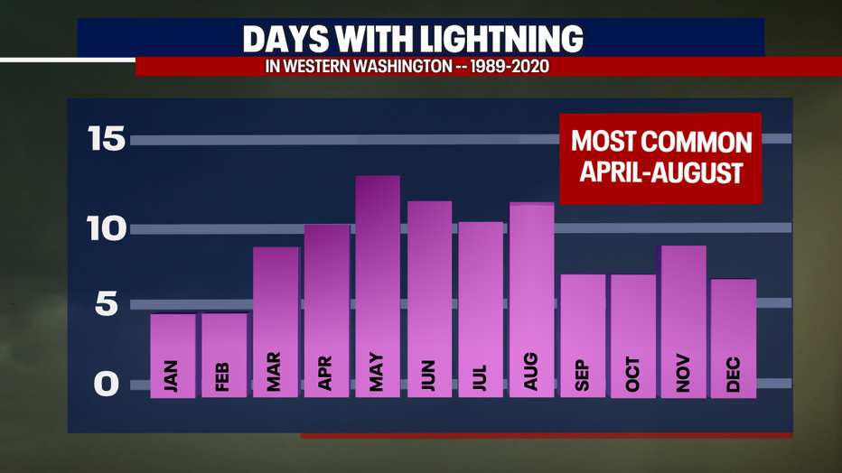
While rare, April through August is the most common times for lightning in Western Washington. (FOX 13 Seattle)
Dry weather returns Friday and Saturday
Friday and Saturday will feature much more sunshine after morning clouds. Afternoon high temperatures will rebound into the mid to upper 70s around the greater Seattle area on Friday, 80s on Saturday.
Summer heat builds next week
High pressure will strengthen over the Pacific Northwest starting Sunday. Inland highs will climb into the low to mid 80s Sunday before reaching the mid to upper 80s Monday through Wednesday.
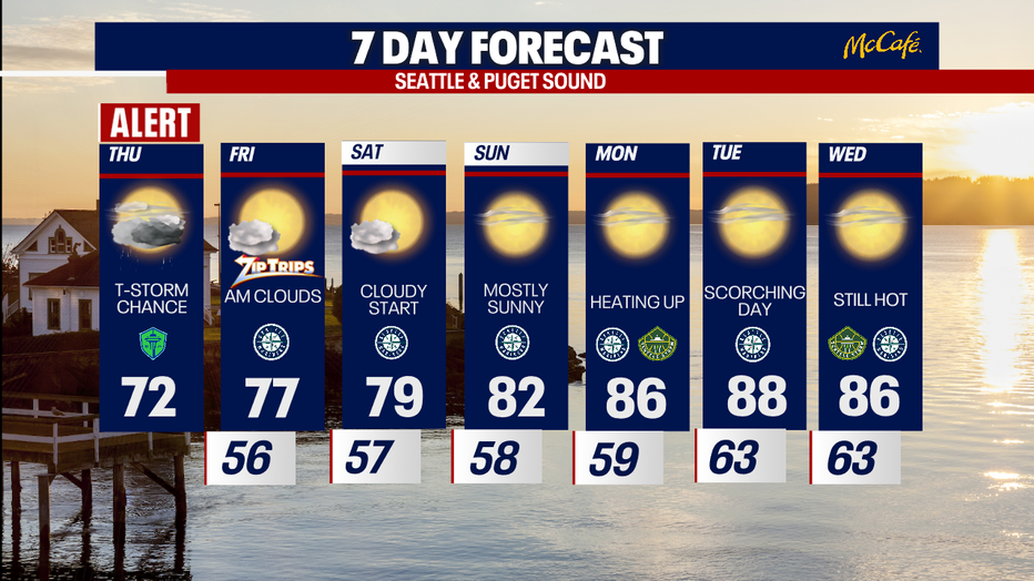
Western Washington will return to warmer drier weather this weekend. (FOX 13 Seattle)
MORE NEWS FROM FOX 13 SEATTLE
Cyclosporiasis in WA: Where the state stands as national outbreak surges
WA low tides: Extreme drop brings final tide-pooling event of the season
WA braces for wildfires as incoming storm expected to bring lightning
Seattle's most infamous parking garage sits atop forgotten landmark
Tacoma's Point Defiance Zoo closes puffin exhibit after 3 birds die
To get the best local news, weather and sports in Seattle for free, sign up for the daily FOX Seattle Newsletter.
Download the free FOX LOCAL app for mobile in the Apple App Store or Google Play Store for live Seattle news, top stories, weather updates and more local and national news.
The Source: Information in this story comes from weather models interpreted by the FOX 13 Seattle weather team.