

Seattle weather: Warm & dry Friday with a chance for showers this weekend
Hotter weekend ahead
There's a chance of showers this weekend, but conditions will be mostly warm and sunny to end the week out.
SEATTLE - Highs Thursday went soaring above average again for the third day in a row. Sea-Tac hit 84 at the airport with even warmer highs to the south.

After the warmth of our daytime heat, we'll stay warmer than normal overnight too. Skies will look mainly clear with a low temperature near 60 for Seattle.

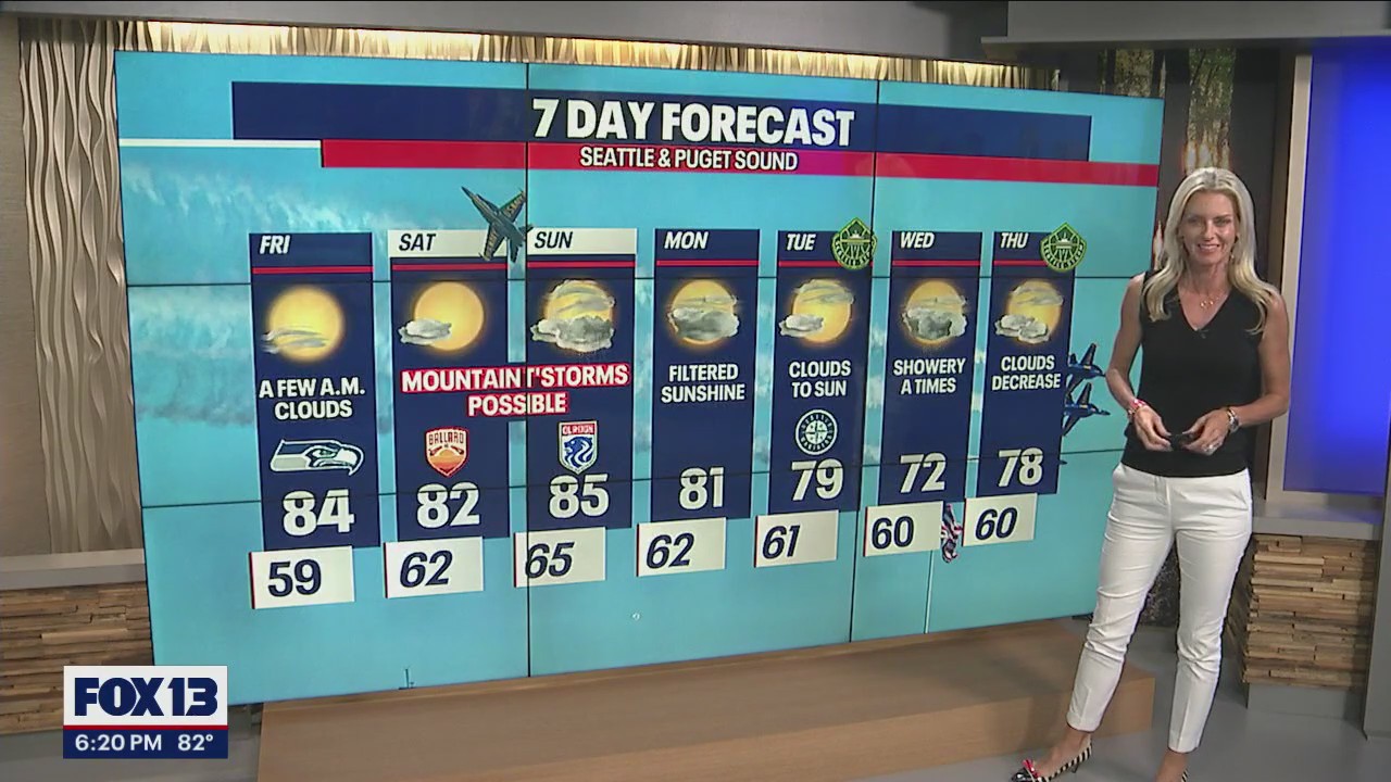
Other than a few clouds at the coast and to the southwest skies are sunny Friday. The warmest temps are south of the metro with Shelton at 88. Look for the mid-80s through the Central Sound.

Saturday we're mostly sunny to partly cloudy with a slight chance for a few light showers rolling over the Cascades into the lowlands. Highs cool into the low 80s.


The weekend will stay warm with highs peaking on Sunday near 85, but there is a better chance of showers moving east to west from the mountains into Puget Sound.
We do expect thunderstorms to fire up over the Cascades with a few finding their way into the foothills as well. If you're planning on heading to the high country be careful as the atmosphere will be unstable at times with possible heavy downpours.


Cloudier skies are with us through next week providing filtered sunshine at times with cooler temperatures too. These conditions are all thanks to a change in our weather pattern as a few disturbances pass through the area giving us a chance for widespread showers. Enjoy!
Have a great rest of the week all! ~Erin Mayovsky, FOX 13 Forecaster

*SeaTac Rain Almanac

*Coast Forecast

*Mountain Forecast

*Central WA Forecast
