

'Particularly Dangerous' winds drive wildfires in eastern WA
WA wildfire outlook: Weather, red flag warnings, air quality
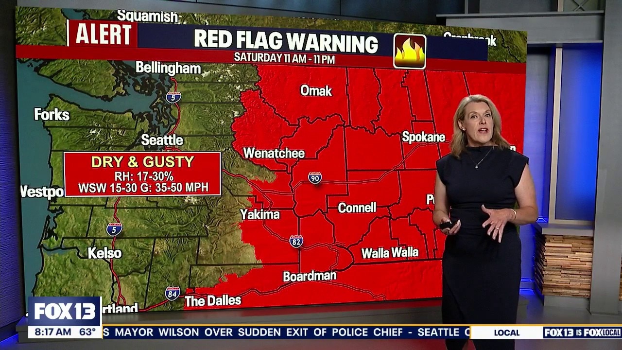
FOX 13 meteorologist Ilona McCauley breaks down Washington's weather conditions, fire outlook, and NWS alerts for areas in the central and eastern part of the state over the weekend.
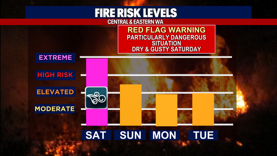
SEATTLE - A cold front that moved into Washington Saturday brought breezy and windy conditions with it, increasing the danger of wildfires burning in the state.
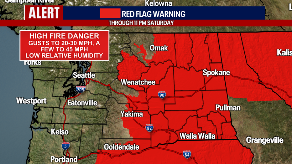
The gusty winds of up to 50 miles per hour in some locations prompted the National Weather Service to issue a red flag warning for a large portion of central and eastern Washington.
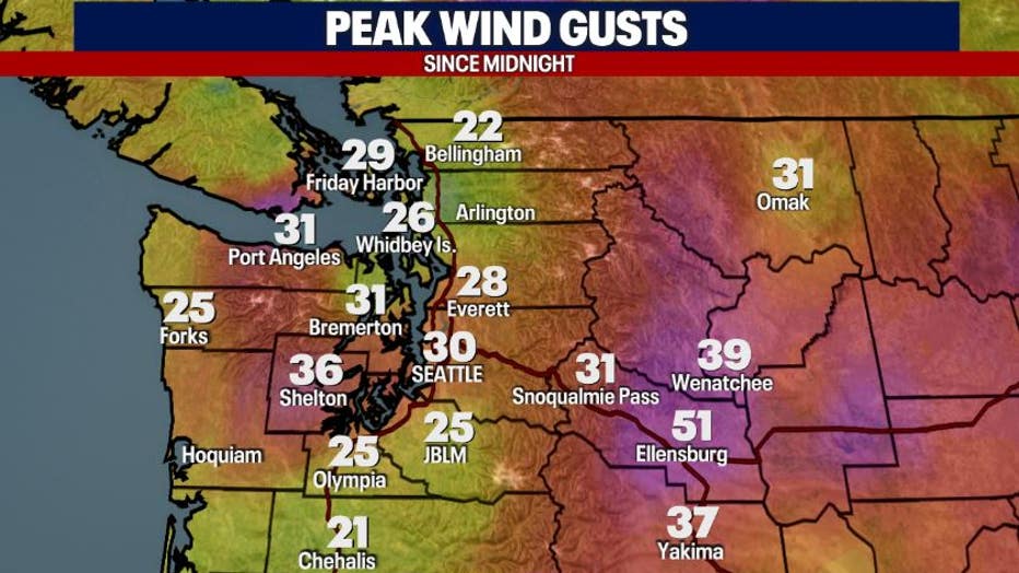
Peak wind gusts in some locations were recorded as high as 37 mph in Yakima and 51 in Ellensburg.
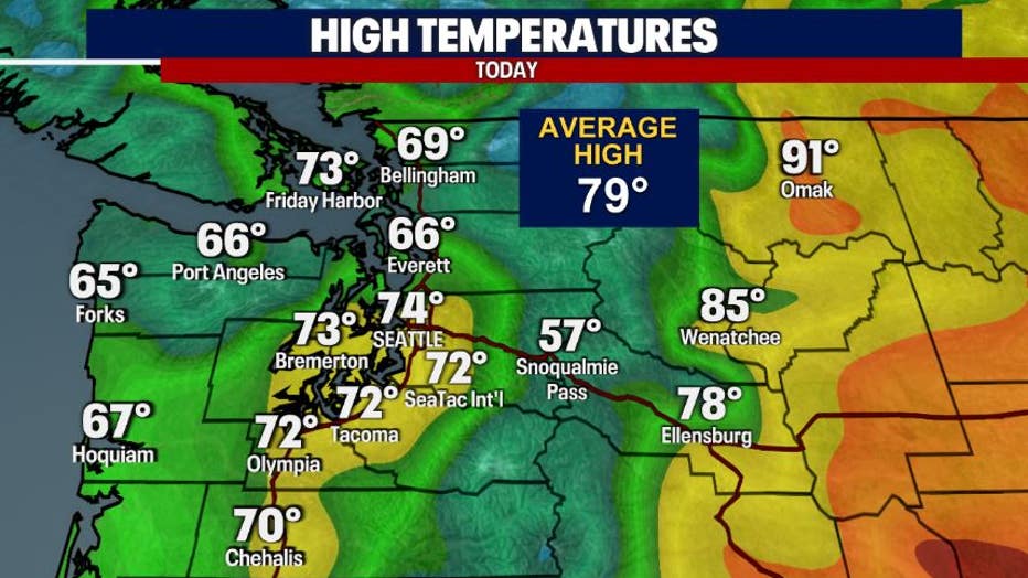
The temperatures remained high in central and eastern Washington and humidity was only at about 11% in some locations, adding to the potential for rapid fire spread for new and ongoing fires.
The NWS also called the conditions on Saturday a "Particularly Dangerous Situation."
This is only the second time that NWS has used this label nationally in relation to fire danger and the first time it’s been used in Washington state.
Drought conditions, along with winds and hot temperatures, prompted Governor Bob Ferguson to declare a statewide wildfire emergency.
A large wind-driven fire called the Old Trails Fire started in the Spokane area at around noon on Saturday. It prompted level 3 evacuations and burned homes, outbuildings and other structures. Level 3 evacuations were also issued for other areas, including in Okanogan County in a large area west of the Okanogan River, north to Oroville, including Palmer Mtn. Tonasket, Saturday afternoon.
As Central and Eastern Washington dealt with critical fire danger, in western Washington, breezy and windy conditions were also an issue, prompting officials to cancel Seafair’s US Navy Blue Angels airshow Sunday. They cited safety as one of the main reasons for the cancellation of the airshow.
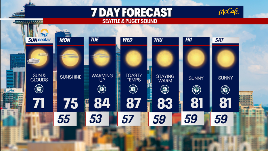
Sunday will bring another round of cooler temperatures. It will be cloudy through mid-morning, with decreasing clouds heading into a sunny afternoon. Temperatures will remain cool, with a high near 71 degrees in the Seattle area. The forecast will start to heat up again early next week, topping out in the 80s Tuesday through Saturday.
MORE NEWS FROM FOX 13 SEATTLE
Seattle police Chief Shon Barnes asked to resign by Mayor Katie Wilson
When to watch the Blue Angels fly at Seattle Seafair 2026
Seafair details new security as Seattle mourns deadly shooting
Seattle police Chief Shon Barnes downplays viral reporter clash
Bite of Seattle shooting: Police recover 'ghost gun', Glock 45, more
Tacoma, WA man pleads not guilty in toddler shooting
Why did it take hours for a press conference on the Bite of Seattle shooting?
Here's where fires in Washington state are burning
To get the best local news, weather and sports in Seattle for free, sign up for the daily FOX Seattle Newsletter.
Download the free FOX LOCAL app for mobile in the Apple App Store or Google Play Store for live Seattle news, top stories, weather updates and more local and national news.