

Seattle weather: One last stretch of warm weather
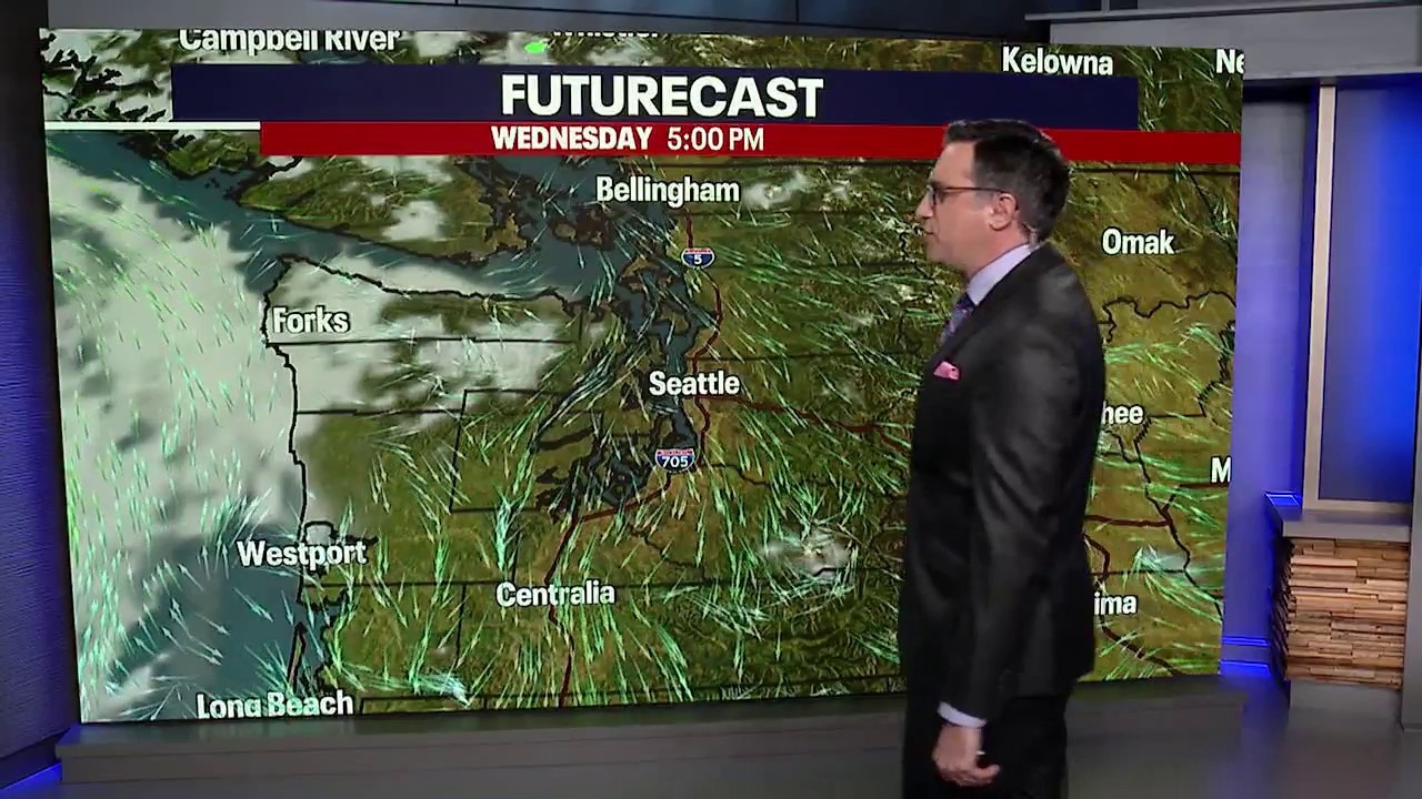
Seattle weather: Mostly dry conditions, mild temperatures for Tuesday
Expect a mix of clouds and sun Tuesday, with a few showers possible along the north coast and across the Northwest Interior. Most of the region should stay dry, but the thicker cloud cover will keep temperatures a bit cooler in the north. Highs will range from the mid-50s to mid-60s.
SEATTLE - A weather system moving into British Columbia is brushing western Washington today, bringing more clouds and a few scattered showers.
The best chances for rain are along the coast and near the Canadian border, while much of the Puget Sound region will stay mainly dry and cloudy.
Tonight will be mostly cloudy with a few light showers by the early morning. Overnight lows will be in the 40s and 50s for most spots.
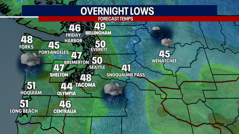
Light scattered rain returns early Wednesday morning to the Puget Sound area. (FOX 13 Seattle)
More showers on Wednesday, especially north
Big picture view:
A cold front will weaken as it moves south and east across western Washington on Wednesday. That will keep the shower chances around through the morning hours, mainly along the coast, in the mountains and across the northern part of the Puget Sound area. Wednesday afternoon looks drier with increasing sunshine. Highs will be in the mid 60s.
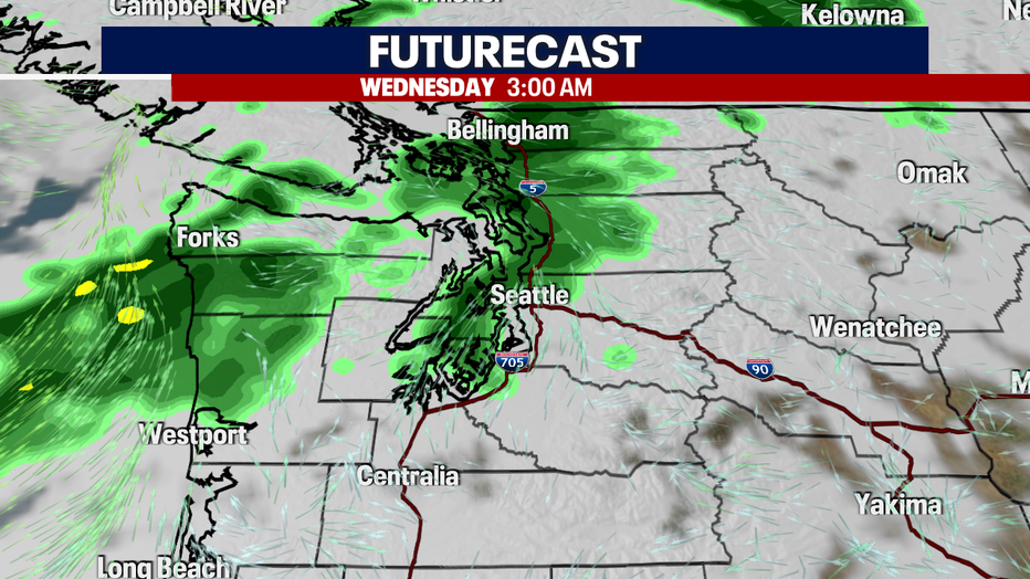
Light rain showers will move into Western Washington early Wednesday morning. (FOX 13 Seattle)
Welcome warm-up in Seattle to end the week
Local perspective:
High pressure will rebuild over the region Thursday, setting us up for a stretch of drier and warmer weather. Thursday should bring plenty of sunshine and afternoon highs in the low 70s for many areas in the central and south Puget Sound. Temperatures will be cooler near the water, with many waterfront communities staying in the 60s.
Friday looks even warmer, as offshore flow develops. Highs across the interior are expected to reach the lower to mid 70s. It should be a great couple of days to enjoy some fall sunshine before our next weather system arrives.
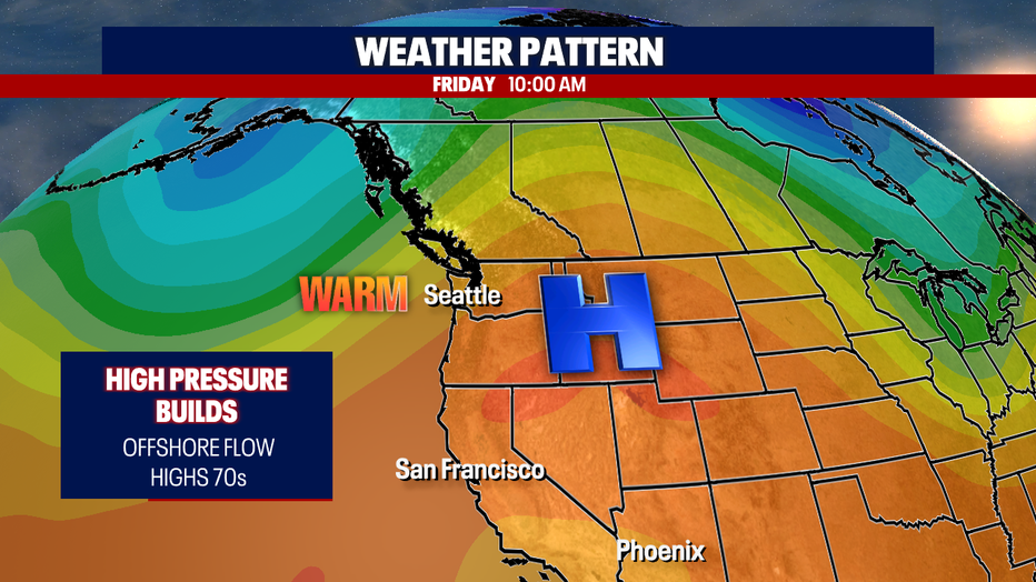
A ridge of high pressure will settle in over the Pacific Northwest on Thursday and Friday. (FOX 13 Seattle)
Cold and rain returns this weekend
What's next:
A trough of low pressure will move toward the region Friday night and Saturday, bringing much cooler temperatures and a return of light rain. Highs will drop about 10 degrees, back into the low 60s.
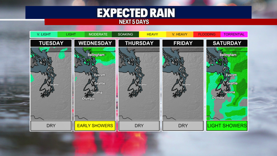
Widespread rain showers return Saturday to the Puget Sound area. (FOX 13 Seattle)
Sunday Into Monday: A Wetter Pacific System
By the numbers:
The bigger weather story arrives Sunday and continues into Monday, when a stronger Pacific system is expected to move into western Washington.
This system has the potential to bring periods of steadier, more widespread rain, mainly along the coast and in the mountains. Stronger winds are also possible along the coast, so it's worth keeping an eye on the forecast as the weekend approaches.
Higher elevations in the mountains could pick up some snow above 5,000 feet.
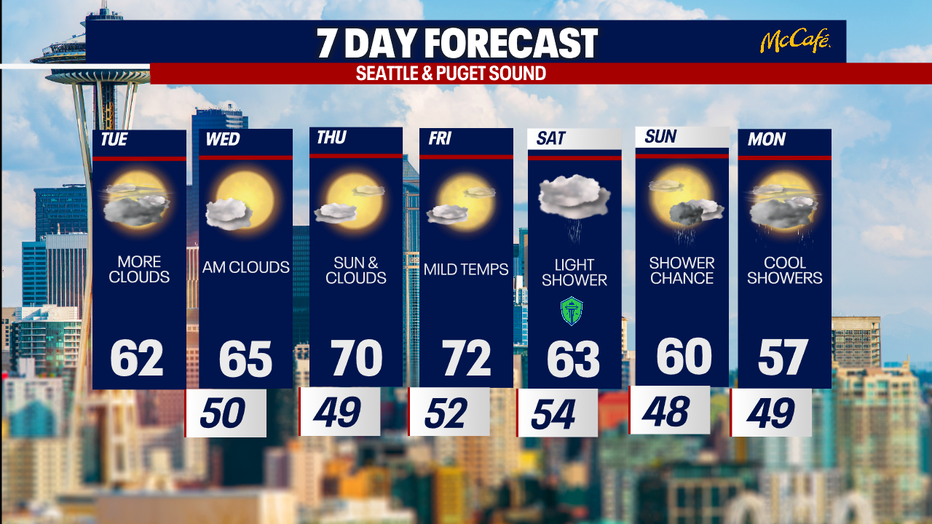
Temperatures will warm into the 70s on Thursday and Friday, but the warm-up will be short-lived. (FOX 13 Seattle)
MORE NEWS FROM FOX 13 SEATTLE
Problems growing with ‘Larch Madness’ in WA's North Cascades
1 dead, 1 injured after drive-by shooting at South Seattle nightclub
Tiger that killed man at wildlife park will not be euthanized, officials say
Longtime Seattle restaurant Pam's Caribbean Kitchen closing Nov. 29
12 killed, over 300 hurt in attack at Saudi airport, officials say
Trump says Russia, Ukraine agree to immediate ‘energy ceasefire’ amid tensions with Zelenskyy
Seattle Kraken surge late to top Capitals in 5-3 victory
To get the best local news, weather and sports in Seattle for free, sign up for the daily FOX Seattle Newsletter.
Download the free FOX LOCAL app for mobile in the Apple App Store or Google Play Store for live Seattle news, top stories, weather updates and more local and national news.
The Source: Information in this story comes from weather models interpreted by the FOX 13 Seattle weather team.