

Seattle weather: Rain and possible thunderstorms on Saturday
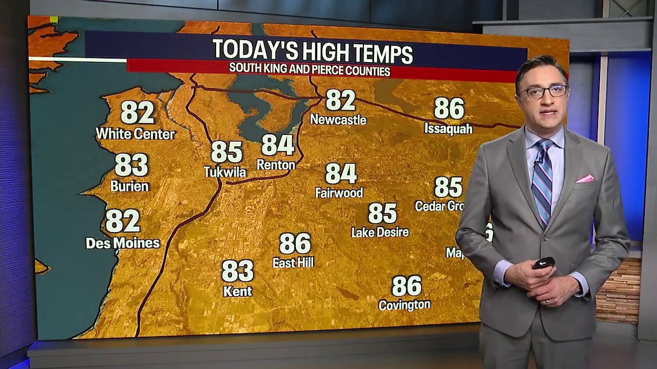
Seattle weather: Warmest temperatures of the week on Thursday
Thursday will be one of the warmest days of the week, with western Washington highs reaching the upper 70s to mid-80s.
SEATTLE - A weaker onshore push Thursday will mean more sunshine and warmer temperatures in the Puget Sound area. Highs will be in the mid-70s to mid-80s for most of Western Washington. An upper-level low pressure system will start moving up the West Coast later today.
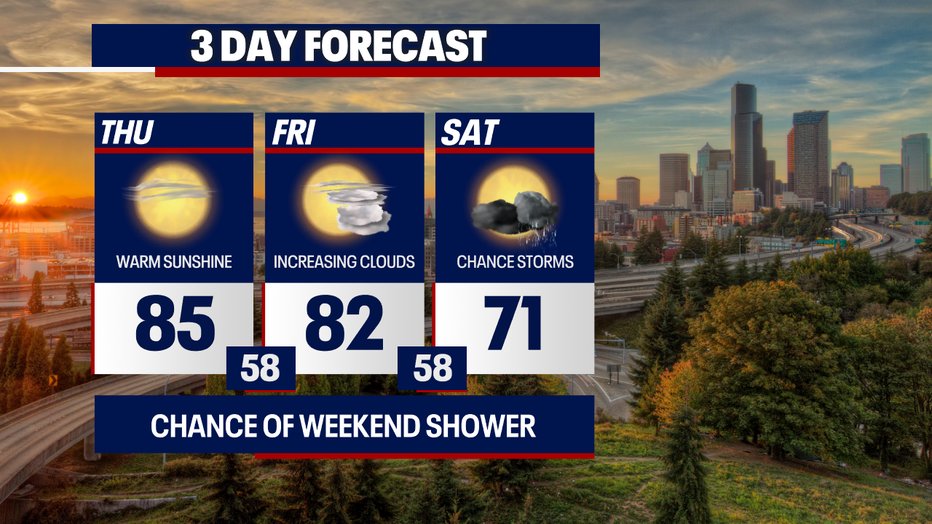
Seattle weather will be especially unsettled in the mountains, where thunderstorms and gusty winds are most likely. (FOX 13 Seattle)
Clouds increase in WA on Friday
Friday will be a transition day as the low pressure system tracks northeast. Expect more afternoon and evening clouds, but temperatures will still be warm, in the low 80s around Seattle.
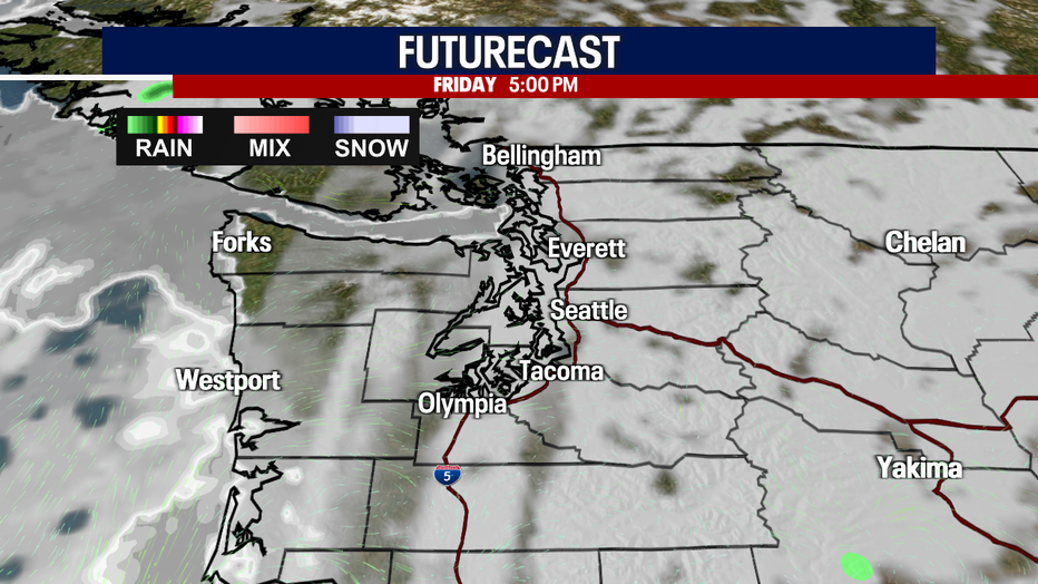
Seattle weather turns cloudier on Friday afternoon. (FOX 13 Seattle)
Summer rain, storms in Seattle this weekend?
Showers and potential thunderstorms will rotate out of the low and move across Western Washington Saturday morning into the afternoon, but the biggest risk of thunderstorms will be over the Cascades. It could also be breezy at times as thunderstorm cells move through. Temperatures will be much cooler, with highs mainly in the 60s and low 70s in the Puget Sound lowlands.
Seattle weather will be especially unsettled in the mountains, where thunderstorms and gusty winds are most likely. (FOX 13 Seattle)
High pressure will rebuild over the Pacific Northwest Sunday and Monday. We will get back to a pattern of morning low clouds followed by afternoon sunshine. Temperatures will be near or just slightly below normal through Tuesday.
Wildfire & air quality outlook in WA
The showers and possible thunderstorms on Saturday will need to be watched closely. While rain would be beneficial, dry lightning could create new fire starts in areas that receive little rainfall. Gusty winds around thunderstorms could also briefly increase the spread potential of existing fires.
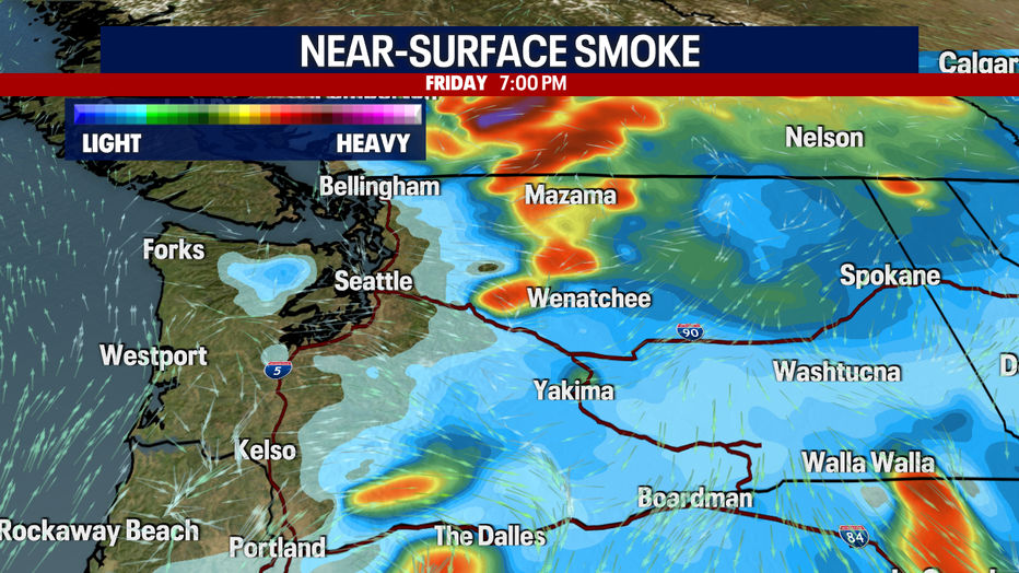
Check local air-quality readings in Eastern Washington if you are sensitive to smoke, especially if new fires develop. (FOX 13 Seattle)
As high pressure rebuilds Sunday and Monday, smoke will become more noticeable in and around active fire areas. Anyone sensitive to smoke should continue checking the latest local air-quality readings and forecasts, especially if new fires develop.
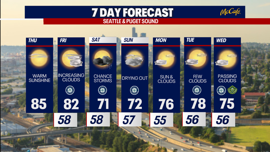
Seattle weather will settle into morning clouds and afternoon sunshine early next week. (FOX 13 Seattle)
Take good care,
Chief Meteorologist Brian MacMillan and the FOX 13 Weather Team
MORE NEWS FROM FOX 13 SEATTLE
Seattle Mayor Katie Wilson’s favorability drops in new poll
A Pioneer Square staple shutters after 49 years
Seattle residents frustrated at lack of information after apartment murder
Salmonella outbreak grows to 431 cases across multiple states, CDC says
WA man dies at Bass Canyon from suspected drug poisoning
Here's where fires in Washington state are burning
Seattle weather: Mostly sunny and warmer afternoon Thursday
To get the best local news, weather and sports in Seattle for free, sign up for the daily FOX Seattle Newsletter.
Download the free FOX LOCAL app for mobile in the Apple App Store or Google Play Store for live Seattle news, top stories, weather updates and more local and national news.
The Source: Information in this story comes from weather models interpreted by the FOX 13 Seattle weather team.