

Seattle weather staying quiet through the weekend
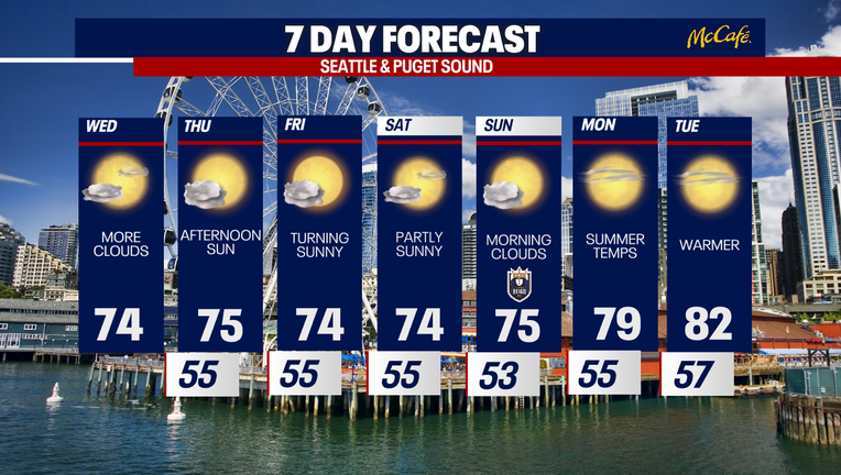
Seattle will keep weather featuring morning clouds, afternoon sunshine, mid-70s through Sunday, then warmer temperatures early next week. (FOX 13 Seattle)
SEATTLE - Today’s weather looked very similar to Tuesday, with temperatures ending up near or just a touch cooler than yesterday. Highs reached the mid-70s across much of Western Washington, while coastal communities stayed cooler in the 60s. Morning clouds gradually gave way to afternoon sunshine for most locations.
One exception was around central Puget Sound, where a convergence zone developed as airflow split around the Olympic Mountains and came back together over the region.
While no rain was expected, clouds lingered longer across parts of the Kitsap Peninsula, Hood Canal, and the greater Seattle area before sunshine became more widespread later in the afternoon.
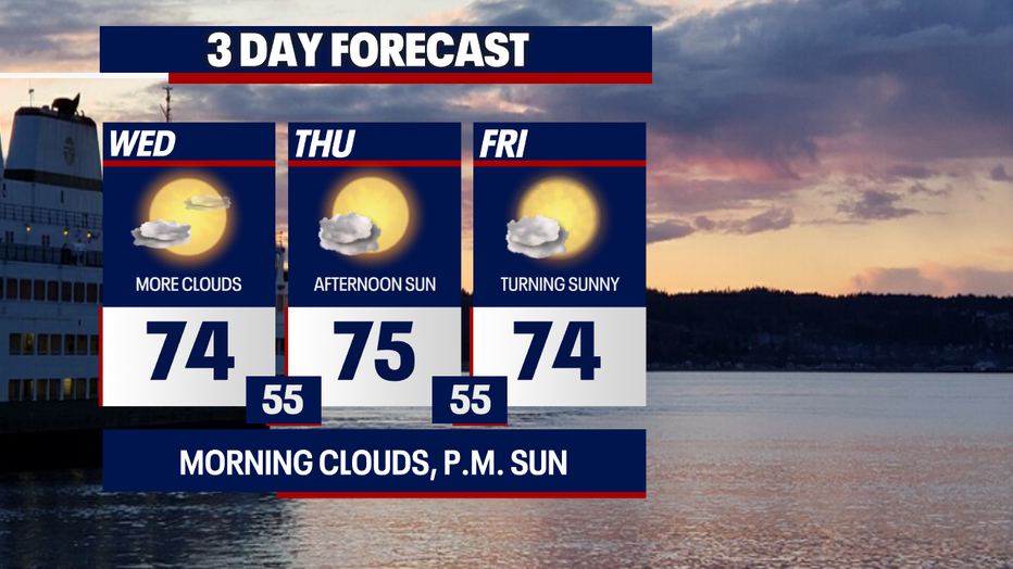
Seattle will keep weather comfortably mild with highs remaining in the mid-70s. (FOX 13 Seattle)
Summer sunshine returns on Thursday
Tomorrow, another round of morning clouds will develop before skies brighten to afternoon sunshine. High temperatures will remain comfortably in the mid-70s for most inland communities, with cooler weather continuing along the coast.
That familiar pattern of morning clouds followed by afternoon sunshine will continue each day through Sunday, keeping temperatures seasonably mild with highs generally in the mid-70s.
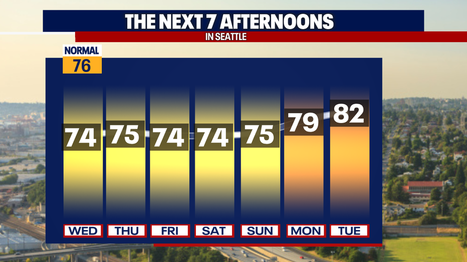
Seattle will see weather peak near 80 Monday before highs climb to around 82 Tuesday. (FOX 13 Seattle)
High pressure will strengthen early next week, allowing temperatures to climb. Highs will reach around 80 degrees Monday before warming into the lower 80s Tuesday.
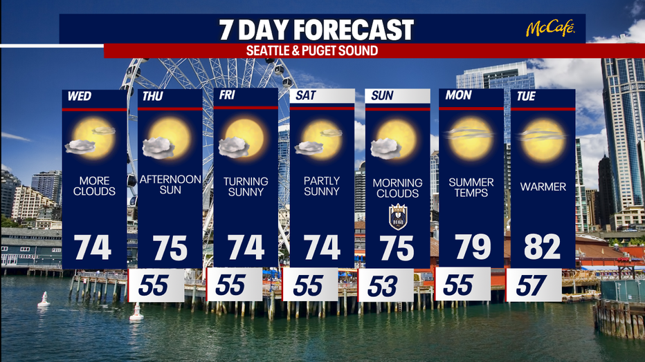
Seattle will keep weather featuring morning clouds, afternoon sunshine, mid-70s through Sunday, then warmer temperatures early next week. (FOX 13 Seattle)
High fire danger in Eastern Washington
Meanwhile, elevated fire danger will continue across Central and Eastern Washington. Red Flag Warnings remained in effect today because of low relative humidity and gusty winds. Similar conditions are expected tomorrow through Saturday, keeping wildfire risk elevated. Ironically, the same weather pattern bringing Western Washington its mild temperatures and morning clouds is also creating breezy, dry conditions east of the Cascades, making it easier for fires to spread.
We are closely watching the deadly Chelan Hills fire near Lake Chelan. Level three "go now" evacuations are posted. Go here for more.
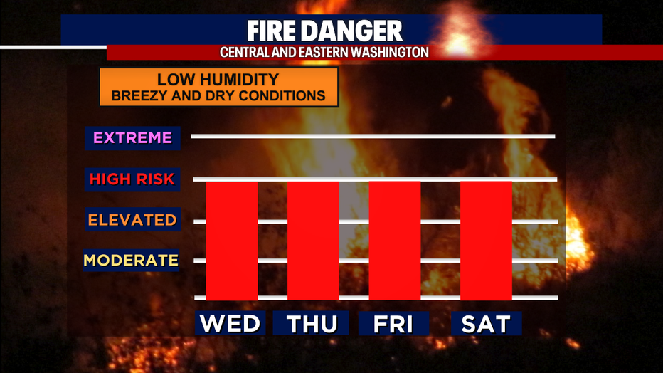
Seattle will see weather driven by the same pattern that keeps central and eastern Washington dry, breezy, and under high wildfire risk through Saturday. (FOX 13 Seattle)
Take good care,
Meteorologist Abby Acone and the FOX 13 Weather Team
MORE NEWS FROM FOX 13 SEATTLE
World Cup ends, Seattle traffic begins: 'Revive I-5' work resumes this week
Evacuations downgraded for wildfire near Lake Chelan
U.S. run at World Cup ends with 4-1 loss to Belgium
Here's where Washington wildfires are currently burning
Seattle-area Lululemon shoplifting suspects charged with organized retail theft
To get the best local news, weather and sports in Seattle for free, sign up for the daily FOX Seattle Newsletter.
Download the free FOX LOCAL app for mobile in the Apple App Store or Google Play Store for live Seattle news, top stories, weather updates and more local and national news.
The Source: Information in this story comes from weather models interpreted by the FOX 13 Seattle weather team.