

Seattle weather: Rain showers, pass level snow ahead
Seattle weather: Wet Tuesday, possible mountain snow this week
Seattle weather: Wet Tuesday, possible mountain snow this week
SEATTLE - Western Washington is in for several more days of cool, showery weather as an area of low pressure moves around the region.
Showers will be a little more consistent across the northern half of Western Washington this afternoon and evening as disturbances rotate around the low. We will see periods of heavier rain and breezy wind Tuesday night.
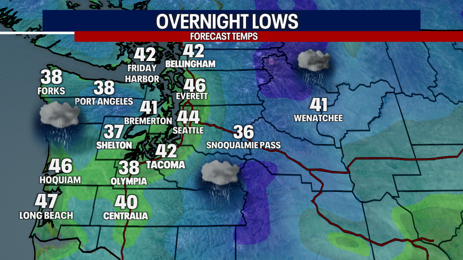
Rain showers and breezy wind will develop overnight in Western Washington. (FOX 13 Seattle)
The southern half of the region has also seen showers, and we'll continue to see periods of wet weather as this system slowly shifts south. Showers will hang on through Thursday as the low drifts south along the coast.
Winter weather advisory for the Cascades
Big picture view:
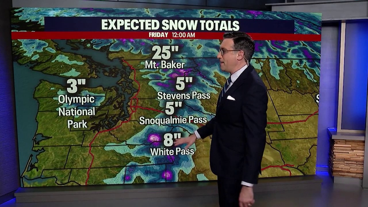
Snow levels will fall through the next couple of days, bringing snow to the mountain passes and higher elevations.
A Winter Weather Advisory remains in effect for the Cascades tonight and Wednesday. Snow levels will start around 4,500 to 5,000 feet today before dropping to roughly 3,500 to 4,000 feet overnight. By Wednesday, snow levels will fall further to around 3,000 to 3,500 feet.
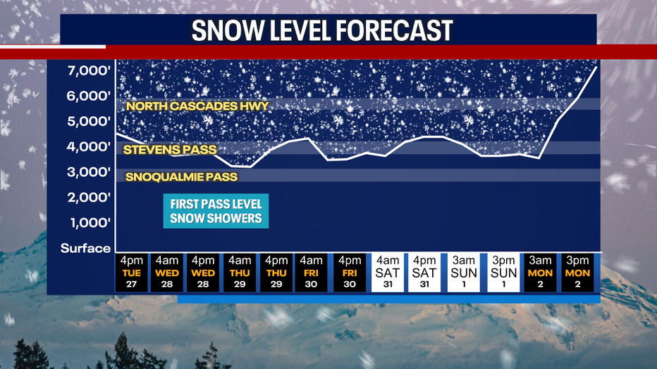
Snow levels will drop to 3,000 to 4,000 feet Tuesday night into Wednesday morning. (FOX 13 Seattle)
By the numbers:
Here's what to expect:
- Tonight: Up to 4 inches of new snow in the Cascades, with higher amounts possible from Mount Rainier south.
- Wednesday: Another 4 inches of snow is possible in the Cascades, again with locally higher totals near and south of Mount Rainier.
- Wednesday night into Thursday: Snow levels will hover between 2,500 and 3,500 feet, allowing light snow to continue at most mountain passes. Another couple of inches of accumulation is possible.
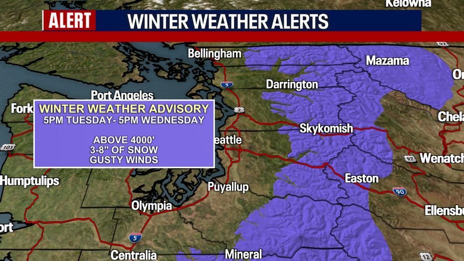
A Winter Weather Advisory has been issued for the Washington Cascades Tuesday evening through Wednesday. (FOX 13 Seattle)
The Olympics will see a trace to 2 inches over the next few days.
If you're traveling over the mountain passes tonight or Wednesday, be prepared for winter driving conditions. Check the latest pass reports and road conditions before heading out, and make sure you're ready for changing conditions along the way.
Weather improves into the weekend
What's next:
The good news is that the pattern should gradually improve late in the week. The low pressure system will remain offshore through Friday before weakening and moving inland Saturday. Shower chances will slowly decrease Friday, with dry conditions expected by Saturday.
Halloween evening will be cool and partly cloudy, but most importantly, it will be dry.
A ridge of high pressure will begin building offshore Sunday and move over Western Washington Monday. That should bring a welcome trend toward drier weather, along with temperatures climbing into the mid and upper 50s by Monday.
Overnight temperatures will trend cooler as high pressure builds, with lows dropping into the upper 20s and 30s Monday morning.
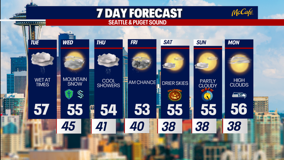
Showers will continue through Friday morning with dropping snow levels in the mountains. (FOX 13 Seattle)
MORE NEWS FROM FOX 13 SEATTLE
Feds ask WA to set aside 400 ballots from suspected noncitizens
Woman hospitalized after bear attacks her near home in Index, WA
WA early voting turnout hits 15%, surpassing 2022 midterm pace
Bremerton Foodline facing severe shortages as demand surges by 55%
Teen rearrested after Rochester High School football threat
To get the best local news, weather and sports in Seattle for free, sign up for the daily FOX Seattle Newsletter.
Download the free FOX LOCAL app for mobile in the Apple App Store or Google Play Store for live Seattle news, top stories, weather updates and more local and national news.
The Source: Information in this story comes from weather models interpreted by the FOX 13 Seattle weather team.