

Burdoin Fire in WA grows to 11,248 acres with 13% containment

WA wildfires update: Governor Ferguson to visit Burdoin Fire
Firefighters are working on multiple wildfires burning across Washington state, with brush fires popping up on the west side, and the Burdoin Fire near the Oregon border burning more than 11,000 acres.
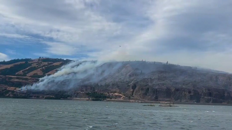
KLICKITAT COUNTY, Wash. - A wildfire burning near Bingen along the Columbia River has surpassed 11,000 acres, though some progress has been made on the fire's containment, according to a Thursday morning update.
(InciWeb)
Keep reading for wildfire status, road closures and evacuation orders.
Burdoin Fire Thursday update
By the numbers:
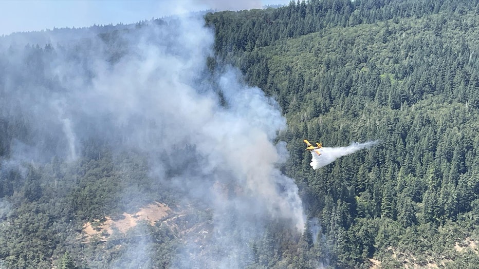
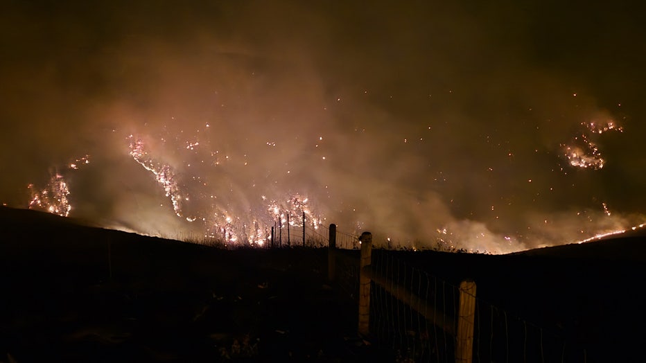
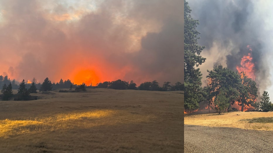
The fire, which was first reported at around 2:30 p.m. on Friday, July 18, is burning about 2.5 miles east of White Salmon, Washington. As of Thursday afternoon, the fire reached 11,248 acres and is now 13% contained.
There are currently 846 personnel, including firefighters, wildland fire engines, aviation resources and other support units battling this fire.
(InciWeb)
What they're saying:
"Monday, fixed wing scoopers and heavy helicopters helped slow the fire’s movement while hand crews and dozers built lines from the west across Catherine Creek and east across Major Creek," the Tuesday press release read. "This operational objective will connect the two lines on the ridges in between these drainages.
"On the east side of the fire, ground crews completed hand and dozer lines around a large spot fire to the east of the Klickitat River and north of Centerville Highway. Work will continue to strengthen, secure, and monitor all firelines east of the river."
Has the Burdoin Fire in WA destroyed any homes?
What we know:
"Klickitat County Sheriff’s Office, Emergency Management and Assessors’ Office are working to visually confirm the number of structures damaged or destroyed. Individual property owners will be contacted directly by a county official."
(InciWeb)
Will the weather help the Burdoin Fire in WA?
What's next:
Officials say Thursday will be a "critical day on the fire", saying that temperatures will be high, and wind gusts will be in the 20-35 mph range – which are the same weather conditions that were present when the fire first ignited. Officials say these weather conditions will challenge the fireline.
Are evacuation orders in place for the Burdoin Fire?
According to Thursday's press release from the Complex Incident Management Team Northwest 13, evacuation zones remain the same.
What they're saying:
"vacuation levels have not changed for the Burdoin Fire. There are Level 3 – Go Now! and Level 2 – Get Set evacuation levels in and around the communities of Klickitat and Wahkiacus."
Burdoin Fire evacuation map
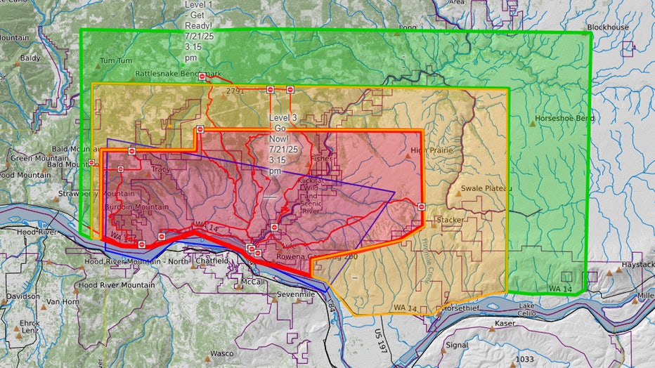
Burdoin Fire evacuation map (July 24, 2025)
What you can do:
Officials ask residents within the evacuation zones to visit the Klickitat County 911 Dispatch/Emergency Management Facebook page for the latest updates.
What roads are closed due to the Burdoin Fire in WA?
Officials say Highway 14 remains closed from milepost 66 east of Bingen, Washington to milepost 76 west of Lyle, Washington.
Other closures include:
- Highway 142 from Highway 14 north of milepost 5.
- Centerville Highway from Highway 13 to Schilling Road.
- Canyon Road is closed.
What caused the Burdoin Fire in Klickitat County, WA?
What we don't know:
According to InciWeb, a government website that tracks wildfires in the United States, the cause of the Burdoin Fire near Bingen remains undetermined and under investigation.
How long will it take crews to put out the Burdoin Fire?
According to Inciweb, the estimated containment date for the Burdoin Fire is August 18, 2025.
This is a developing story. Check back for updates.
The Source: Information in this story comes from a Thursday morning press release by the Complex Incident Management Team Northwest 13, the Washington Department of Natural Resources, the U.S. Forest Service Department of Agriculture and the U.S. Department of the Interior Bureau of Land Management/
MORE NEWS FROM FOX 13 SEATTLE
Witness captures video of plane crashing into water near Mukilteo
Judge lifts gag order in Idaho murders case against Bryan Kohberger
Fire truck thief goes on rampage in Everett damaging 14 vehicles
Idaho hiker mistaken for Travis Decker tells all
2 men arrested in $600k ATM robbery spree across WA
Gallery: Capitol Hill Block Party rocks Seattle streets
To get the best local news, weather and sports in Seattle for free, sign up for the daily FOX Seattle Newsletter.
Download the free FOX LOCAL app for mobile in the Apple App Store or Google Play Store for live Seattle news, top stories, weather updates and more local and national news.