

Smoke, heat advisory choke WA as 100K acres burn
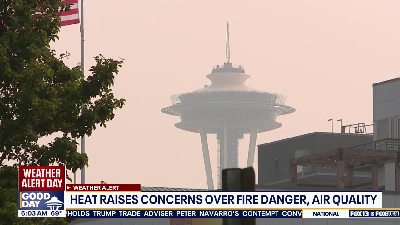
WA heat raises concerns over fire danger, air quality
It's a Weather Alert Day Wednesday as another Heat Advisory in place raises concerns over wildfire danger and poor air quality in Washington state.
SEATTLE - FOX 13 Seattle is tracking multiple wildfires burning over 100,000 acres across Washington state.
As crews battle the blazes on the frontlines, wildfire smoke and hazy skies are beginning to impact local air quality. Meanwhile, an active heat advisory and dry weather are fueling concerns that new fires could ignite.
Keep reading for the latest information on air quality, forecast conditions and active wildfires burning in Washington state.
WA wildfire smoke forecast: What to expect Wednesday
Most of the smoke over Washington will move east as the day progresses on Wednesday. While the Puget Sound region experienced poor air quality and smoke late Tuesday, conditions should begin to clear by Thursday.
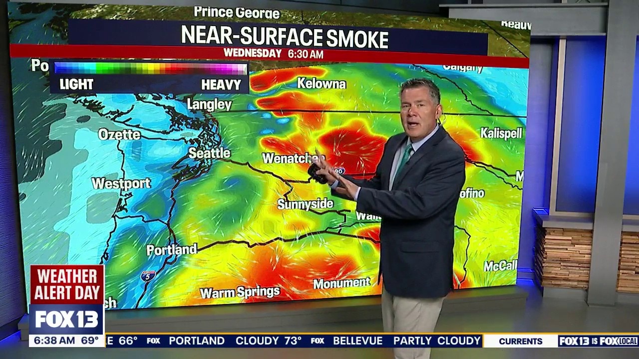
Seattle smoke forecast for Wednesday, July 22
FOX 13's Stephen Kilbreath breaks down the wildfire smoke forecast for the Puget Sound region and across Washington state.
By Friday morning, forecast models showed minimal remaining smoke across Puget Sound and the Washington coast.
WA Air Quality Index
According to AirNow, as of Wednesday, the air quality in the Puget Sound region is running anywhere from good (green) to moderate (yellow).
Other places in central and eastern Washington have experienced air quality that is unhealthy for sensitive groups (orange) and unhealthy (red).
Some areas in Ferry County are experiencing very unhealthy (purple) air quality – like in Republic, Washington, where the AQI measured at 232.
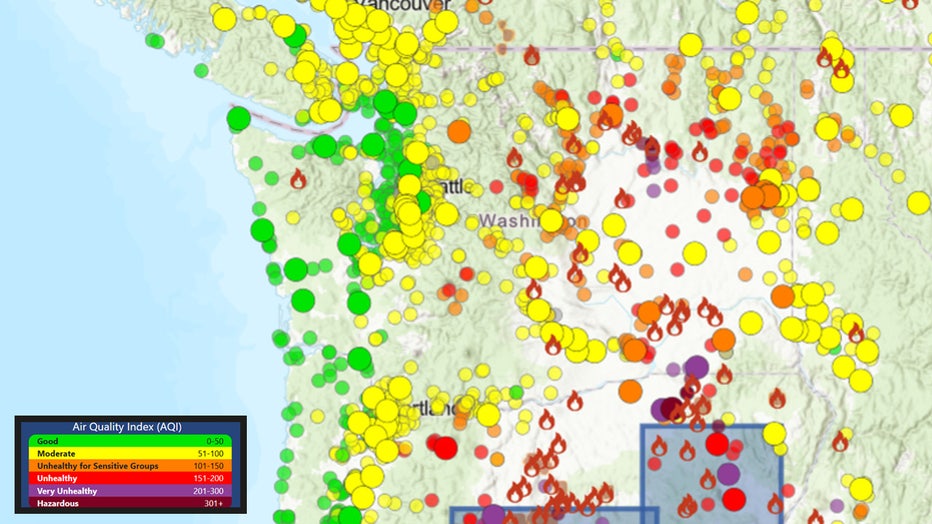
Air Quality Index map for Tuesday, July 21 at 10 a.m. (AirNow)
Wednesday air quality indexes for cities in WA
- Tacoma: 65 (Moderate)
- Seattle: 55 (Moderate)
- Bellingham: 74 (Moderate)
- Yakima: 113 (Unhealthy for sensitive groups)
- Chelan: 132 (Unhealthy for sensitive groups)
- Wenatchee: 126 (Unhealthy for sensitive groups)
- Republic: 232 (Very unhealthy)
- Moses Lake: 153 (Unhealthy)
- Walla Walla: 147 (Unhealthy for sensitive groups)
- Spokane: 126 (Unhealthy for sensitive groups)
A heat advisory is in effect for WA through Wednesday
Tuesday and Wednesday will be the warmest days this week, with several Puget Sound area spots seeing some of the warmest temperatures of the year so far.
The heat advisory, which went into effect Tuesday morning, will continue through late Wednesday at 11 p.m.
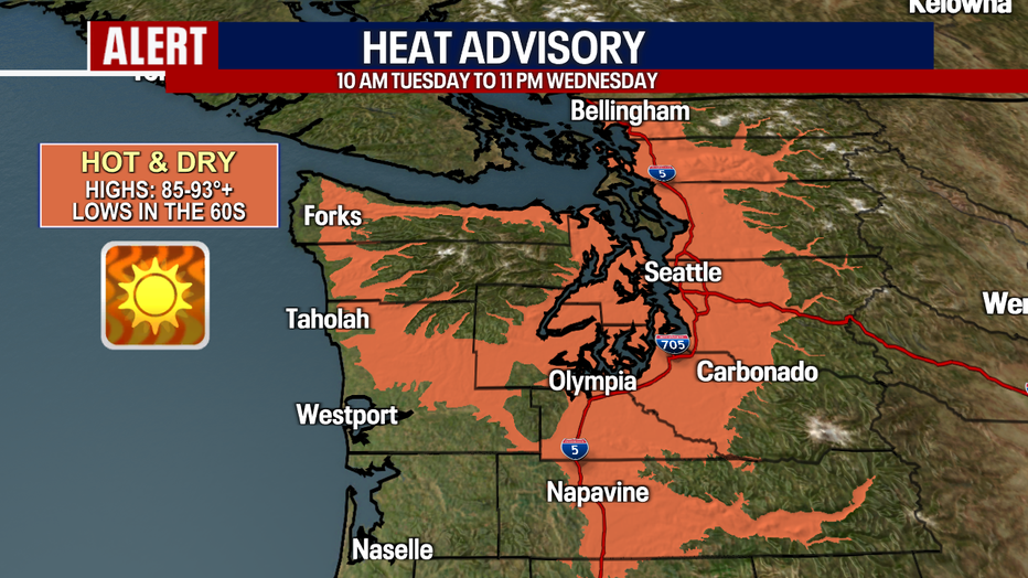
Offshore flow will strengthen in the coming days, heating up our temperatures into the 90s. (FOX13 Seattle)
WA Wildfires map
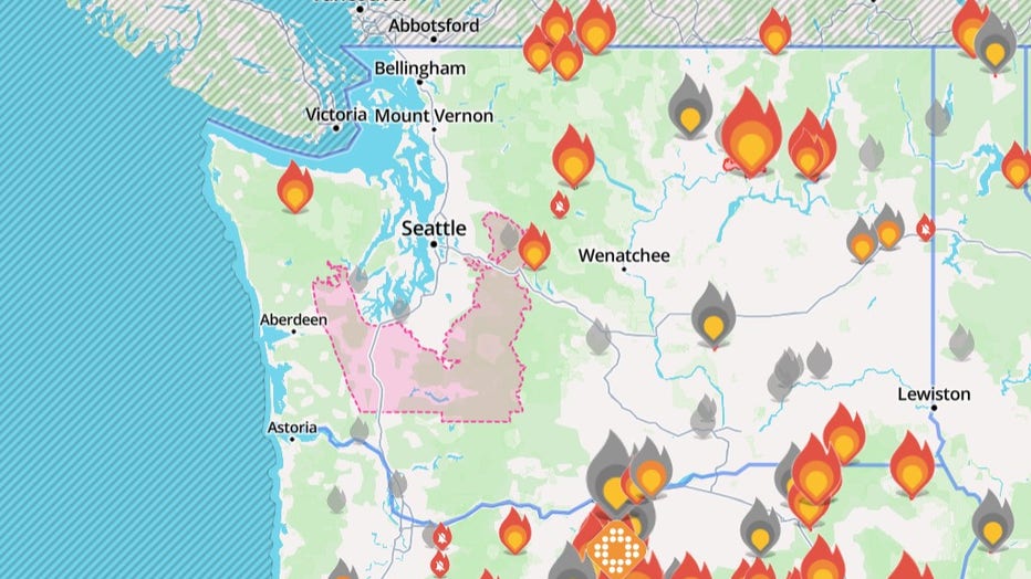
Map of wildfires burning in Washington state (July 22, 2026). (Watch Duty)
While several wildfires burning across Washington have reached full containment, 100% containment doesn't mean a fire is 100% extinguished. It simply means the fire is fully surrounded, though it can still actively burn and produce smoke.
Active Washington state wildfires
Kaiser Canyon Fire in Okanogan County
The Kaiser Canyon Fire is burning near the town of Nespelem in Okanogan County. The fire has reached nearly 80,000 acres – nearly a 20,000-acre increase in 48 hours. At least 13 structures have been lost so far.
Level 3 "Go Now" evacuations were ordered from Buffalo Lake North to Owhi Lake and the Columbia River Camp Ground. Level 2 "Get Ready" evacuations were issued for the town of Nespelem, Agency Campus, and areas to the north and west.
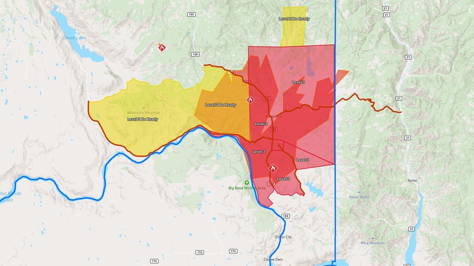
Kaiser evacuation order map for July 19, 2026.
The wildfire is 1% contained. Hundreds of firefighters, along with engines, dozers and aircraft, are actively working to stop the forward progression of the fire.
The latest evacuation map can be found online, and updates are being posted to the Colville Tribes Emergency Management Facebook page.
Red Cross shelters have been set up for evacuees at the following locations:
- Coulee Dam High School Gym (503 Crest Drive)
- Lake Roosevelt Gym (500 Civic Way)
- Omak Community Center (601 Centon Street)
- Omak Long House (25 Mission Road)
Modrite Fire in Ferry County
The Modrite Fire is burning near Lake Roosevelt and is approximately 8,882 acres. It was sparked on July 17 due to a lightning strike, located east of the Kaiser Canyon Fire.
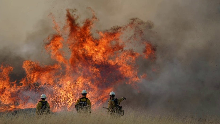
The fire remains 0% contained, and at least five structures have been damaged or destroyed. Firefighters are working to keep the fire south of Coyote Creek Road.
Level 3 "Go Now" evacuations are in effect for Wilmont Creek Road, from Silver Creek to Rodgers Bar. Silver Creek Road is closed between Four Corners and Kewa Road.
An evacuation shelter is set up at Kettle Falls Middle School (101 W. 11th Avenue).
Little Giant Fire near Leavenworth
The Little Giant Fire burning northwest of Leavenworth is burning 777 acres and remains 0% contained. The fire was caused by a lightning strike on July 15.
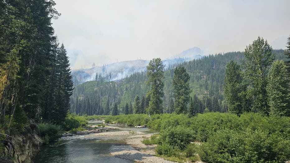
Little Giant Fire from Nineteen Mile Campground on July 21, 2026. (InciWeb)
Royal Lake Fire in Adams County
The Royal Lake Fire, burning west of Othello in Adams County, is 95% contained.
Firefighters were able to stop forward progress on the flames and are working on maintaining the containment lines. The burn area was sitting around 2,000 acres by the end of the weekend.
Focus over the weekend remained on mopping up hot spots and reinforcement of containment.
There were no evacuation orders in place on July 18, however residents and visitors were advised to remain alert in case of any fire activity changes.
Three Queens Fire in Kittitas County
A small wildfire burned just east of Snoqualmie Pass heading into last weekend, just hours after the first Red Flag Warning of the season was issued in western Washington.
The Three Queens Fire has burned approximately 30 acres near Lake Kachess, Three Queens, and Hibox Mountain. The burn area is in steep, rocky terrain, and air and ground support resources are responding.
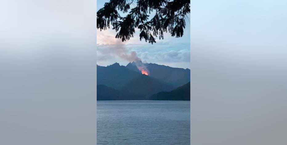
Three Queens Fire burns amid Red Flag Warning in Kittitas County, WA
The Three Queens Fire is burning just east of Snoqualmie Pass, hours after the first Red Flag Warning of the season was issued in regions across Washington state.
Mt. Tom Creek Fire burning in WA's Olympic National Park
The Mt. Tom Creek Fire is burning high in a remote area on the west side of Olympic National Park.
According to fire officials, the wildfire is about six miles from the Hoh Rain Forest, but all trails, the Visitor Center and campground remain open to the public.
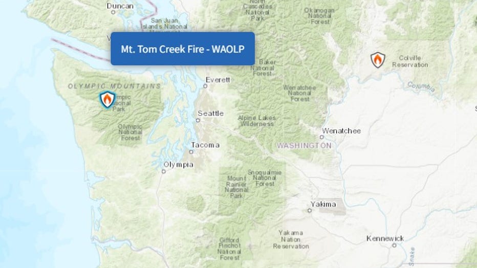
(InciWeb)
The fire was started by a lightning strike on Tuesday, June 23. As of July 13, the fire is 27% contained and burning 69 acres. Fire restrictions were implemented on June 25 and remained in effect heading into the second week of July.
B and O Fire in Okanogan County
As of July 15, the B and O Fire burning northwest of the city of Okanogan has burned 2,762 acres and is 95% contained.
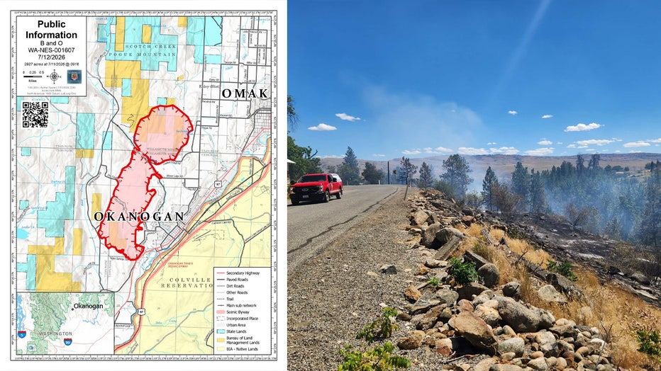
(InciWeb)
According to Watch Duty, all areas near the B and O Fire evacuation zone are now under a Level 1 "Get Ready" Advisory.
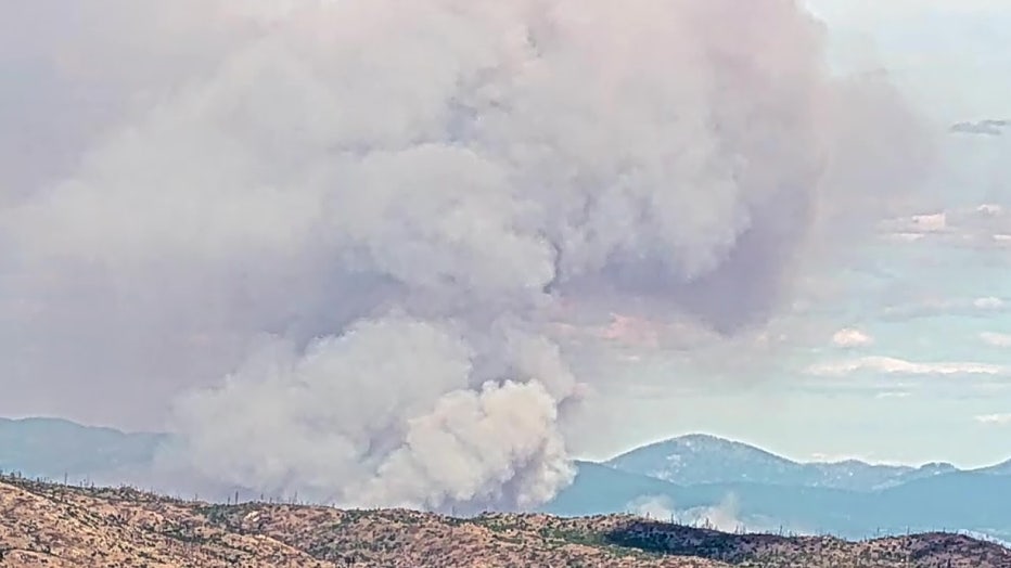
B and O Fire in Okanogan, WA
A Red Cross evacuation center is open, and the Okanogan County Fairgrounds is accepting evacuated animals.
Multiple wildfires spark in Franklin County, WA (contained)
The four different wildfires that sparked in Franklin County after lightning strikes are now 100% contained after burning nearly 47,000 acres.
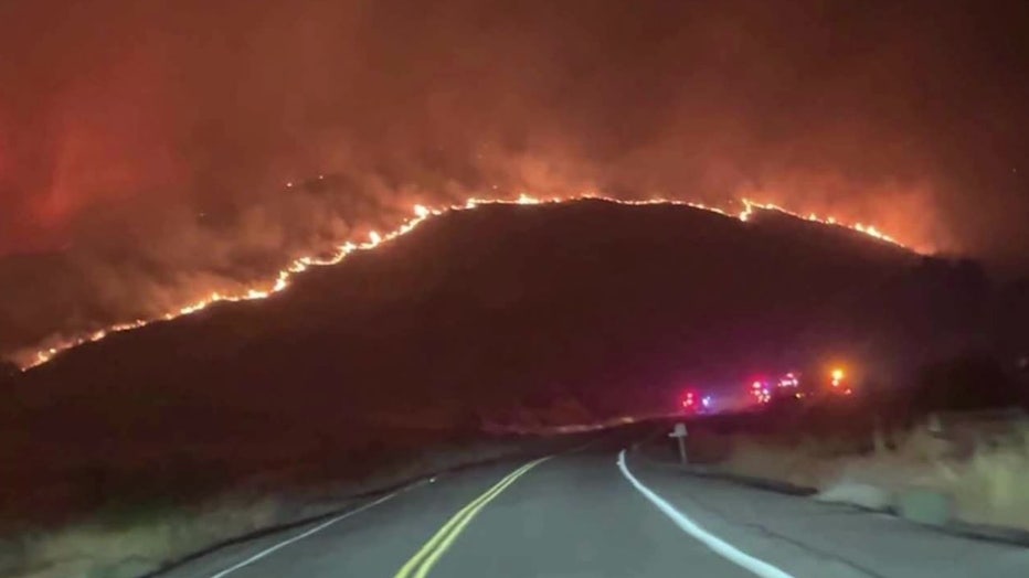
Lyons Ferry Fire
Lyons Ferry Fire in Franklin County (contained)
The Lyons Ferry Fire near Kahlotus reached 33,749 acres and is now 100% contained.
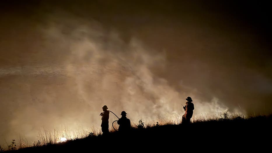
Lyons Ferry Fire (InciWeb)
Neff Jones Fire in Franklin County (contained)
The Neff Jones Fire reached 7,276 acres northeast of Richland and is now 100% contained.
Devils Canyon Fire in Franklin County (contained)
The Devils Canyon Fire south of Kahlotus reached nearly 5,000 acres and is now 100% contained.
Wallace Walker Fire in Franklin County (contained)
The Wallace Walker Fire, which sparked just southwest of the Devils Canyon Fire along the Snake River, reached 801 acres and is now 100% contained.
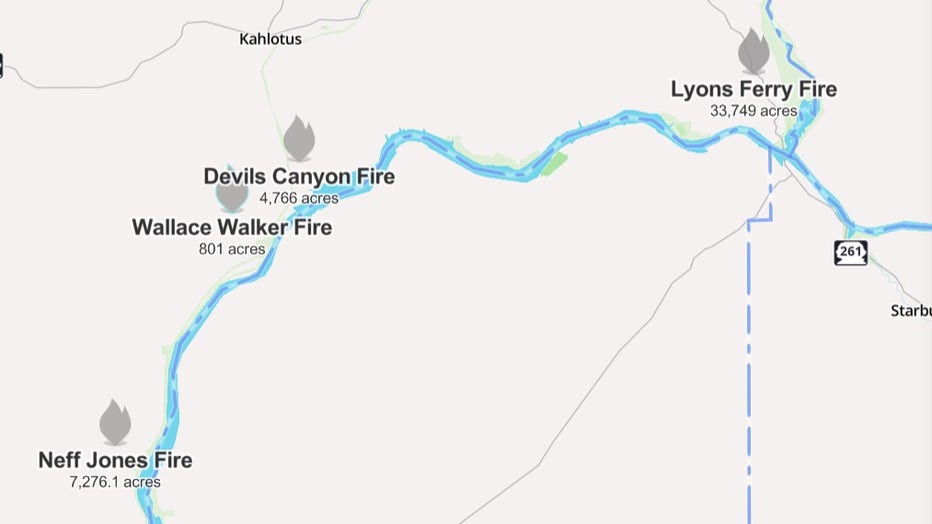
All four wildfires that sparked due to lightning strikes in Franklin County are 100% contained. (Watch Duty)
Plum Fire in Lincoln County (contained)
A 150-acre wildfire, sparked in Lincoln County on July 15, was named the Plum Fire. It was burning near the city of Grand Coulee.
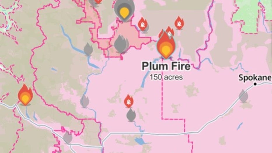
(Watch Duty)
State fire mobilization was authorized for the Plum Fire, which officials said threatened homes and power lines. The fire began around 5:30 p.m. and primarily burnt wheatgrass and sagebrush.
While the fire reached 100% containment, the cause is under investigation.
Quincy Lakes Fire burning near WA's Ancient Lakes (contained)
The Quincy Lakes Fire, which prompted Grant County officials to issue a Level 3 "Go Now" evacuation order, is now 100% contained as of July 13.
Evacuation levels for the Ancient Lakes area have also been downgraded to Level 2.
All of Ancient Lakes were under a Level 2 "Get Set" evacuation order. However, through the hard work of responding crews, firefighters were able to get it fully contained. It reached a total of 289 acres.
Transfer Fire burning in Lake Chelan (contained)
The Transfer Fire sparked just east of Lake Chelan prompted emergency officials to issue evacuation orders.
As of July 13, all evacuation levels have been lifted. The fire is now 100% contained, and reached 35 acres in size.
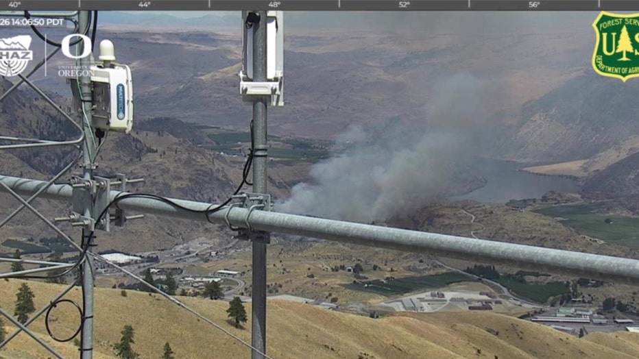
Transfer Fire near Lake Chelan on July 12, 2026. (Source: ALERTWest)
Chelan Hills Fire burning in Douglas County (contained)
First spotted in the early hours of July 4, a wildfire in Douglas County, across from Lake Chelan, burned nearly 10,000 acres, with some reports saying more than 100 structures had been destroyed.
As of July 10, the fire was 100% contained.
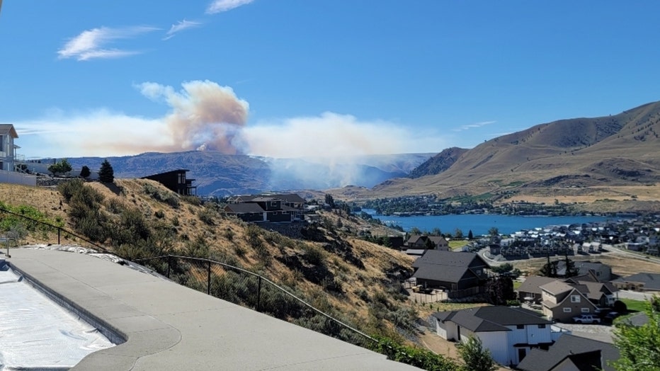
Chelan Hills fire burns in Douglas County near Lake Chelan, Washington
Douglas County Sheriff Tyler Caille says investigators believe someone started the fire near Highway 97 at or around midnight on July 4 before it spread into the surrounding area. Caille confirms a criminal investigation is currently underway.
County officials fear the death toll could rise as emergency teams gain access to heavily burned areas.
The sheriff says teams with search dogs will be going from parcel to parcel in McNeil Canyon to make sure everyone is accounted for following the fire.
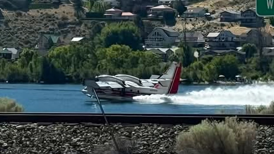
Firefighting planes scoop water to battle the Chelan Hills fire in Douglas County, Washington near Lake Chelan on July 4, 2026
Ryegrass Coulee Fire in Kittitas County (contained)
The Ryegrass Coulee Fire sparked near the Vantage Bridge on July 8, prompted a full closure of I-90 and Level 3 "Go Now" evacuations for the entire city of Vantage.
As of July 10, the fire is 100% contained and reached 537 acres.
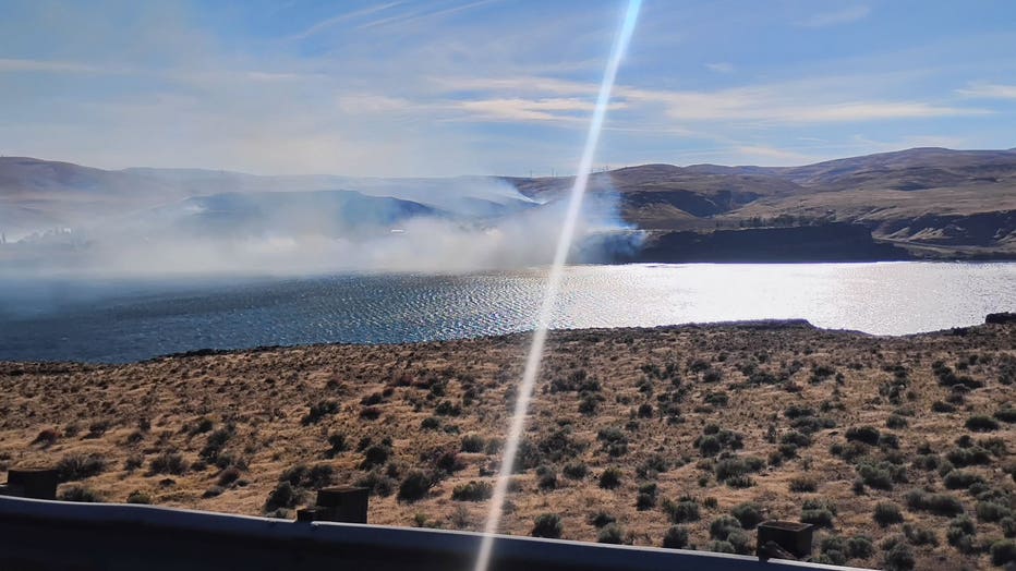
Wildfire burning near Vantage, WA (Credit: Jacqueline Steele)
Crawford Oaks Fire burning in Klickitat County (contained)
There are no longer evacuation orders in place for people living in the area of the Crawford Oaks Fire in Klickitat County. The previous Level 3 orders were put in place when the fire was moving quickly through grassy areas north of Highway 14.
Heading into the Fourth of July weekend, officials closed Highway from Avery Park to Highway 197. However, the roadway has since reopened. People driving on the road are asked to restrict themselves to driving 35 mph as many firefighting and road crews still remain in the area.
Henderson Fire near Lake Chelan (contained)
Evacuation orders were dropped for the Henderson Fire burning in Chelan County. This wildfire broke out near Henderson Road on July 1.
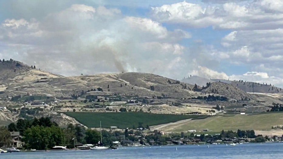
It initially prompted Level 1, 2 and 3 evacuations near Lake Chelan, but were lowered hours later by Chelan County Emergency Management. Officials say the human-caused fire burned hundreds of acres.
Hamilton Fire burning near Winthrop (contained)
Evacuation orders for areas west of Winthrop in Okanogan County have been removed after the fire's rapid growth previously prompted the entire town to evacuate.
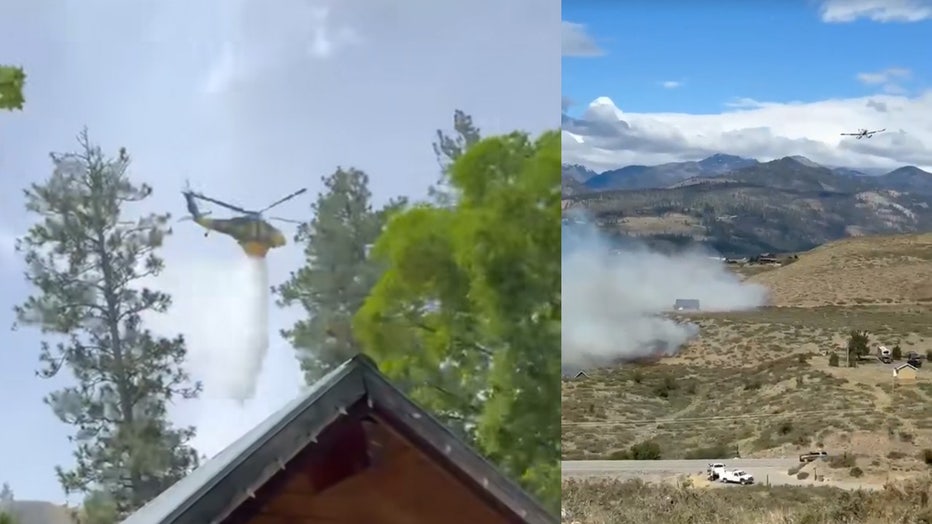
The Hamilton Fire started around 9 a.m. on June 28, and by the early afternoon it had grown to roughly 300 acres with no immediate signs of stopping.
Deputy State Fire Marshal Amy Thornton said it was burning grass and brush and threatened homes, infrastructure and public safety.
By June 30, the Okanogan County Emergency Management team confirmed the fire was 100% contained and all advisories were removed.
Kartar Fire near Omak (contained)
The Kartar Fire burned 11,746 acres south and east of Omak Lake on the Colville Reservation, about 15 miles southeast of Omak. As of July 2, the fire was 100% contained.
A total of 276 firefighting personnel worked on the fire, which investigators believe was human-caused. The fire was first reported on June 16 around 7 p.m.
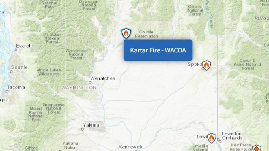
(InciWeb)
Garred Road Fire near Coulee City (contained)
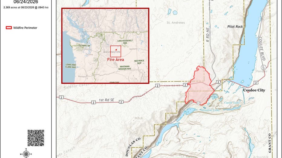
The Garred Road Fire burned 3,369 acres in Grant and Douglas counties, about 4 miles west of Coulee City, and is now 100% contained.
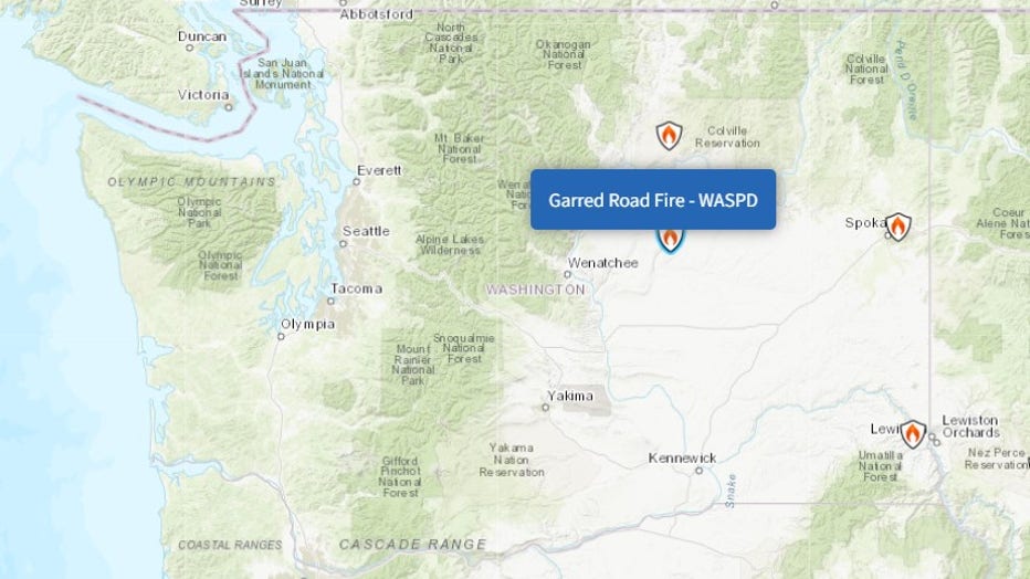
(InciWeb)
The fire was first reported on June 22 around 4 p.m.
Upriver Fire burning in Spokane (contained)
The Upriver Fire, burning a mile east of Spokane, is now 100% contained. It reached 213 acres in size.
The human-caused fire forced about 1,500 residents to evacuate and destroyed at least 15 homes.
Snake River Fire near Clarkston (contained)
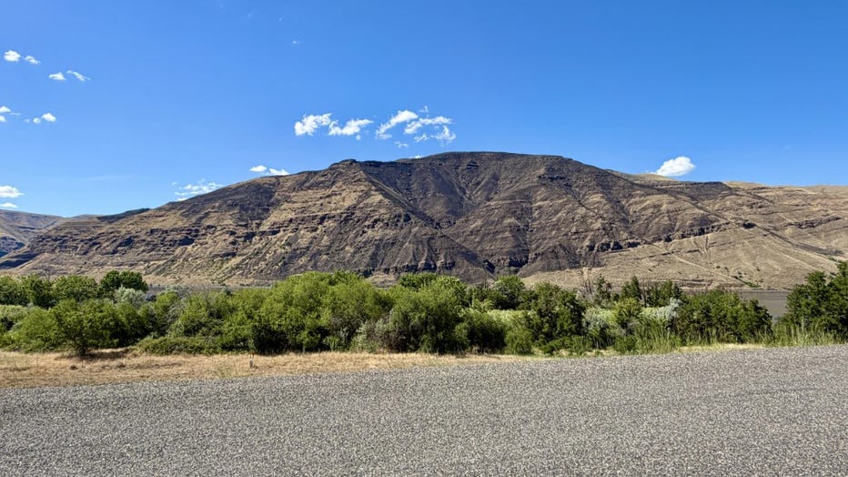
The Snake River Fire, which burned approximately five miles northwest of Clarkston, was first reported on June 12. It is now 100% contained, burning a total of 693 acres.
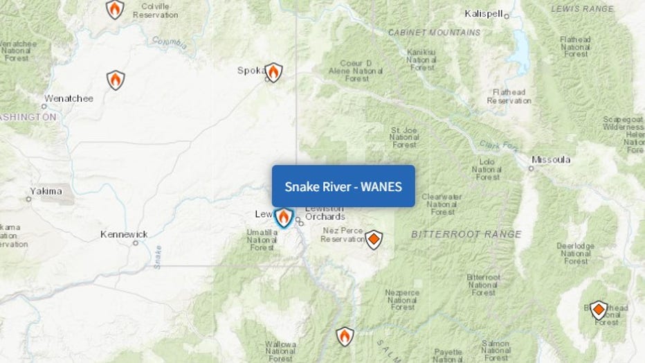
The cause of the Snake River Fire remains under investigation.
See the full list of wildfires that scorched Washington state in 2025.
The Source: Information in this story comes from InciWeb, Watch Duty, AirNow, the National Weather Service and original reporting by FOX 13 Seattle.
MORE NEWS FROM FOX 13 SEATTLE
The 'Jimothy' effect: Seattle raccoon inspires mural, food bank donations
Vashon Island family searching for stolen 350-pound pet pig
5 Point Café community rallies behind injured Seattle bartender
WA US Attorney immediately fired by Trump files lawsuit
Seattle's 'Jimothy' mania: Tattoos, merch, games go viral
To get the best local news, weather and sports in Seattle for free, sign up for the daily FOX Seattle Newsletter.
Download the free FOX LOCAL app for mobile in the Apple App Store or Google Play Store for live Seattle news, top stories, weather updates and more local and national news.