

WA air quality map: Wildfire smoke forecast and updates across the state
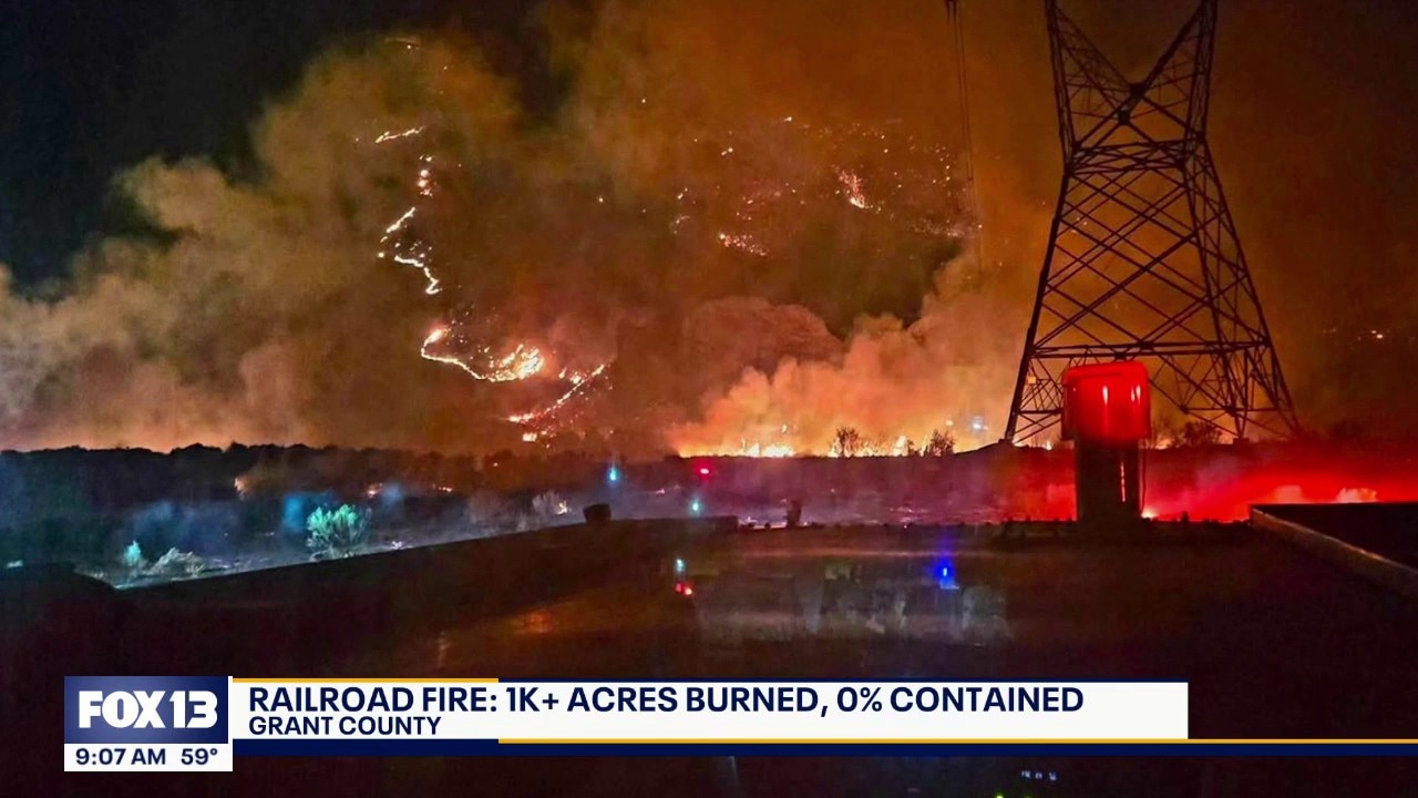
Washington wildfires update for Friday, July 24
FOX 13 Seattle is tracking multiple wildfires burning across Washington state as a weekend Red Flag Warning raises concerns that new blazes could spark.
SEATTLE - FOX 13 Seattle is tracking multiple wildfires burning across Washington state, and the near-surface smoke forecast shows that smoky air quality will likely impact eastern Washington.
As crews battle the blazes on the frontlines, wildfire smoke and hazy skies are beginning to impact local air quality. Meanwhile, dry air and wind gusts could potentially fuel existing blazes.
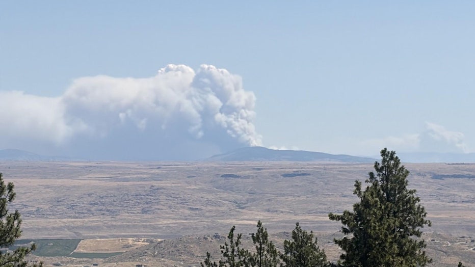
Kaiser Canyon Fire in Okanogan County. (InciWeb)
Keep reading for the latest information on air quality, forecast conditions and active wildfires burning in Washington state.
WA wildfire smoke map
Multiple areas of central and eastern Washington were under Air Quality Alerts through Wednesday due to wildfire smoke pouring in, which could be at dangerous levels for sensitive groups.
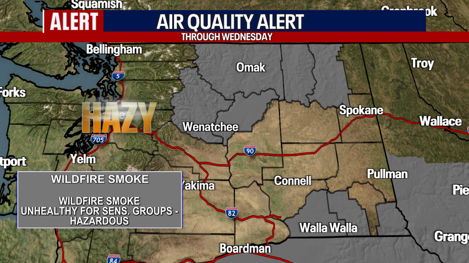
The air quality for central and eastern Washington will remain unhealthy for a large portion of the area. (FOX 13 Seattle)
Luckily, in western Washington, the Air Quality Index is "good" all around. Wildfire smoke will continue to impact communities in eastern and western Washington.
WA Air Quality Index
Some communities east of the Cascade crest are under air quality alerts, with some places like Pullman, Walla Walla and Clarkston dipping into unhealthy levels, according to AirNow.
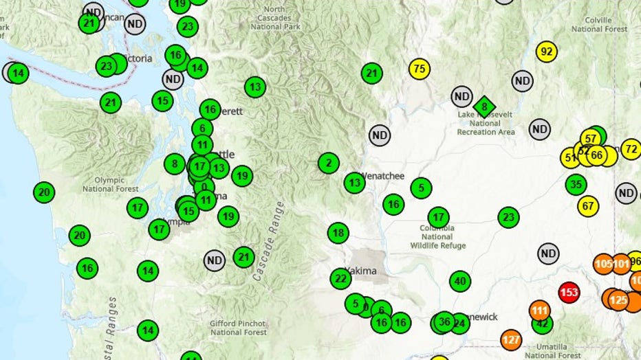
AirNow
Wednesday air quality indexes for cities in WA
- Spokane: 84 (Moderate)
- Walla Walla: 152 (Unhealthy)
- Moses Lake: 38 (Good)
- Chelan: 85 (Moderate)
- Pullman: 83 (Moderate)
- Clarkston: 91 (Moderate)
- Wenatchee: 21 (Good)
- Yakima: 18 (Good)
- Leavenworth: 6 (Good)
- Seattle: 29 (Good)
- Tacoma: 28 (Good)
- Bellingham: 28 (Good)
WA Weather Forecast
After a warm and sunny Friday, western Washington could run into some scattered showers Saturday, with rumbles of thunder possible for the North Cascades.
Eastern and central Washington are expected to stay hot and dry, with a Fire Weather Watch in effect through the weekend.
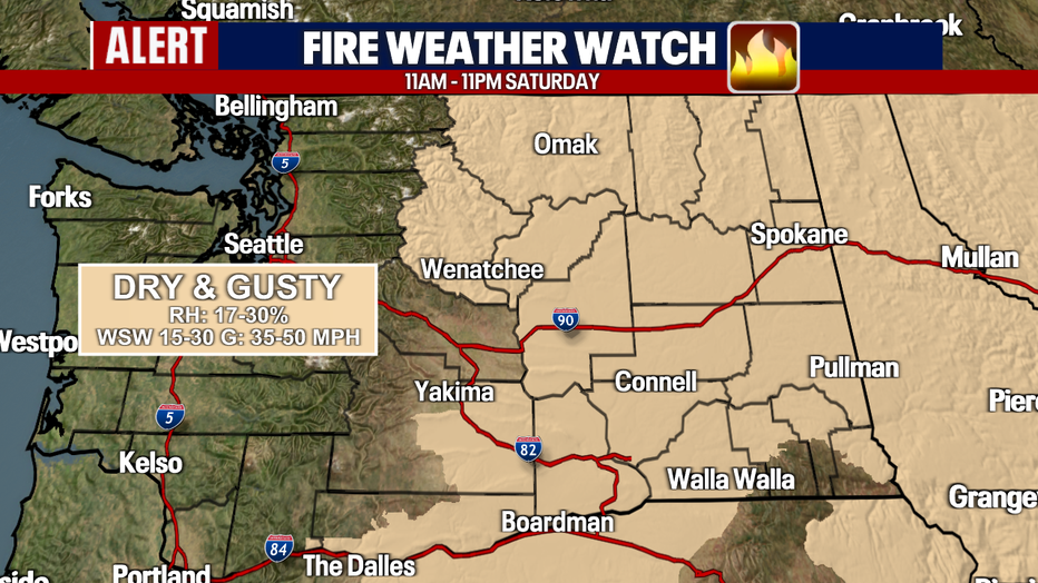
A Fire Weather Watch for eastern and central Washington will be in effect Saturday due to dry and gusty winds. (FOX 13 Seattle)
Washington firefighting officials will be on high alert for any new wildfires that develop during the dry stretch, along with monitoring and containing all existing wildfires.
WA Wildfires map
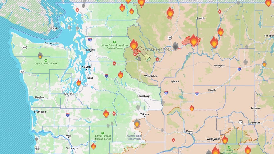
Map showing wildfires burning in Washington State on July 30, 2026. (Watch Duty)
While several wildfires burning across Washington have reached full containment, 100% containment doesn't mean a fire is 100% extinguished. It simply means the fire is fully surrounded, though it can still actively burn and produce smoke.
Active wildfires in Washington state
Kaiser Canyon Fire in Okanogan County
The Kaiser Canyon Fire, which has been burning near the town of Nespelem for several weeks, has reached nearly 130,000 acres and is 29% contained.
Evacuation orders in place for Kaiser Canyon Fire
There are Level 3 "Go Now" and Level 2 "Get Set" evacuation orders in place for the Kaiser Canyon Fire. Areas in red indicate Level 3 evacuation zones and areas in yellow show areas where people need to be ready to leave at a moment's notice.
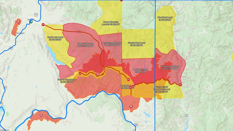
Kaiser Canyon Fire Evacuation map (Perimeter Map)
Modrite Fire in Ferry County
The Modrite Fire burning west of Lake Roosevelt near Inchelium, Washington, is currently at 21,249 acres and is reported to be 27% contained. It sparked on July 17 after a lightning strike.
Evacuation orders in place for the Modrite Fire
There are Level 3 "Go Now" and Level 2 "Get Set" evacuation orders in place for the Modrite Fire. In the map below, areas in red indicate Level 3 evacuations and areas in yellow are where people need to be ready to leave at a moment's notice.
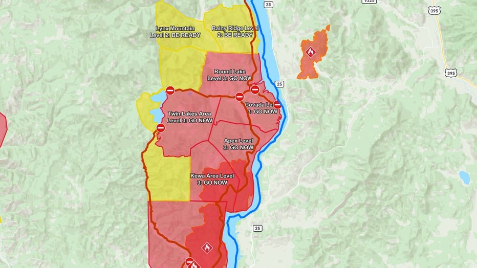
Modrite Fire Evacuation Map (Perimeter Map)
An evacuation shelter is set up at Kettle Falls Middle School (101 W. 11th Avenue).
Sinlahekin Fire in Okanogan County
In addition to the Kaiser Canyon and Modrite Fires, another wildfire is burning in Okanogan County near Tonasket. The Sinlahekin Fire has grown to 17,377 acres near the Sinlahekin Campground, and remains 0% contained.
Evacuation orders in place for the Sinlahekin Fire
Level 3 "Go Now" and Level 2 "Get Ready" evacuation orders are in place for the Sinlahekin Fire. For an updated evacuation map for all Okanogan County wildfires, check Perimeter Map.
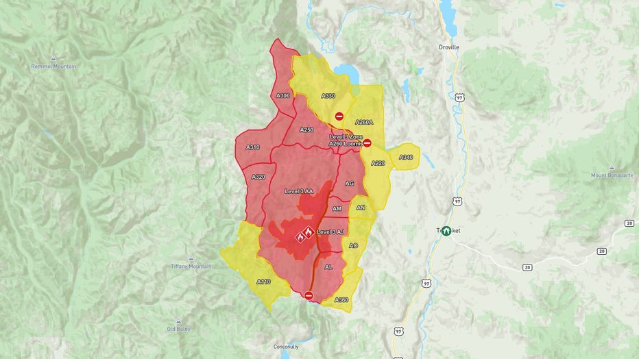
Sinlahekin Fire Evacuation Map (Perimeter Map)
Ptarmigan Fire in Okanogan County
The Ptarmigan Fire, burning about four miles south of the Canadian border in the Pasayten Wilderness in Okanogan County, is burning 12,000 acres as of July 30. It remains 0% contained.
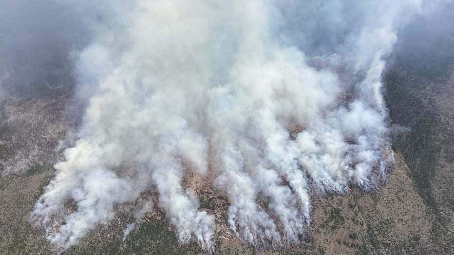
The Ptarmigan Fire, taken on July 20, 2026, burning four miles south of the Canadian border in the Pasayten Wilderness. (USDA Forest Service)
The fire was caused by lightning. Various trails within the Pasayten Wilderness are currently closed. A full list of closed trails can be found on the U.S. Forest Service website.
Little Giant Fire near Leavenworth
The Little Giant Fire, burning near Leavenworth, is about 25,400 acres. The fire remains 0% contained as of July 30.
Investigators say the fire ignited after a lightning strike.
Evacuation orders in place for the Little Giant Fire
There are Level 3 "Go Now", Level 2 "Get Set" and Level 1 "Get Ready" evacuation orders in place for the Little Giant Fire. An updated evacuation map can be found on the Chelan County Incident Map.
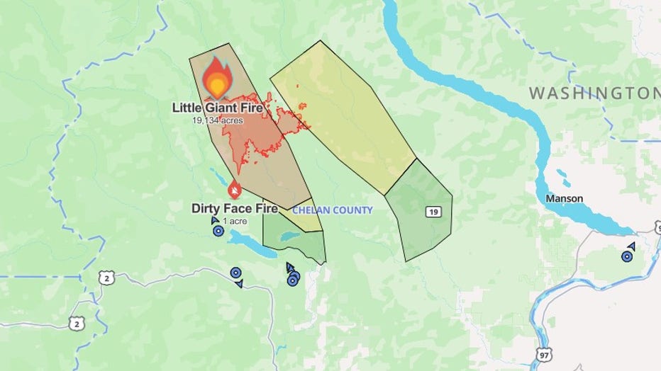
Little Giant Fire Evacuation map (Via: Chelan County Emergency Management)
Bradeen Hill Fire in Stevens County
A vegetation fire that sparked last weekend has grown to 4,167 acres and is 7% contained. The Bradeen Hill Fire is currently burning in an elevated, forested area of Stevens County near Lake Roosevelt.
Level 3 "Go Now" evacuation orders are in effect for the Gifford area, near Beck Road and Addy-Gifford Road. Level 2 "Get Set" and Level 1 "Get Ready" evacuations are also in place. An updated evacuation map can be found online.
Three Queens Fire in Kittitas County
The Three Queens Fire, burning north of Kachess Lake in Kittitas County, Washington, is burning 89 acres and is 0% contained.
The burn area is in steep, rocky terrain, and air and ground support resources are working to reinforce containment lines.
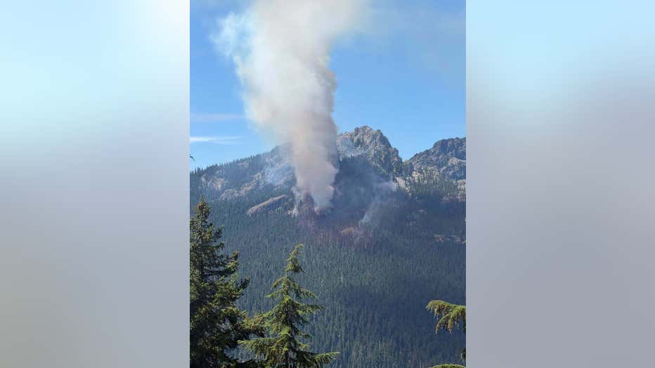
Three Queens Fire burning in Kittitas County, Washington. (USDA Forest Service)
Mt. Tom Creek Fire burning in WA's Olympic National Park
The lightning-caused Mt. Tom Creek Fire, burning high in a remote area on the west side of Olympic National Park, is burning 69 acres and was 75% contained as of Tuesday.
According to fire officials, the wildfire is about six miles from the Hoh Rain Forest, but all trails, the Visitor Center and campground remain open to the public.
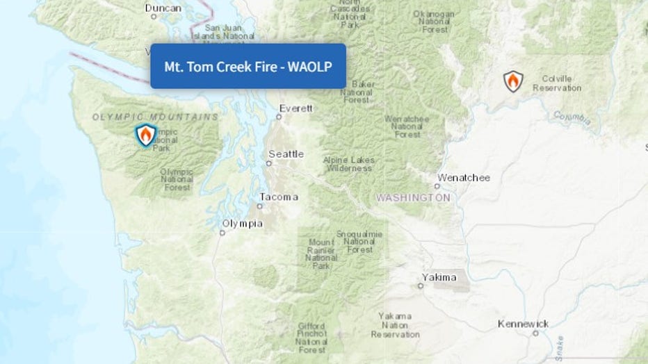
(InciWeb)
Railroad Fire in Grant County (contained)
The Railroad Fire located south of Vantage, Washington, in Grant County burned 8,216 acres and reached 100% containment.
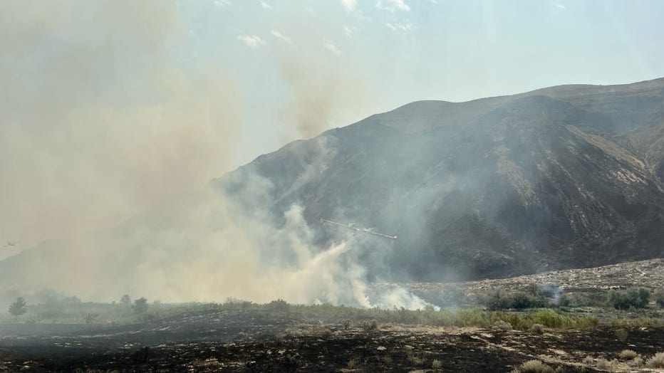
(Watch Duty)
The Railroad fire destroyed several structures and forced mandatory evacuations for several communities. All evacuation orders have since been lifted.
Signal Peak Fire in Yakima County (contained)
A 3,000-acre wildfire in Yakima County, near the town of White Swan, has been fully contained. It's being Signal Peak Fire threatened homes, crops, infrastructure and cultural sites. The cause of the fire is under investigation.
B and O Fire in Okanogan County
As of July 15, the B and O Fire burning northwest of the city of Okanogan has burned 2,762 acres and remains 95% contained.
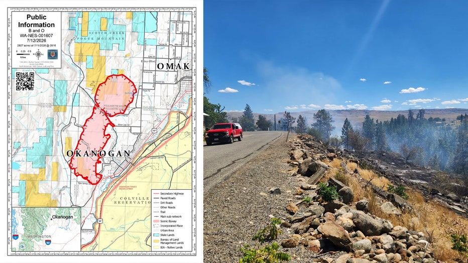
(InciWeb)
According to Watch Duty, all areas near the B and O Fire evacuation zone are now under a Level 1 "Get Ready" Advisory.
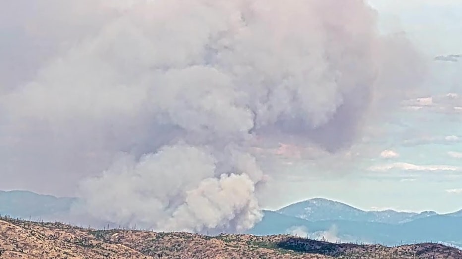
B and O Fire in Okanogan, WA
A Red Cross evacuation center is open, and the Okanogan County Fairgrounds is accepting evacuated animals.
Multiple wildfires spark in Franklin County, WA (contained)
The four different wildfires that sparked in Franklin County after lightning strikes are now 100% contained after burning nearly 47,000 acres.
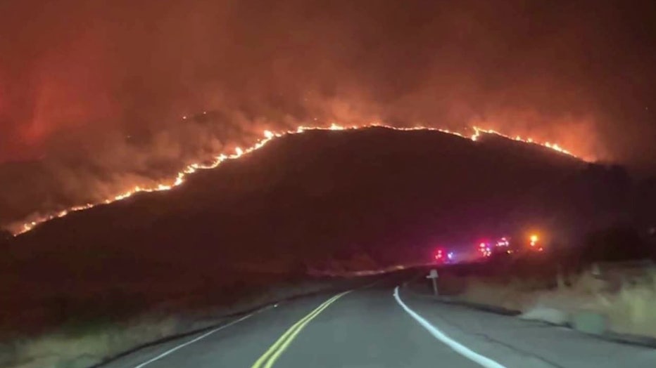
Lyons Ferry Fire
Lyons Ferry Fire in Franklin County (contained)
The Lyons Ferry Fire near Kahlotus reached 33,749 acres and is now 100% contained.
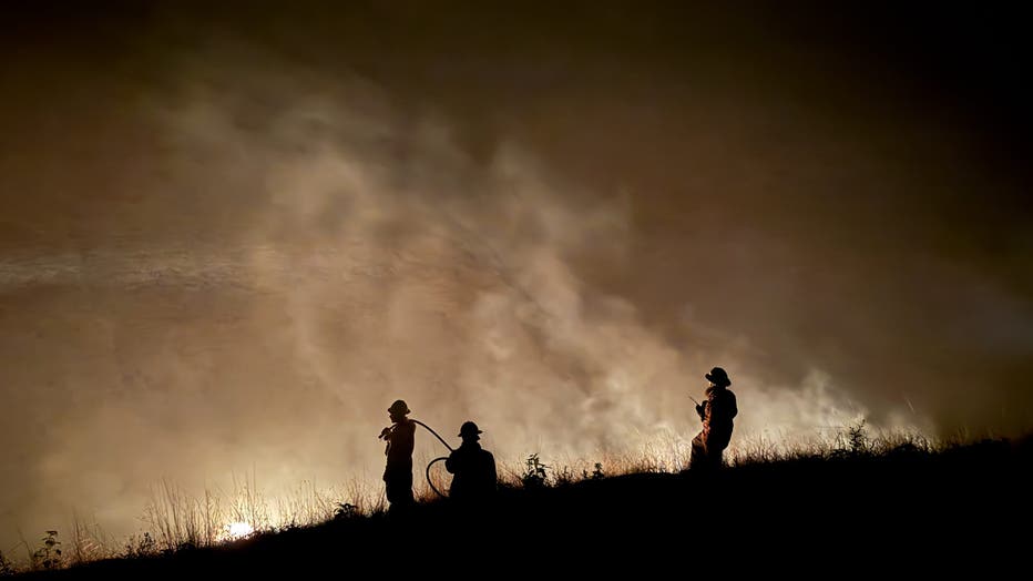
Lyons Ferry Fire (InciWeb)
Neff Jones Fire in Franklin County (contained)
The Neff Jones Fire reached 7,276 acres northeast of Richland and is now 100% contained.
Devils Canyon Fire in Franklin County (contained)
The Devils Canyon Fire south of Kahlotus reached nearly 5,000 acres and is now 100% contained.
Wallace Walker Fire in Franklin County (contained)
The Wallace Walker Fire, which sparked just southwest of the Devils Canyon Fire along the Snake River, reached 801 acres and is now 100% contained.
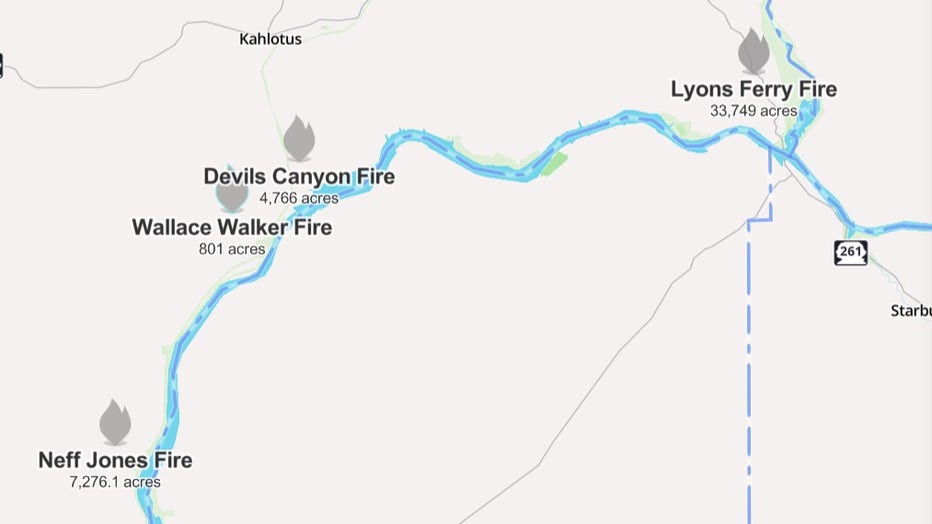
All four wildfires that sparked due to lightning strikes in Franklin County are 100% contained. (Watch Duty)
Royal Lake Fire in Adams County (contained)
The Royal Lake Fire, located west of Othello in Adams County, is now 100% contained after burning 2,037 acres.
Plum Fire in Lincoln County (contained)
A 150-acre wildfire, sparked in Lincoln County on July 15, was named the Plum Fire. It was burning near the city of Grand Coulee.
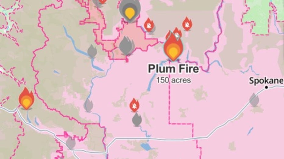
(Watch Duty)
State fire mobilization was authorized for the Plum Fire, which officials said threatened homes and power lines. The fire began around 5:30 p.m. and primarily burnt wheatgrass and sagebrush.
While the fire reached 100% containment, the cause is under investigation.
Quincy Lakes Fire burning near WA's Ancient Lakes (contained)
The Quincy Lakes Fire, which prompted Grant County officials to issue a Level 3 "Go Now" evacuation order, is now 100% contained as of July 13.
Evacuation levels for the Ancient Lakes area have also been downgraded to Level 2.
All of Ancient Lakes were under a Level 2 "Get Set" evacuation order. However, through the hard work of responding crews, firefighters were able to get it fully contained. It reached a total of 289 acres.
Transfer Fire burning in Lake Chelan (contained)
The Transfer Fire sparked just east of Lake Chelan prompted emergency officials to issue evacuation orders.
As of July 13, all evacuation levels have been lifted. The fire is now 100% contained, and reached 35 acres in size.
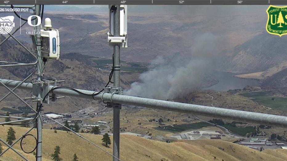
Transfer Fire near Lake Chelan on July 12, 2026. (Source: ALERTWest)
Chelan Hills Fire burning in Douglas County (contained)
First spotted in the early hours of July 4, a wildfire in Douglas County, across from Lake Chelan, burned nearly 10,000 acres, with some reports saying more than 100 structures had been destroyed.
As of July 10, the fire was 100% contained.
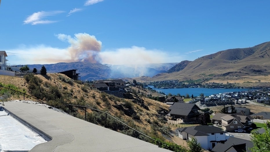
Chelan Hills fire burns in Douglas County near Lake Chelan, Washington
Douglas County Sheriff Tyler Caille says investigators believe someone started the fire near Highway 97 at or around midnight on July 4 before it spread into the surrounding area. Caille confirms a criminal investigation is currently underway.
County officials fear the death toll could rise as emergency teams gain access to heavily burned areas.
The sheriff says teams with search dogs will be going from parcel to parcel in McNeil Canyon to make sure everyone is accounted for following the fire.
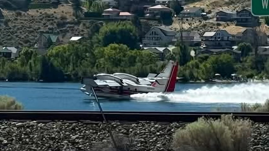
Firefighting planes scoop water to battle the Chelan Hills fire in Douglas County, Washington near Lake Chelan on July 4, 2026
Ryegrass Coulee Fire in Kittitas County (contained)
The Ryegrass Coulee Fire sparked near the Vantage Bridge on July 8, prompted a full closure of I-90 and Level 3 "Go Now" evacuations for the entire city of Vantage.
As of July 10, the fire is 100% contained and reached 537 acres.
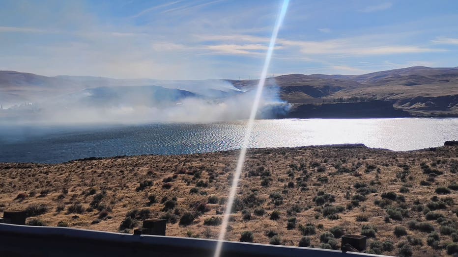
Wildfire burning near Vantage, WA (Credit: Jacqueline Steele)
Crawford Oaks Fire burning in Klickitat County (contained)
There are no longer evacuation orders in place for people living in the area of the Crawford Oaks Fire in Klickitat County. The previous Level 3 orders were put in place when the fire was moving quickly through grassy areas north of Highway 14.
Heading into the Fourth of July weekend, officials closed Highway from Avery Park to Highway 197. However, the roadway has since reopened. People driving on the road are asked to restrict themselves to driving 35 mph as many firefighting and road crews still remain in the area.
Henderson Fire near Lake Chelan (contained)
Evacuation orders were dropped for the Henderson Fire burning in Chelan County. This wildfire broke out near Henderson Road on July 1.
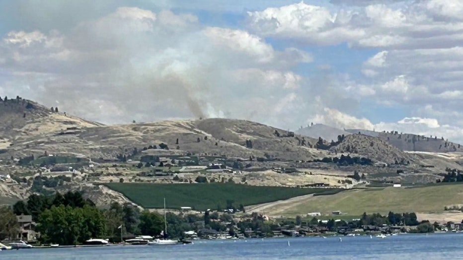
It initially prompted Level 1, 2 and 3 evacuations near Lake Chelan, but were lowered hours later by Chelan County Emergency Management. Officials say the human-caused fire burned hundreds of acres.
Hamilton Fire burning near Winthrop (contained)
Evacuation orders for areas west of Winthrop in Okanogan County have been removed after the fire's rapid growth previously prompted the entire town to evacuate.
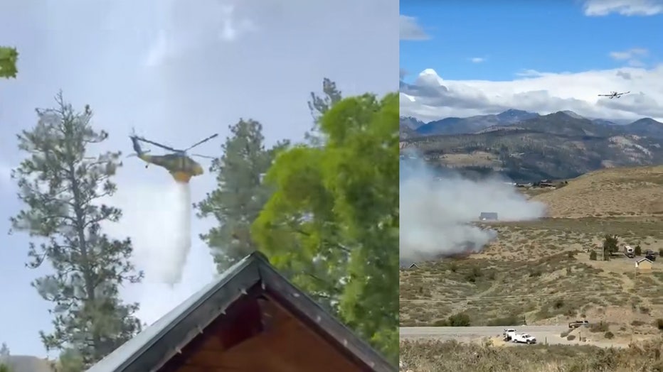
The Hamilton Fire started around 9 a.m. on June 28, and by the early afternoon it had grown to roughly 300 acres with no immediate signs of stopping.
Deputy State Fire Marshal Amy Thornton said it was burning grass and brush and threatened homes, infrastructure and public safety.
By June 30, the Okanogan County Emergency Management team confirmed the fire was 100% contained and all advisories were removed.
Kartar Fire near Omak (contained)
The Kartar Fire burned 11,746 acres south and east of Omak Lake on the Colville Reservation, about 15 miles southeast of Omak. As of July 2, the fire was 100% contained.
A total of 276 firefighting personnel worked on the fire, which investigators believe was human-caused. The fire was first reported on June 16 around 7 p.m.
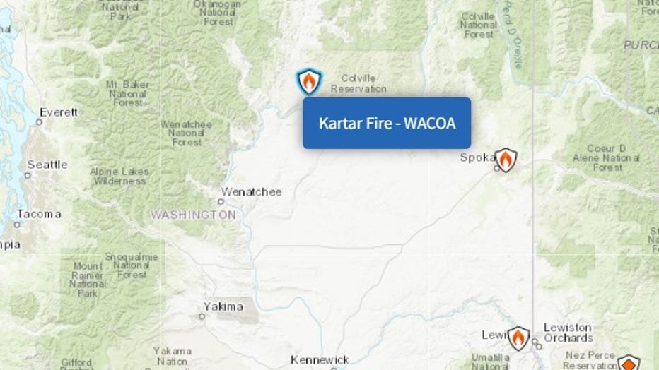
(InciWeb)
Garred Road Fire near Coulee City (contained)
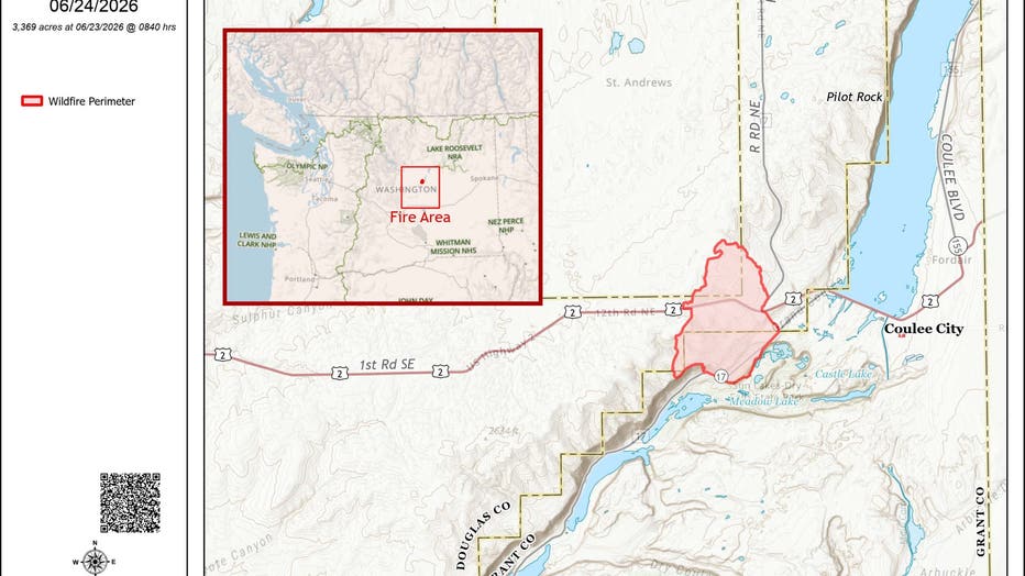
The Garred Road Fire burned 3,369 acres in Grant and Douglas counties, about 4 miles west of Coulee City, and is now 100% contained.
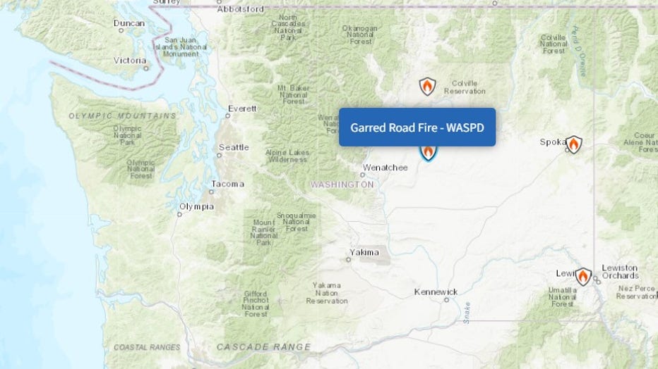
(InciWeb)
The fire was first reported on June 22 around 4 p.m.
Upriver Fire burning in Spokane (contained)
The Upriver Fire, burning a mile east of Spokane, is now 100% contained. It reached 213 acres in size.
The human-caused fire forced about 1,500 residents to evacuate and destroyed at least 15 homes.
Snake River Fire near Clarkston (contained)
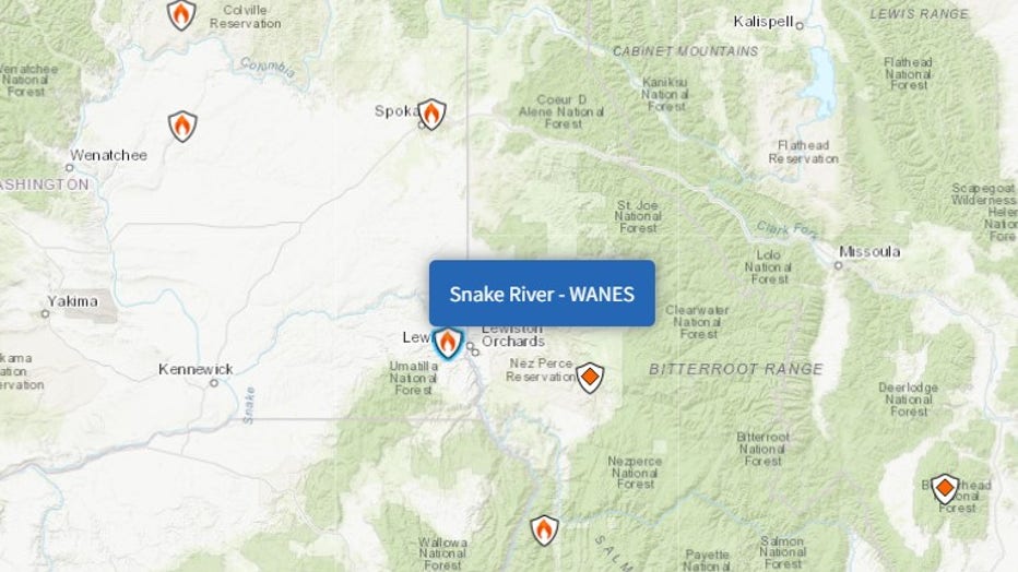
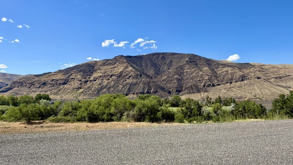
The Snake River Fire, which burned approximately five miles northwest of Clarkston, was first reported on June 12. It is now 100% contained, burning a total of 693 acres.
The cause of the Snake River Fire remains under investigation.
See the full list of wildfires that scorched Washington state in 2025.
The Source: Information in this story comes from InciWeb, Watch Duty, AirNow, the National Weather Service and original reporting by FOX 13 Seattle.
MORE NEWS FROM FOX 13 SEATTLE
The 'Jimothy' effect: Seattle raccoon inspires mural, food bank donations
Vashon Island family searching for stolen 350-pound pet pig
5 Point Café community rallies behind injured Seattle bartender
WA US Attorney immediately fired by Trump files lawsuit
Seattle's 'Jimothy' mania: Tattoos, merch, games go viral
To get the best local news, weather and sports in Seattle for free, sign up for the daily FOX Seattle Newsletter.
Download the free FOX LOCAL app for mobile in the Apple App Store or Google Play Store for live Seattle news, top stories, weather updates and more local and national news.